


Get to know Dacheng Township
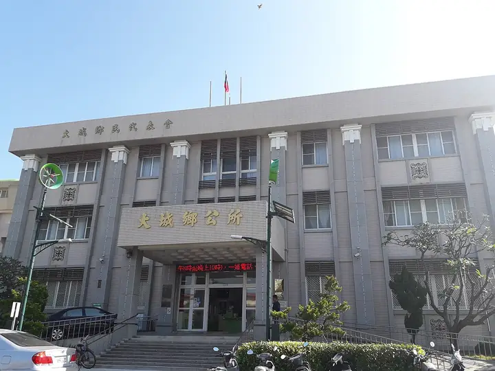
Photo adjustments
EXIF orientation normalized; resized without changing aspect ratio; converted to WebP. No subject edits.
- Administrative area
- Rural township · 鄉
- Part of
- Changhua County
- Chinese name
- 大城鄉
- Local areas
- Rural township guide
Area & population
- Area in the source
- 63.74 km²
Source: cited geographic source, as of the dates shown.
A village seen through photographs
The image house stands beside the wetlands at the mouth of the Zhuoshui River (濁水溪), in southwestern Changhua County (彰化縣). Its exhibitions draw on the photographic book South Wind (南風), recording Taixi Village (台西村) over many years. The images address industrial development’s effects on the village and changes in its environment and community. The venue also provides space for residents’ photography and cultural activities.
Rural forms in hand-shaped clay
At Xu Zonghuan’s Taoyuan Workshop (許宗煥陶園工作坊), hand-shaped pottery draws on traditional rural life and childhood memories. Casuarina trees, peanuts, frogs in ditches and fallen wood appear in the ceramic work. Dacheng’s wheat ripens in spring, turning its fields golden; Erlin Township Office’s regional itinerary places this landscape in January through March.
Sources for this guide
四季饗宴慢活之旅 · Erlin Township Office regional tourism leaflet; hosted by Taipei Municipal Zhongshan Girls High School
Original English written from the listed sources and checked sentence by sentence against quoted extracts by a separate reviewer. Updated 2026-09-27.
Explore Dacheng Township
Core places to explore, with English and Chinese names.
Dacheng Township 大城鄉
Plan your visit
Getting there
Dacheng Township is about 25 km in a straight line from central Changhua County. Search for 大城鄉 in a map app to find stations and your accommodation.
Where to stay →More in Changhua County
Sources & geographic information
Administrative names and parent areas: Official geographic directory · Reference date 2026-09-06.
Map data © OpenStreetMap contributors. Pins mark approximate centres, not entrances or boundaries.