


Get to know Shetou Township
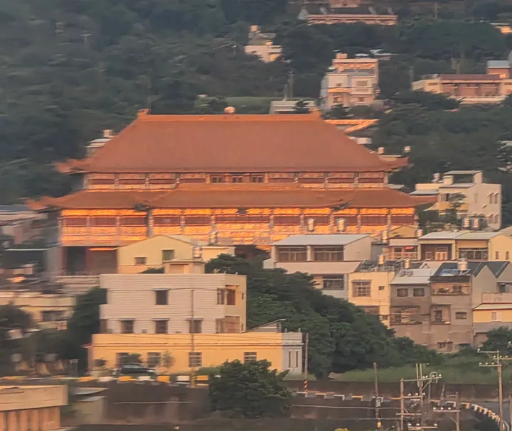
Photo adjustments
Full frame retained; proportionally resized and converted to WebP. No retouching or changes to the photographed subject. Card displays may crop the view.
- Administrative area
- Rural township · 鄉
- Part of
- Changhua County
- Chinese name
- 社頭鄉
- Local areas
- Rural township guide
Area & population
- Area in the source
- 36.00 km²
Source: cited geographic source, as of the dates shown.
Hutian Temple’s outlook
Hutian Temple (護天宮) stands above the Changhua Plain (彰化平原), with views of passing high-speed trains, sunsets and lights after dark. It is close to the Changqing Cycleway (長青自行車道). A 2026 improvement project renewed the paving of the temple forecourt and added landscaping and accessible facilities.
Paths through planted woodland
The Qingshuiyan Trails (清水岩步道群), beside Qingshuiyan Temple (清水岩寺), span Shetou and Tianzhong (田中). Their Zhongyangling Afforestation Trail (中央嶺造林步道) follows a route used for planting work in 1956. Acacias line stone steps leading past Wufeng Viewing Platform (五峰觀景平台), Fule Valley (福樂谷), a planting memorial and old vines and trees. A steep wooden stairway leads to Qingtian Ridge (擎天崗).
Sources for this guide
社頭護天宮停車設施完工啟用 參山處邀大家中秋節來賞月-參山國家風景區管理處 · Tri-Mountain National Scenic Area Administration
清水岩步道群 · Forestry and Nature Conservation Agency
Original English written from the listed sources and checked sentence by sentence against quoted extracts by a separate reviewer. Updated 2026-09-27.
Explore Shetou Township
Core places to explore, with English and Chinese names.
Shetou Township 社頭鄉
Plan your visit
Getting there
Shetou Township is about 7 km in a straight line from central Changhua County. Search for 社頭鄉 in a map app to find stations and your accommodation.
Where to stay →More in Changhua County
Sources & geographic information
Administrative names and parent areas: Official geographic directory · Reference date 2026-09-06.
Map data © OpenStreetMap contributors. Pins mark approximate centres, not entrances or boundaries.