


Get to know Chaozhou Township
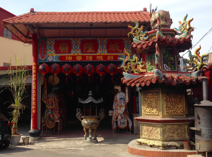
Photo adjustments
Full frame retained; proportionally resized and converted to WebP. No retouching or changes to the photographed subject. Card displays may crop the view.
- Administrative area
- Township · 鎮
- Part of
- Pingtung County
- Chinese name
- 潮州鎮
- Local areas
- Township guide
Area & population
- Area in the source
- 42.00 km²
Source: cited geographic source, as of the dates shown.
From an old street to a town
Early settlers gathered around the old street and built the Three Mountain Kings Temple (三山國王廟), from which the town’s streets developed. The land is mostly flat and slopes from east to west; the Donggang River (東港溪) marks the township’s northern side.
An office turned museum
The Pingtung Traditional Opera Story House (屏東戲曲故事館) occupies the old Chaozhou post office (舊潮州郵局), a building formerly used as a Japanese-period township office. Its reuse as the museum was planned from 2011. Around the town’s roundabout, local snacks include lengre bing (冷熱冰) and swordfish fishcakes (旗魚黑輪). The township also contains Linhou Silin Flatland Forest Park (林後四林平地森林園區).
Sources for this guide
潮州鎮 · Pingtung County Government
舊潮州郵局(戲曲故事館) · Pingtung County Government
Original English written from the listed sources and checked sentence by sentence against quoted extracts by a separate reviewer. Updated 2026-09-27.
Explore Chaozhou Township
Core places to explore, with English and Chinese names.
Chaozhou Township 潮州鎮
Plan your visit
Getting there
Chaozhou Township is about 15 km in a straight line from central Pingtung County. Search for 潮州鎮 in a map app to find stations and your accommodation.
Where to stay →More in Pingtung County
Sources & geographic information
Administrative names and parent areas: Official geographic directory · Reference date 2026-09-06.
Map data © OpenStreetMap contributors. Pins mark approximate centres, not entrances or boundaries.