


Get to know Chunri Township
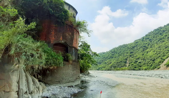
Photo adjustments
Full frame retained; proportionally resized and converted to WebP. No retouching or changes to the photographed subject. Card displays may crop the view.
- Administrative area
- Rural township · 鄉
- Part of
- Pingtung County
- Chinese name
- 春日鄉
- Local areas
- Rural township guide
Area & population
- Area in the source
- 160.00 km²
Source: cited geographic source, as of the dates shown.
Mountains and river margins
Steep mountain terrain dominates the township, with limited flat land along the western foothills and lower reaches of the Shihwen (士文溪) and Lili (力里溪) rivers. Older crops included taro, sweet potatoes, peanuts, maize and millet; mangoes, wax apples and papayas are now prominent.
Old Qijia’s slate houses
Old Qijia (老七佳部落), or Tjuvecekadan, lies between the Qijia (七佳溪) and Lili streams. The settlement retains fifty complete slate houses, together with house forecourts, quarry sites and water sources that show how the community occupied its mountain setting. Residents moved to New Qijia (新七佳部落) in 1972, while continuing to maintain and pass on the older settlement’s cultural heritage.
Explore Chunri Township
Core places to explore, with English and Chinese names.
Chunri Township 春日鄉
Plan your visit
Getting there
Chunri Township is about 35 km in a straight line from central Pingtung County. Search for 春日鄉 in a map app to find stations and your accommodation.
Where to stay →More in Pingtung County
Sources & geographic information
Administrative names and parent areas: Official geographic directory · Reference date 2026-09-06.
Map data © OpenStreetMap contributors. Pins mark approximate centres, not entrances or boundaries.