


Get to know Majia Township
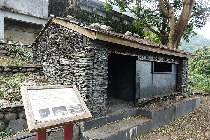
Photo adjustments
Full-frame source proportionally resized and converted to WebP for display. No subject alteration. Source-supplied marks and edits remain; cards may crop the view.
- Administrative area
- Rural township · 鄉
- Part of
- Pingtung County
- Chinese name
- 瑪家鄉
- Local areas
- Rural township guide
Area & population
- Area in the source
- 79.00 km²
Source: cited geographic source, as of the dates shown.
Culture and settlement
The Taiwan Indigenous Peoples Cultural Park (台灣原住民族文化園區) was created as an outdoor museum to preserve Indigenous cultures, support research and provide public education. Elsewhere in the township, the old stone-slab houses at Fawan (笩灣) offer a different connection with Paiwan life. Nose-flute traditions and Liangshan love songs (涼山情歌) are also associated with Majia.
Liangshan Waterfall
Liangshan Waterfall (涼山瀑布) lies in Liangshan Village (涼山村), fed by Niujiaowan Stream (牛角灣溪). Its three levels differ in character: the first falls in a slender flow into a pool, while the upper two are more forceful, particularly when water levels are high. Tall trees line the approach to the first cascade.
Sources for this guide
瑪家鄉 · Pingtung County Government
台灣原住民族文化園區 · Pingtung County Government
涼山瀑布 · Pingtung County Government
臺灣原住民族文化園區-茂林國家風景區管理處 · Maolin National Scenic Area Administration
Original English written from the listed sources and checked sentence by sentence against quoted extracts by a separate reviewer. Updated 2026-09-27.
Explore Majia Township
Core places to explore, with English and Chinese names.
Places to explore around Majia Township
Plan your visit
Getting there
Majia Township is about 20 km in a straight line from central Pingtung County. Search for 瑪家鄉 in a map app to find stations and your accommodation.
Where to stay →Build your route
Start with Taiwan Indigenous Peoples Cultural Park. The linked place guides have entrance and visit details.
Continue with Pingtung County →More in Pingtung County
Sources & geographic information
Administrative names and parent areas: Official geographic directory · Reference date 2026-09-06.
Photo: Taiwan Indigenous Peoples Cultural Park · Sin-siōng · CC BY-SA 4.0. Full-frame source proportionally resized and converted to WebP for display. No subject alteration. Source-supplied marks and edits remain; cards may crop the view.

Map data © OpenStreetMap contributors. Pins mark approximate centres, not entrances or boundaries.