


Get to know Wutai Township
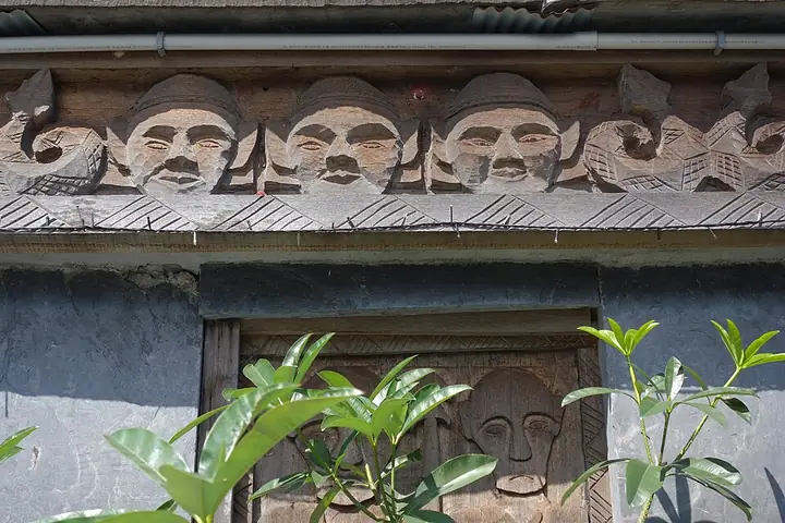
Photo adjustments
Full-frame source proportionally resized and converted to WebP for display. No subject alteration. Source-supplied marks and edits remain; cards may crop the view.
- Administrative area
- Rural township · 鄉
- Part of
- Pingtung County
- Chinese name
- 霧臺鄉
- Local areas
- Rural township guide
Area & population
- Area in the source
- 279.00 km²
Source: cited geographic source, as of the dates shown.
What to see
Yanban Lane (岩板巷) climbs the hillside on a pavement of flat stone slabs. Its railings carry pottery vessels decorated with snake motifs and other patterns: triangles represent mountains and rivers, horizontal lines rivers, and circles unity. The lanes also contain stone sculptures, smithies and bronze workshops. Houses are assembled from local stone cut and shaped by hand.
Culture and collections
Wutai Rukai Museum (霧臺魯凱族文物館) combines modern construction with stone slabs. Local artist Du Zaifu (杜再福) designed its exterior and completed the decoration with his father, Du Banan (杜巴男). Traditional dance provides the theme for the enclosing wall, while displays inside include clothing, everyday utensils and objects from Rukai settlements.
Explore Wutai Township
Core places to explore, with English and Chinese names.
Places to explore around Wutai Township
Plan your visit
Getting there
Wutai Township is about 25 km in a straight line from central Pingtung County. Search for 霧臺鄉 in a map app to find stations and your accommodation.
Where to stay →Build your route
Start with Wutai Rukai Village. The linked place guides have entrance and visit details.
Continue with Pingtung County →More in Pingtung County
Sources & geographic information
Administrative names and parent areas: Official geographic directory · Reference date 2026-09-06.
Photo: Wutai Rukai Village · Sin-siōng · CC BY 4.0. Full-frame source proportionally resized and converted to WebP for display. No subject alteration. Source-supplied marks and edits remain; cards may crop the view.

Map data © OpenStreetMap contributors. Pins mark approximate centres, not entrances or boundaries.