


Get to know Xinpi Township
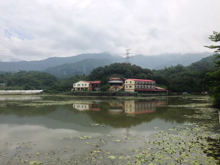
Photo adjustments
Full frame retained; proportionally resized and converted to WebP. No retouching or changes to the photographed subject. Card displays may crop the view.
- Administrative area
- Rural township · 鄉
- Part of
- Pingtung County
- Chinese name
- 新埤鄉
- Local areas
- Rural township guide
Area & population
- Area in the source
- 59.00 km²
Source: cited geographic source, as of the dates shown.
Setting and landscape
The roughly 24-hectare park occupies former protected woodland in Jiangong Village (建功村). The park has coconut and mahogany groves and an artificial lake supplied by groundwater and natural springs. The site lies in the Linbian River (林邊溪) basin, where subsurface water supports its constructed wetlands. These provide habitat for insects, reptiles, birds, fish and aquatic plants.
What to see
Jiangong's park includes a cycle path, a plant-dyeing workshop and an ecological education area. A separate site, Xinpi Comprehensive Recreation Park (新埤鄉綜合休閒公園), covers about seven hectares. Its features include an ecological pond, a curved bridge, lotuses, a pavilion, a bronze statue, basketball facilities and a children's play area.
Explore Xinpi Township
Core places to explore, with English and Chinese names.
Xinpi Township 新埤鄉
Plan your visit
Getting there
Xinpi Township is about 25 km in a straight line from central Pingtung County. Search for 新埤鄉 in a map app to find stations and your accommodation.
Where to stay →More in Pingtung County
Sources & geographic information
Administrative names and parent areas: Official geographic directory · Reference date 2026-09-06.
Map data © OpenStreetMap contributors. Pins mark approximate centres, not entrances or boundaries.