


Get to know Xayar County
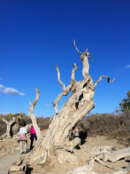
Photo adjustments
Full frame retained; proportionally resized and converted to WebP. No retouching or changes to the photographed subject. Card displays may crop the view.
- Administrative area
- County · 县
- Part of
- Aksu Prefecture
- Chinese name
- 沙雅县
- Local areas
- County guide
Area & population
- Area in the source
- 31,887.28 km²
- Population · 2020
- 278,516
- Administrative seat
- Xayar Town (Shayar, Shaya)
Source: cited geographic source, as of the dates shown.
Poplars along the Tarim
The 139 Poplar Scenic Road (139胡杨秘境自驾公路) follows the river for 139 kilometres and crosses three bridges. Its named landscapes include Xingxing Lake (星星湖), Paman Reservoir (帕满水库), Kekequele (科克却勒) and Moon Bay (月亮湾). Shayanzhou combines poplars growing in wetland, gravel desert, sand desert and water, with a floating pier, Poplar Lake (胡杨湖) and an observation tower among its features.
Fields and local flavours
The Yanqi–Xayar agricultural tourism park (雁栖·沙雅现代农业科技产业园) lies in Sayibake Village (萨依巴克村), Gulebage Town (古勒巴格镇). Its activities centre on agricultural displays and countryside recreation. Local foods named by the Ministry of Culture and Tourism include Xayar grilled fish (沙雅烤鱼) and Hailou pilaf (海楼抓饭).
Sources for this guide
新疆·阿克苏“胡杨秘境 诗画田园”之旅 · Ministry of Culture and Tourism
Original English written from the listed sources and checked sentence by sentence against quoted extracts by a separate reviewer. Updated 2026-09-27.
Explore Xayar County
Core places to explore, with English and Chinese names.
Xayar County 沙雅县
Plan your visit
Getting there
Xayar County is about 210 km in a straight line from central Aksu Prefecture. Search for 沙雅县 in a map app to find stations and your accommodation.
Where to stay →More in Aksu Prefecture
Sources & geographic information
Administrative names and parent areas: Official geographic directory · Reference date 2026-09-06.
Map data © OpenStreetMap contributors. Pins mark approximate centres, not entrances or boundaries.