


Get to know Aksu Prefecture
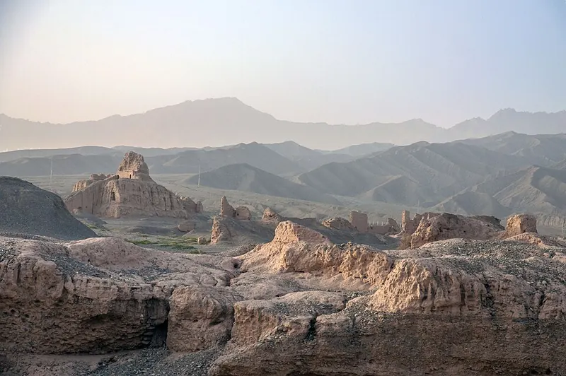
Photo adjustments
Full frame retained; proportionally resized and converted to WebP. No retouching or changes to the photographed subject. Card displays may crop the view.
- Administrative area
- Prefecture · 地区
- Part of
- Xinjiang
- Chinese name
- 阿克苏地区
- Local areas
- 9 local areas
Area & population
- Area in the source
- 127,817.00 km²
- Population · 2020 Census
- 2,714,422
- Administrative seat
- Aksu City
Source: cited geographic source, as of the dates shown.
Explore Aksu Prefecture
Core places to explore, with English and Chinese names.
Kizil Caves 克孜尔千佛洞
Subashi Temple 苏巴什佛寺遗址
Tianshan Mysterious Grand Canyon 天山神秘大峡谷
Kuqa 库车
Kuqa Royal Palace 库车王府
Wensu Tomur Grand Canyon Visitor Center 温宿托木尔大峡谷游客中心
Tianshan Tomur Tourism Area 天山托木尔旅游区
Yanquan Mountain Park 燕泉山
Kizilgaha Beacon Tower 克孜尔尕哈烽燧
Kuqa Old Town 库车老城
Kizil Ghost City 克孜尔魔鬼城
Tianshan Tomur Grand Canyon 天山托木尔大峡谷
Ta Village 塔村
Aksu Prefecture Museum 阿克苏地区博物馆
Aksu 阿克苏市
Kuqa 库车市
Wensu County 温宿县
Xayar County 沙雅县
Toksu County 新和县
Baicheng County 拜城县
Uqturpan County 乌什县
Awat County 阿瓦提县
Kalpin County 柯坪县
Places to explore around Aksu Prefecture
 Cliffside grottoes and walkways at the Kizil Caves, Baicheng County · 拜城县克孜尔千佛洞崖壁石窟与栈道 Source-recorded photograph date: 2006-10-01.
Kizil Caves克孜尔千佛洞
Kizil’s cave shrines were cut into the Mingwudag cliffs above the river in Baicheng County. Their forms and painted scenes preserve an important part of ancient Kucha’s Buddhist culture. The surviving murals are fragmentary, and…
Read the place guide →Earthen ruins of Subashi Temple near Kuqa · 苏巴什佛寺遗址 Photograph date recorded by the source: 2014-10-14 18:54:37.Subashi Temple苏巴什佛寺遗址
Subashi is a ruined Buddhist monastic complex near Kuqa, with earthen structures spread across eastern and western areas. Its surviving towers and walls convey the scale of religious life in the ancient Kucha region. Objects…
Read the place guide →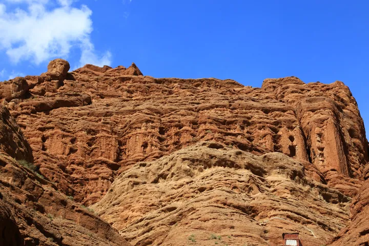 Red sandstone cliffs of the Tianshan Mysterious Grand Canyon, Kuqa · 库车天山神秘大峡谷红砂岩峡谷 Source-recorded photograph date: 2016-09-26 14:22:54.
Tianshan Mysterious Grand Canyon天山神秘大峡谷
Kuqa’s Tianshan Mysterious Grand Canyon cuts through red-brown sandstone and conglomerate on the southern side of the Tianshan. Narrow passages, high walls and changing light give the walk its character. The attraction is a…
Read the place guide → A street corner in the old town of Kuqa: earthen-walled single-storey shops with blue doors and a red signboard in Uyghur and Chinese, red metal carts and a covered stall along the kerb, two old cartwheels and gourds hung on the wall, a bed frame standing outside a house, and bare trees and power lines overhead.
Kuqa库车
Kuqa is a modern oasis city in the region of ancient Kucha, whose Buddhist art, music and languages formed part of Silk Road exchange. The old-town streets and reconstructed royal palace provide an urban introduction, while…
Read the place guide →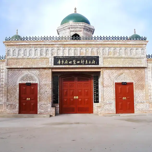 Kuqa Royal Palace · 库车王府
Kuqa Royal Palace库车王府
Kuqa Royal Palace presents the history of the local hereditary rulers in a reconstructed courtyard complex. The present buildings were rebuilt in the 2000s after the older palace was destroyed, so the visit is an interpretation…
Read the place guide →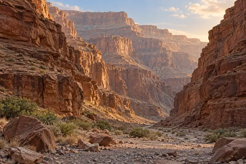 AI illustration · AI 示意图(仅供参考,非该地点实拍)
Wensu Tomur Grand Canyon Visitor Center温宿托木尔大峡谷游客中心
Wensu Grand Canyon, also promoted as Tianshan Tomur Grand Canyon, is a branching landscape of red cliffs, eroded pillars and salt-related landforms. The variety of shapes reflects several geological processes rather than a…
Read the place guide → AI illustration · AI 示意图(仅供参考,非该地点实拍)
Tianshan Tomur Tourism Area天山托木尔旅游区
The Tomur tourism area in Wensu links the Tamu village landscape with the separate Tomur Grand Canyon.
Read the place guide →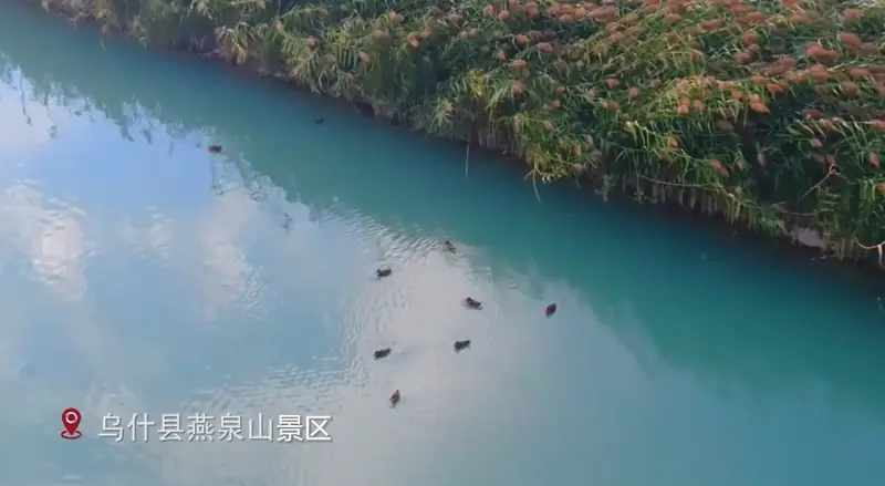 Yanquan Mountain Park · 燕泉山
Yanquan Mountain Park燕泉山
Yanquan Mountain (燕泉山) is a park in the centre of Wushi county town (乌什县), Aksu Prefecture, Xinjiang, named for Yanzi Mountain (燕子山) and the Nine Springs (九眼泉).
Read the place guide →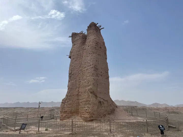 The eroded earthen Kizilgaha Beacon Tower near Kuqa, Aksu Prefecture · 阿克苏地区库车市克孜尔尕哈烽燧 Source-recorded photograph date: 2022-06-10.
Kizilgaha Beacon Tower克孜尔尕哈烽燧
Rammed-earth beacon tower 13 km northwest of Kuqa, dated to the Han, a national protected site and part of the Silk Roads World Heritage listing.
Read the place guide → Kuqa Old Town · 库车老城
Kuqa Old Town库车老城
Kuqa Old Town (库车老城) is the old quarter of Kuqa City (库车市), Aksu Prefecture, Xinjiang, and its Restan tourism and leisure district (热斯坦旅游休闲街区) was named in March 2025 in the Ministry of Culture and Tourism's fourth batch of national tourism and leisure districts.
Read the place guide → Kizil Ghost City · 克孜尔魔鬼城
Kizil Ghost City克孜尔魔鬼城
The Kizil Red Stone Forest (克孜尔红石林), the place the catalogue lists as Kizil Ghost City (克孜尔魔鬼城), is a yardang landform area lying between Kizil township (克孜尔乡) and Heiyingshan township (黑英山乡) in Baicheng County (拜城县), Aksu Prefecture (阿克苏地区), Xinjiang.
Read the place guide →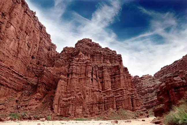 Tianshan Tomur Grand Canyon · 天山托木尔大峡谷
Tianshan Tomur Grand Canyon天山托木尔大峡谷
The Tomur Grand Canyon (天山托木尔大峡谷), also called the Kuduluke Grand Canyon (库都鲁克大峡谷), is a natural scenic area in Wensu County (温宿县), Aksu Prefecture (阿克苏地区), Xinjiang, where a set of named landforms is gathered.
Read the place guide → Ta Village · 塔村
Ta Village塔村
Ta Village (塔村) is the short name of Tagelake Village (塔格拉克村) in Kekeya township (柯柯牙镇), Wensu County (温宿县), Aksu Prefecture (阿克苏地区), Xinjiang — a village at the foot of Tomur Peak (托木尔峰), the highest peak of the Tianshan, whose economy now runs largely on rural tourism.
Read the place guide →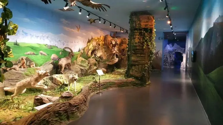 Aksu Prefecture Museum · 阿克苏地区博物馆
Aksu Prefecture Museum阿克苏地区博物馆
Regional museum in Aksu city, opened in its colour-block building in 2009, with galleries on Kucha, Dolan folk life and ancient Xinjiang coins.
Read the place guide →Local life & food
Aksu Prefecture local specialties
阿克苏地区特色美食 · 10 specialties to discover
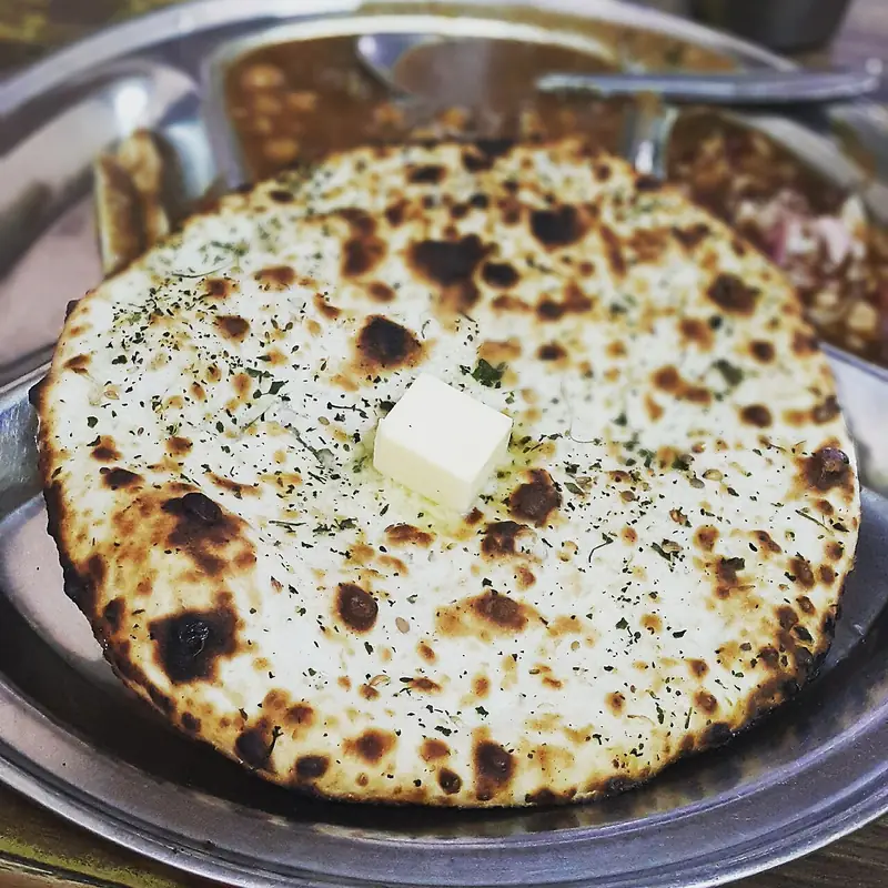 Kuqa Giant Nang Bread 库车大馕Reference photo of a similar dish · 同类菜品参考照片
Kuqa Giant Nang Bread (库车大馕) is the oversized flatbread of Kuqa (库车) in Aksu Prefecture (阿克苏地区). Xinjiang Daily sums it up as big, thin, crisp and fragrant.
Read the dish guide →
Photo adjustments
Full frame retained; EXIF orientation normalized, proportionally resized to at most 800 pixels and converted to WebP. No generated pixels or subject changes. Cards may crop the display.
 Kuqa Noodle Soup 库车汤面AI illustration · AI 示意图(仅供参考,非实拍)
Kuqa Noodle Soup (库车汤面) is a breakfast of hand-pulled noodles in broth from Kuqa (库车), Aksu Prefecture (阿克苏地区).
Read the dish guide →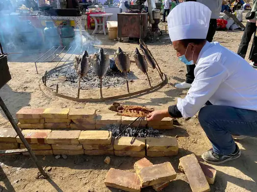 Shayar Roast Lamb 沙雅烤羊
Shayar Roast Lamb (沙雅烤羊) includes the whole-animal roast described by Shayar County Government (沙雅县人民政府), cooked with saxaul and red-willow branches.
Read the dish guide →Photo adjustments
EXIF orientation normalized; resized without changing aspect ratio; converted to WebP. No subject edits.
 Wensu Thin-Skinned Buns 温宿薄皮包子Reference photo of a similar dish · 同类菜品参考照片
Wensu Thin-Skinned Buns (温宿薄皮包子) are steamed buns with a very thin, unleavened wrapper around a filling of diced mutton or beef and onion, popular among Uyghurs, Uzbeks and Tatars. In Uyghur they are called pitir manta.
Read the dish guide →
Photo adjustments
Full frame retained; EXIF orientation normalized, proportionally resized to at most 800 pixels and converted to WebP. No generated pixels or subject changes. Cards may crop the display.
 Xinhe Braised Pigeon 新和卤鸽AI illustration · AI 示意图(仅供参考,非实拍)
Xinhe Braised Pigeon (新和卤鸽) is pigeon braised in a seasoned stock, a snack of Xinhe County (新和县) in Aksu Prefecture (阿克苏地区), Xinjiang. China News Service names Xinhe, with Wensu (温宿县), as a well-known home of braised pigeon.
Read the dish guide → Awat Meat Braised in Museles Wine 阿瓦提慕萨莱思炖肉AI illustration · AI 示意图(仅供参考,非实拍)
Awat Meat Braised in Museles Wine (阿瓦提慕萨莱思炖肉) is listed among the local specialties of Aksu Prefecture, Xinjiang. 炖 describes slow simmering.
Read the dish guide → Baicheng Oil Chicken 拜城油鸡AI illustration · AI 示意图(仅供参考,非实拍)
Baicheng Oil Chicken (拜城油鸡) is listed among the local specialties of Aksu Prefecture, Xinjiang. The name includes 鸡 (chicken).
Read the dish guide →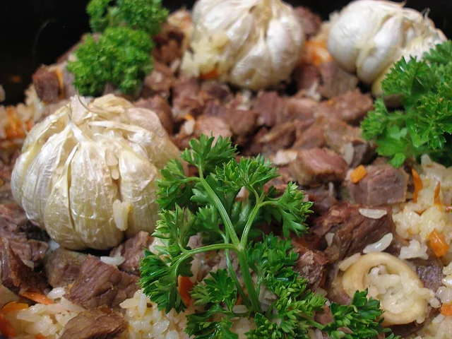 Polo rice 抓饭
The rice is rich and separate-grained, with sweet carrot, savory meat and occasional fruit sweetness rather than a sticky porridge texture.
Source ↗Read the dish guide →
Photo adjustments
EXIF orientation applied where present; resized proportionally to at most 640 px on the long edge and encoded as WebP. No crop, retouching, recoloring or subject changes.
More dishes from across Xinjiang are in the Xinjiang food guide.
Counties & districts in Aksu Prefecture
9 areas belong directly to Aksu Prefecture.
9 areas
Aksu 阿克苏市
Aksu (Uyghur: ئاقسۇ, Aqsu; Chinese: 阿克苏; pinyin: Ākèsū) is a city in and the seat of Aksu Prefecture, Xinjiang, lying at the northern edge of the Tarim Basin.
Explore the area →County-level cityKuqa 库车市
Kuqa ( KOO-chə) is a county-level city in Aksu Prefecture, Xinjiang, China. It is located in the center of Xinjiang, where the northern limit of the Tarim Basin meets the southern foot of the Tian Shan…
Explore the area →CountyWensu County 温宿县
Wensu County, also known as Onsu County (Uyghur: ئونسۇ ناھىيىسى, romanized: Onsu Nahiyisi), is a county in the Xinjiang Uygur Autonomous Region of China, under the administration of Aksu Prefecture, bordering…
Explore the area →CountyXayar County 沙雅县
Xayar County, also Shayar County or, from Mandarin Chinese, Shaya, is a county in the Xinjiang Uyghur Autonomous Region and is under the administration of the Aqsu Prefecture.
Explore the area →Show fewer areas
Toksu County 新和县
Xinhe County as the official romanized name, also formerly known as its Uyghur name Toksu County (Uyghur: توقسۇ ناھىيىسى; Chinese: 托克苏县), is a county in Aksu Prefecture, Xinjiang Uyghur Autonomous Region…
Explore the area →CountyBaicheng County 拜城县
Baicheng County as the official romanized name, also transliterated from Uyghur as Bay County (pronounced like 'bye',, Uyghur: باي ناھىيىسى; Chinese: 拜县), is a county in Aksu Prefecture of the Xinjiang Uyghur…
Explore the area →CountyUqturpan County 乌什县
Uqturpan County or Uchturpan County (transliterated from Uyghur: ئۇچتۇرپان ناھىيىسى; Chinese: 乌什吐鲁番县), also Wushi County, is a county in the Xinjiang Uyghur Autonomous Region under the administration of Aksu…
Explore the area →CountyAwat County 阿瓦提县
Awat County (Uyghur: ئاۋات ناھىيىسى) is a county in Aksu Prefecture, Xinjiang Uyghur Autonomous Region, China. Awat County is located on the southern foot of the Tian Shan mountain range and on the northern…
Explore the area →CountyKalpin County 柯坪县
Kalpin County is a county in the Xinjiang Uygur Autonomous Region and is under the administration of the Aksu Prefecture.
Explore the area →No areas match this name.
Plan your visit
Getting there
Search for 阿克苏地区 in a map app to find stations and your accommodation.
Where to stay →Build your route
Kizil Caves and Subashi Temple are about 45 km apart in a straight line. The linked place guides have entrance and visit details.
Continue with Xinjiang →More in Xinjiang
Sources & geographic information
Administrative names and parent areas: Official geographic directory · Reference date 2026-09-06.
Background text adapted from Aksu Prefecture — Wikipedia contributors, under CC BY-SA 4.0. Text has been shortened and reorganized; source revision 1324443127.
Photo: Kizil Caves · Rolfmueller · CC BY-SA 3.0. Full frame retained; proportionally resized and converted to WebP. No retouching or changes to the photographed subject. Card displays may crop the view.

Photo: Subashi Temple · Scott Newman · CC BY-SA 2.0. Full frame retained; proportionally resized and converted to WebP. No retouching or changes to the photographed subject. Card displays may crop the view.

Photo: Tianshan Mysterious Grand Canyon · Thinkdnt · CC BY-SA 4.0. Full frame retained; proportionally resized and converted to WebP. No retouching or changes to the photographed subject. Card displays may crop the view.
.jpg)
Photo: Kuqa · Windmemories · CC BY-SA 4.0. Full frame retained; proportionally resized and converted to WebP. No retouching or changes to the photographed subject. Card displays may crop the view.

Photo: Kuqa Royal Palace · Source photographer · License not provided. EXIF orientation normalized; resized without changing aspect ratio; converted to WebP. No subject edits.
Photo: Yanquan Mountain Park · Source photographer · License not provided. EXIF orientation normalized; resized without changing aspect ratio; converted to WebP. No subject edits.
Photo: Kizilgaha Beacon Tower · Este Momento · CC BY-SA 4.0. Full frame retained; proportionally resized and converted to WebP. No retouching or changes to the photographed subject. Card displays may crop the view.
.png)
Photo: Kuqa Old Town · Source photographer · License not provided. EXIF orientation normalized; resized without changing aspect ratio; converted to WebP. No subject edits.
Photo: Kizil Ghost City · Source photographer · License not provided. EXIF orientation normalized; resized without changing aspect ratio; converted to WebP. No subject edits.
Photo: Tianshan Tomur Grand Canyon · landagent · CC BY-SA 3.0. EXIF orientation normalized; resized without changing aspect ratio; converted to WebP. No subject edits.

Photo: Ta Village · Source photographer · License not provided. EXIF orientation normalized; resized without changing aspect ratio; converted to WebP. No subject edits.
Photo: Aksu Prefecture Museum · Source photographer · License not provided. EXIF orientation normalized; resized without changing aspect ratio; converted to WebP. No subject edits.
Map data © OpenStreetMap contributors. Pins mark approximate centres, not entrances or boundaries.