


Get to know Hutubi County
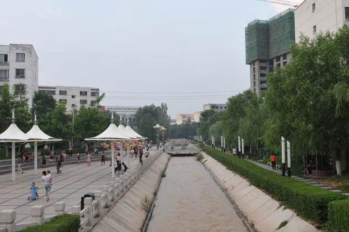
Photo adjustments
Full frame retained; proportionally resized and converted to WebP. No retouching or changes to the photographed subject. Card displays may crop the view.
- Administrative area
- County · 县
- Part of
- Changji Hui Autonomous Prefecture
- Chinese name
- 呼图壁县
- Local areas
- County guide
Area & population
- Area in the source
- 9,517.53 km²
- Population · 2020
- 192,638
- Administrative seat
- Hutubi Town
Source: cited geographic source, as of the dates shown.
Figures on the cliff
The carvings occupy about 120 square metres deep in the Tianshan Mountains (天山). Male and female figures appear standing or reclining, clothed or unclothed. The county culture and tourism bureau interprets the imagery as expressing wishes for fertility. The rock art became a national key cultural relic protection unit in 2013. The surrounding cliffs combine reddish-brown rock with bands of orange, yellow, blue and green.
A park beside the channel
Century Park (世纪园) follows Sangong Channel (三工渠). Construction began in spring 2004 and finished in autumn 2007. Its features include Cui Lake (翠湖), an artificial lake, white-marble bridges, a grape-covered corridor and the Xinjiang Saka Museum (新疆塞人博物馆). Bronze sculptures and relief walls portray local customs.
Sources for this guide
【旅游景区基本情况】呼图壁县A级旅游景区基本情况_呼图壁县人民政府 · Hutubi County Culture, Sports, Radio, Television and Tourism Bureau
Original English written from the listed sources and checked sentence by sentence against quoted extracts by a separate reviewer. Updated 2026-09-27.
Explore Hutubi County
Core places to explore, with English and Chinese names.
Places to explore around Hutubi County
 AI illustration · AI
 Plan your visit
Getting there
Hutubi County is about 30 km in a straight line from central Changji Hui Autonomous Prefecture. Search for 呼图壁县 in a map app to find stations and your accommodation.
Where to stay →Build your route
Start with Kangjiashimenzi Rock Art. The linked place guides have entrance and visit details.
Continue with Changji Hui Autonomous Prefecture →More in Changji Hui Autonomous Prefecture
Sources & geographic information
Administrative names and parent areas: Official geographic directory (dmfw.mca.gov.cn) · Reference date 2026-09-06.
Map data © OpenStreetMap contributors. Pins mark approximate centres, not entrances or boundaries.