


Get to know Jimsar County

Photo adjustments
Full frame retained; EXIF orientation normalized, proportionally resized to at most 800 pixels and converted to WebP. No generated pixels or subject changes. Cards may crop the display.
- Administrative area
- County · 县
- Part of
- Changji Hui Autonomous Prefecture
- Chinese name
- 吉木萨尔县
- Local areas
- County guide
Area & population
- Area in the source
- 8,140.84 km²
- Population · 2020
- 153,197
- Administrative seat
- Jimsar Town
Source: cited geographic source, as of the dates shown.
Two sets of city walls
Beiting has inner and outer cities, each with walls, gates and ditches. Both sets of walls were built from rammed earth, with projecting bastions and corner towers; the outer city also had bent entrance enclosures. In 2018, archaeologists excavated four gates and a Buddhist temple, recovering coins, lotus-patterned floor bricks, roof-tile fragments, pottery and animal bones. The remains record a city repeatedly developed during the Tang dynasty (唐).
An old route across the range
The Cheshi route passes through Quanzijie Town (泉子街镇), linking Jimsar north of the mountains with Turpan (吐鲁番) to the south. The county’s southern mountain valleys include Wutang Valley (吾塘沟), Weihu Valley (渭户沟) and Hua’er Valley (花儿沟).
Sources for this guide
旅游资源多样_吉木萨尔县人民政府网 · Jimsar County People’s Government
【道中华】实证西域为中国固有领土之② | 北庭都护府在哪里?一次意外发现揭开神秘面纱 · China Ethnic News / Dao Zhonghua; National Ethnic Affairs Commission
Original English written from the listed sources and checked sentence by sentence against quoted extracts by a separate reviewer. Updated 2026-09-27.
Explore Jimsar County
Core places to explore, with English and Chinese names.
Places to explore around Jimsar County
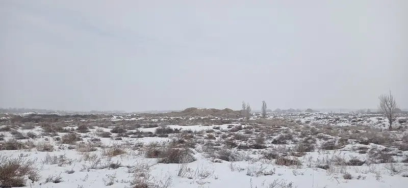 Beiting Ancient City Ruins (北庭故城), Jimsar County. Photograph: "Landscape in the inner city".
Beiting Ancient City Ruins北庭故城
Beiting Ancient City (北庭故城) is the archaeological site of a Tang-dynasty garrison city in Jimsar County (吉木萨尔县), Changji Hui Autonomous Prefecture, Xinjiang — the seat of the Beiting Protectorate, and a Major Historical and Cultural Site Protected at the National Level and a World Cultural Heritage site.
Read the place guide →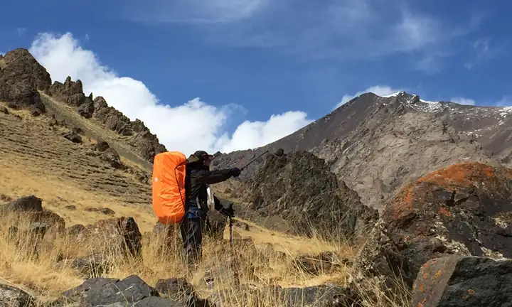 Cheshi Ancient Road Hiking Section · 车师古道正规徒步段
Cheshi Ancient Road Hiking Section车师古道正规徒步段
Che Shi Ancient Road (车师古道) is a historic mountain route that runs from Dalongkou in Quanzijie township, Jimsar County (吉木萨尔县), Xinjiang, south across the Tianshan to the Jiaohe ruins at Turpan, and it is still walked today.
Read the place guide →Plan your visit
Getting there
Jimsar County is about 140 km in a straight line from central Changji Hui Autonomous Prefecture. Search for 吉木萨尔县 in a map app to find stations and your accommodation.
Where to stay →Build your route
Beiting Ancient City Ruins and Cheshi Ancient Road Hiking Section are both listed here. The linked place guides have entrance and visit details.
Continue with Changji Hui Autonomous Prefecture →More in Changji Hui Autonomous Prefecture
Sources & geographic information
Administrative names and parent areas: Official geographic directory · Reference date 2026-09-06.
Photo: Beiting Ancient City Ruins · Kerdipole · CC BY-SA 4.0. Full frame retained; EXIF orientation normalized, proportionally resized to at most 800 pixels and converted to WebP. No generated pixels or subject changes. Cards may crop the display.

Photo: Cheshi Ancient Road Hiking Section · Source photographer · License not provided. EXIF orientation normalized; resized without changing aspect ratio; converted to WebP. No subject edits.
Map data © OpenStreetMap contributors. Pins mark approximate centres, not entrances or boundaries.