


Get to know Mori Kazakh Autonomous County
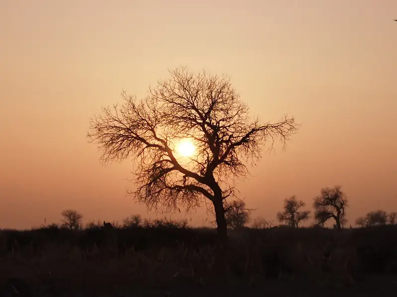
Photo adjustments
EXIF orientation normalized; resized without changing aspect ratio; converted to WebP. No subject edits.
- Administrative area
- Autonomous county · 自治县
- Part of
- Changji Hui Autonomous Prefecture
- Chinese name
- 木垒哈萨克自治县
- Local areas
- Autonomous county guide
Area & population
- Area in the source
- 13,510.28 km²
- Population · 2020
- 67,256
- Administrative seat
- Mori Town
Source: cited geographic source, as of the dates shown.
Five dunes and a poplar forest
Mingshashan National Desert Park (鸣沙山国家沙漠公园) lies roughly 160 kilometres north of the county seat. Its poplar-forest scenic area covers more than thirty square kilometres. The dunes form another part of the park, more than thirty kilometres from the forest. Five yellowish-brown dunes rise here, with the largest exceeding one hundred metres in vertical height and running from southwest to northeast.
Sand that sounds beneath a slide
In an October 2018 Tianshan Net account, reporter Aliya Turhong (阿丽娅·吐尔洪) describes visitors sliding down the fine sand and hearing a roar as it moved beneath them. Elsewhere in the county, Pingdingshan’s dry fields and Caizigou Artists’ Village (菜籽沟艺术家村落) feature in the county tourism commission’s description of rural destinations.
Sources for this guide
达人情醉木垒胡杨林鸣沙山 感叹值得用心去欣赏_ 文旅厅要闻_ 新疆维吾尔自治区文化和旅游厅 · Tianshan Net; Xinjiang Department of Culture and Tourism
木垒出台旅游优惠政策 促进全域旅游旺季更旺_ 地州动态_ 新疆维吾尔自治区文化和旅游厅 · Mori County Tourism Development Commission; Xinjiang Department of Culture and Tourism
Original English written from the listed sources and checked sentence by sentence against quoted extracts by a separate reviewer. Updated 2026-09-27.
Explore Mori Kazakh Autonomous County
Core places to explore, with English and Chinese names.
Places to explore around Mori Kazakh Autonomous County
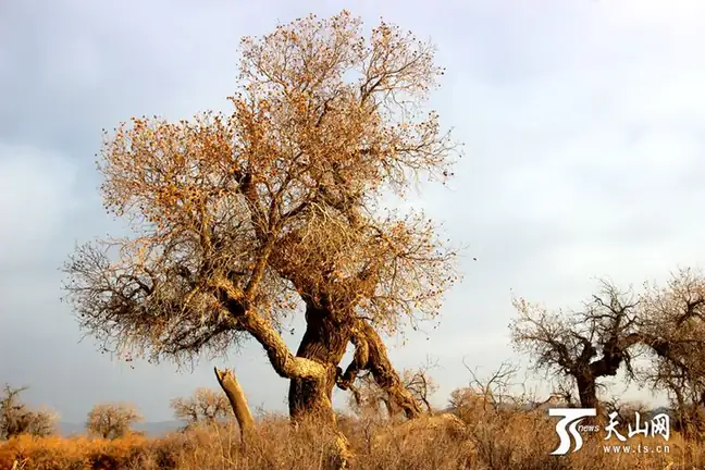 Mori Poplar Forest and Mingsha Hill · 木垒胡杨林与鸣沙山
Mori Poplar Forest and Mingsha Hill木垒胡杨林与鸣沙山
Mori Poplar Forest and Mingsha Hill (木垒胡杨林与鸣沙山) are two sights of Mingsha Hill National Desert Park (鸣沙山国家沙漠公园) in Mori Kazakh Autonomous County (木垒哈萨克自治县), Changji Hui Autonomous Prefecture, Xinjiang.
Read the place guide → AI illustration · AI 示意图(仅供参考,非该地点实拍)
Pingdingshan Grassland平顶山
Pingdingshan (平顶山) here is Pingdingshan village in Zhaobishan township (照壁山乡), Mori Kazakh Autonomous County (木垒哈萨克自治县), Changji Hui Autonomous Prefecture, Xinjiang, whose ten-thousand-mu dry farmland is the core of the county's mountain dry-field landscape.
Read the place guide →Plan your visit
Getting there
Mori Kazakh Autonomous County is about 240 km in a straight line from central Changji Hui Autonomous Prefecture. Search for 木垒哈萨克自治县 in a map app to find stations and your accommodation.
Where to stay →Build your route
Mori Poplar Forest and Mingsha Hill and Pingdingshan Grassland are both listed here. The linked place guides have entrance and visit details.
Continue with Changji Hui Autonomous Prefecture →More in Changji Hui Autonomous Prefecture
Sources & geographic information
Administrative names and parent areas: Official geographic directory · Reference date 2026-09-06.
Photo: Mori Poplar Forest and Mingsha Hill · Source photographer · License not provided. EXIF orientation normalized; resized without changing aspect ratio; converted to WebP. No subject edits.
Map data © OpenStreetMap contributors. Pins mark approximate centres, not entrances or boundaries.