


Get to know Dayao County
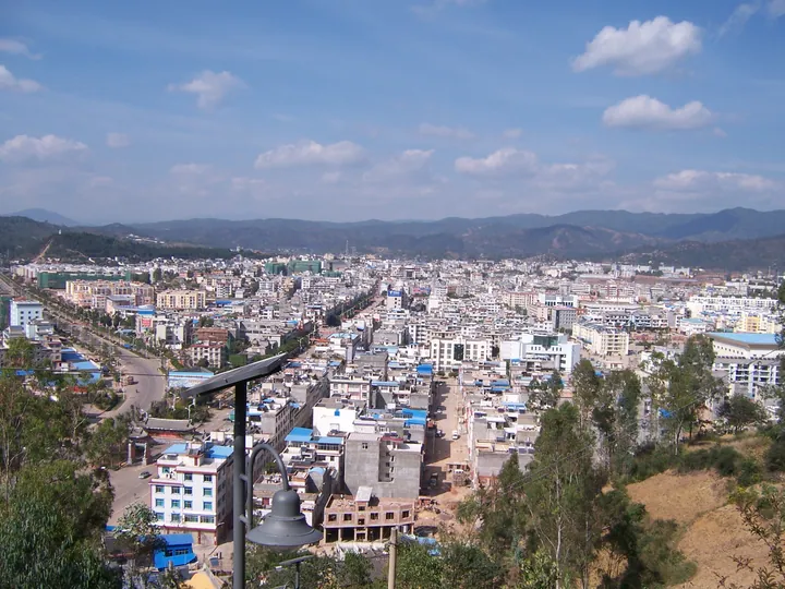
Photo adjustments
Full frame retained; proportionally resized and converted to WebP. No retouching or changes to the photographed subject. Card displays may crop the view.
- Administrative area
- County · 县
- Part of
- Chuxiong Yi Autonomous Prefecture
- Chinese name
- 大姚县
- Local areas
- County guide
Area & population
- Area in the source
- 4,146.00 km²
Source: cited geographic source, as of the dates shown.
Brine, timber and old roads
Shiyang retains stone-paved packhorse routes marked by hoofprints, old salt wells and a salt-culture museum. The museum presents salt-making history, salt-transport maps and the town’s wells. A timber evaporation structure, the Shaiyanpeng (晒盐篷), was used to increase the concentration of brine. Eighteen metres high and more than fifty metres long, it has a bamboo-covered roof supported by rows of timber posts.
A copper figure of Confucius
Shiyang Confucian Temple (石羊孔庙) faces south, with the Xiangshui River (香水河) passing in front. Its buildings include Dacheng Hall (大成殿), side halls and a teaching hall. Inside Dacheng Hall stands a copper statue of Confucius (孔子), measuring 2.3 metres high and weighing 2.5 tonnes.
Sources for this guide
跟着“滇超”游楚雄 | 精品景区:“千年盐都·祭孔圣地”大姚县石羊古镇等您来!-大姚县人民政府 · Dayao Culture and Tourism Bureau
Original English written from the listed sources and checked sentence by sentence against quoted extracts by a separate reviewer. Updated 2026-09-27.
Explore Dayao County
Core places to explore, with English and Chinese names.
Places to explore around Dayao County
 AI illustration · AI
 Plan your visit
Getting there
Dayao County is about 80 km in a straight line from central Chuxiong Yi Autonomous Prefecture. Search for 大姚县 in a map app to find stations and your accommodation.
Where to stay →Build your route
Start with Shiyang Ancient Town. The linked place guides have entrance and visit details.
Continue with Chuxiong Yi Autonomous Prefecture →More in Chuxiong Yi Autonomous Prefecture
Sources & geographic information
Administrative names and parent areas: Official geographic directory (dmfw.mca.gov.cn) · Reference date 2026-09-06.
Map data © OpenStreetMap contributors. Pins mark approximate centres, not entrances or boundaries.