


Get to know Nanhua County
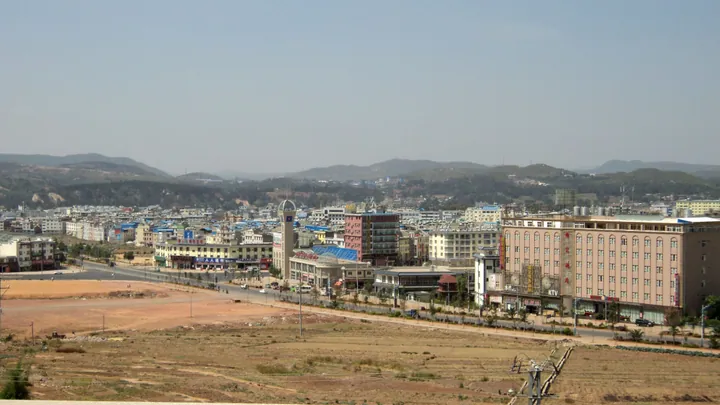
Photo adjustments
Full frame retained; proportionally resized and converted to WebP. No retouching or changes to the photographed subject. Card displays may crop the view.
- Administrative area
- County · 县
- Part of
- Chuxiong Yi Autonomous Prefecture
- Chinese name
- 南华县
- Local areas
- County guide
Area & population
- Area in the source
- 2,343.00 km²
Source: cited geographic source, as of the dates shown.
Embroidery, songs and village courtyards
The valley lies near the meeting point of Nanhua, Yao’an (姚安) and Mouding (牟定). Its named sites include Yakou Village (垭口村), Jiaolouzhai (角楼寨), Qijia Courtyard (起家大院) and Ma’anzhai (马鞍寨). Traditional clothing, embroidery, mountain songs and left-foot dancing form part of the valley’s cultural life. Hospitality traditions include welcoming music and wine offered in sheep-horn cups.
Mushrooms and village cooking
Food is another part of Miyilu’s village tourism. The local repertoire includes wild mushrooms, black goat, black-boned chicken and wild vegetables. A Nanhua County Government account also records roasted fresh matsutake, bitter-buckwheat cakes dipped in honey, potatoes cooked in copper pots and sweet bamboo shoots boiled with ham among dishes served in the valley.
Sources for this guide
南华咪依噜风情谷-南华县人民政府 · Nanhua County Government
南华扮靓咪依噜风情谷-南华县人民政府 · Nanhua County Government
Original English written from the listed sources and checked sentence by sentence against quoted extracts by a separate reviewer. Updated 2026-09-27.
Explore Nanhua County
Core places to explore, with English and Chinese names.
Nanhua County 南华县
Plan your visit
Getting there
Nanhua County is about 30 km in a straight line from central Chuxiong Yi Autonomous Prefecture. Search for 南华县 in a map app to find stations and your accommodation.
Where to stay →More in Chuxiong Yi Autonomous Prefecture
Sources & geographic information
Administrative names and parent areas: Official geographic directory (dmfw.mca.gov.cn) · Reference date 2026-09-06.
Map data © OpenStreetMap contributors. Pins mark approximate centres, not entrances or boundaries.