


Get to know Dongchuan District

Photo adjustments
Full frame retained; proportionally resized and converted to WebP. No retouching or changes to the photographed subject. Card displays may crop the view.
- Administrative area
- District · 市辖区
- Part of
- Kunming
- Chinese name
- 东川区
- Local areas
- District guide
Area & population
- Area in the source
- 1,858.00 km²
- Population · 2020
- 260,744
Source: cited geographic source, as of the dates shown.
The solitary Laolong Tree
Near Huagou (花沟), Laolong Tree (老龙树) stands on an isolated hill within the Red Land scenic area, without other tall trees around it. The fir has an evergreen, umbrella-shaped crown and reaches about ten metres in height. It was a filming location for Forever Young (无问西东).
A tree in local belief
A local legend says the tree died for three years before returning to life. Residents regard it as a protector of favourable weather and good harvests, and hold ritual observances during festivals. The Dongchuan district government’s tourism guidance identifies June potato blossoms and the November potato harvest as periods when the fields are especially colourful.
Sources for this guide
红土为布,洋芋花开丨这片土地本身就是一幅流动的巨幅油画_昆明市东川区人民政府_美丽东川 · Dongchuan District Culture and Tourism Bureau / District People’s Government
【趣玩东川·山水之趣】红土地之魂·千年老龙树_昆明市东川区人民政府_美丽东川 · Dongchuan District People’s Government
Original English written from the listed sources and checked sentence by sentence against quoted extracts by a separate reviewer. Updated 2026-09-27.
Explore Dongchuan District
Core places to explore, with English and Chinese names.
Places to explore around Dongchuan District
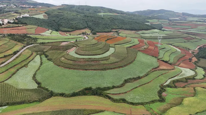 Terraced fields in the colours of the Dongchuan Red Land, Kunming ·
 Plan your visit
Getting there
Dongchuan District is about 125 km in a straight line from central Kunming. Search for 东川区 in a map app to find stations and your accommodation.
Where to stay →Build your route
Start with Dongchuan Red Land. The linked place guides have entrance and visit details.
Continue with Kunming →More in Kunming
Sources & geographic information
Administrative names and parent areas: Official geographic directory · Reference date 2026-09-06.
Photo: Dongchuan Red Land · 瑞丽江的河水 · CC BY-SA 4.0. Full frame retained; proportionally resized and converted to WebP. No retouching or changes to the photographed subject. Card displays may crop the view.

Map data © OpenStreetMap contributors. Pins mark approximate centres, not entrances or boundaries.