


Get to know Ximeng Va Autonomous County
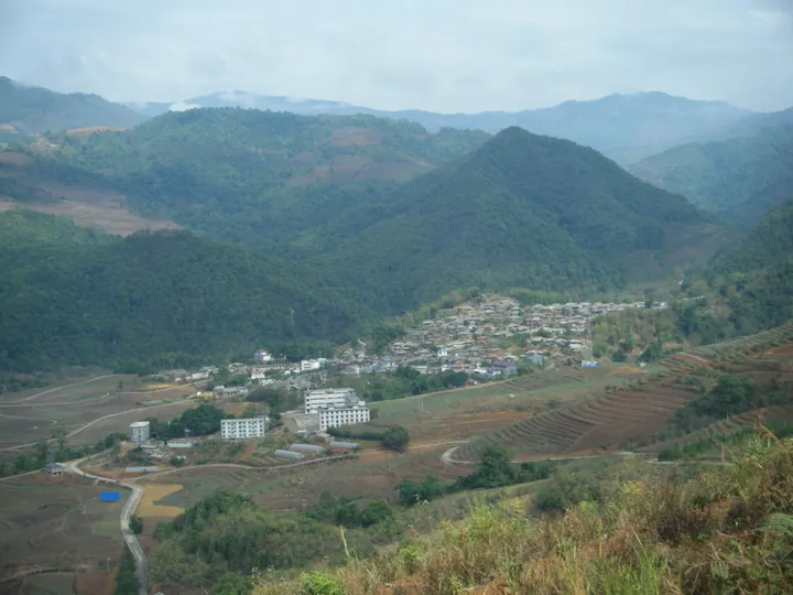
Photo adjustments
Full frame retained; proportionally resized and converted to WebP. No retouching or changes to the photographed subject. Card displays may crop the view.
- Administrative area
- Autonomous county · 自治县
- Part of
- Pu'er
- Chinese name
- 西盟佤族自治县
- Local areas
- Autonomous county guide
Area & population
- Area in the source
- 1,391.00 km²
- Population · 2020 census
- 87,291
- Administrative seat
- Mengsuo
Source: cited geographic source, as of the dates shown.
Mountain country and named sights
Almost all of Ximeng is mountain or hill country, with only a small area of flat basin land. Elevations range from 590 to 2,458.9 metres, producing pronounced vertical differences in mountain climate. Mengsuo Longtan (勐梭龙潭) is a nationally rated 4A scenic area; the Wa Bulue tourism resort (佤部落旅游度假区) is a provincial tourism resort.
Song and wooden drums
The song Awa People Sing a New Song (阿佤人民唱新歌) originated in Ximeng. Wooden-drum ceremonies are part of its Wa cultural celebrations. At the county’s 2024 Wooden Drum Festival (木鼓节), Dai, Wa and Lahu participants beat the drums together and sang the song. The programme brought drum worship and drum playing into the same celebration.
Sources for this guide
西盟概况-西盟佤族自治县人民政府 · Ximeng County Government
【精彩回顾】中国佤族木鼓节—祭木鼓 敲木鼓-西盟佤族自治县人民政府 · Ximeng County Government
Original English written from the listed sources and checked sentence by sentence against quoted extracts by a separate reviewer. Updated 2026-09-30.
Explore Ximeng Va Autonomous County
Core places to explore, with English and Chinese names.
Places to explore around Ximeng Va Autonomous County
 Mengsuo Dragon Pool ·
 Plan your visit
Getting there
Ximeng Va Autonomous County is about 145 km in a straight line from central Pu'er. Search for 西盟佤族自治县 in a map app to find stations and your accommodation.
Where to stay →Build your route
Start with Mengsuo Dragon Pool. The linked place guides have entrance and visit details.
Continue with Pu'er →More in Pu'er
Sources & geographic information
Administrative names and parent areas: Official geographic directory · Reference date 2026-09-06.
Photo: Mengsuo Dragon Pool · Source photographer · License not provided. EXIF orientation normalized; resized without changing aspect ratio; converted to WebP. No subject edits.
Map data © OpenStreetMap contributors. Pins mark approximate centres, not entrances or boundaries.