


Get to know Yanjin County
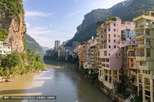
Photo adjustments
EXIF orientation normalized; resized without changing aspect ratio; converted to WebP. No subject edits.
- Administrative area
- County · 县
- Part of
- Zhaotong
- Chinese name
- 盐津县
- Local areas
- County guide
Area & population
- Area in the source
- 1,416.00 km²
Source: cited geographic source, as of the dates shown.
Hoofprints on the cliffside
The surviving road section is about 350 metres long and 1.7 metres wide, with 243 hoofprints worn into its surface. It once carried packhorse traffic transporting cloth, salt, rice, mountain produce, medicinal materials and tea. From the pass, the old route can be seen together with the river, railway and modern roads threading the gorge.
A Tang envoy’s record
The Yuan Zi Cliff Inscription (袁滋题记摩崖石刻) dates to 794, recording an imperial mission to Nanzhao (南诏). Its 122 characters run in eight vertical lines; the signature uses seal script and the rest regular script. Across the Guan River (关河), hanging coffins associated with the Bo people (僰人) remain on the cliffs.
Sources for this guide
跟着档案看云南——昭通篇 |豆沙关:千年古道上的文明印记_云南档案网 · Yanjin County Archives, via Yunnan Archives
Original English written from the listed sources and checked sentence by sentence against quoted extracts by a separate reviewer. Updated 2026-09-27.
Explore Yanjin County
Core places to explore, with English and Chinese names.
Places to explore around Yanjin County
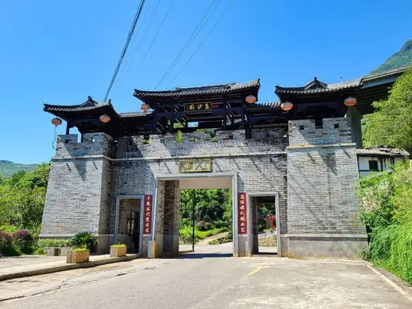 Doushaguan Ancient Town ·
 Plan your visit
Getting there
Yanjin County is about 100 km in a straight line from central Zhaotong. Search for 盐津县 in a map app to find stations and your accommodation.
Where to stay →Build your route
Start with Doushaguan Ancient Town. The linked place guides have entrance and visit details.
Continue with Zhaotong →More in Zhaotong
Sources & geographic information
Administrative names and parent areas: Official geographic directory · Reference date 2026-09-06.
Photo: Doushaguan Ancient Town · Source photographer · License not provided. EXIF orientation normalized; resized without changing aspect ratio; converted to WebP. No subject edits.
Map data © OpenStreetMap contributors. Pins mark approximate centres, not entrances or boundaries.