


Get to know Zhenxiong County
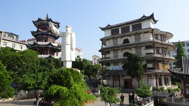
Photo adjustments
Full frame retained; proportionally resized and converted to WebP. No retouching or changes to the photographed subject. Card displays may crop the view.
- Administrative area
- County · 县
- Part of
- Zhaotong
- Chinese name
- 镇雄县
- Local areas
- County guide
Area & population
- Area in the source
- 3,785.00 km²
- Population · 2020
- 1,349,795
Source: cited geographic source, as of the dates shown.
River headwaters
The county spans elevations from 630 to 2,416 metres and includes the Chishui, Wu River (乌江) and Baishui River (白水江) systems. Chishuiyuan Town (赤水源镇) contains the Chishui headwaters, its Sister Springs (赤水河源姊妹泉), Little Stone Forest (小石林) and Wanjuanshu Waterfall (万卷书瀑布).
History and local produce
Zhenxiong traces its administrative history to Nanguang County (南广县) in the Han dynasty. Local historical remains include Western Zhou bronze axes, Western Han wuzhu coins and the ancient carvings of Mangbu (芒部). Chishuiyuan grows maize, potatoes and red beans; its fruit and nut crops include chestnuts, walnuts, peaches, plums and strawberries.
Explore Zhenxiong County
Core places to explore, with English and Chinese names.
Zhenxiong County 镇雄县
Plan your visit
Getting there
Zhenxiong County is about 115 km in a straight line from central Zhaotong. Search for 镇雄县 in a map app to find stations and your accommodation.
Where to stay →More in Zhaotong
Sources & geographic information
Administrative names and parent areas: Official geographic directory · Reference date 2026-09-06.
Map data © OpenStreetMap contributors. Pins mark approximate centres, not entrances or boundaries.