


Get to know Qingyuan County
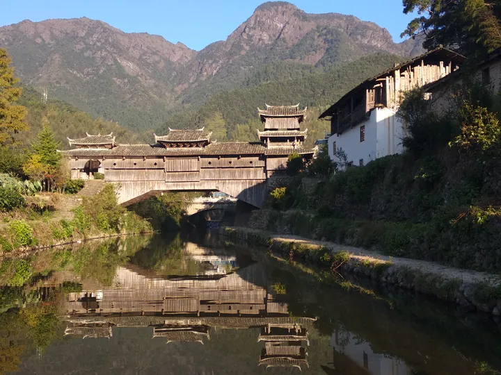
Photo adjustments
Full frame retained; proportionally resized and converted to WebP. No retouching or changes to the photographed subject. Card displays may crop the view.
- Administrative area
- County · 县
- Part of
- Lishui
- Chinese name
- 庆元县
- Local areas
- County guide
Area & population
- Area in the source
- 1,898.00 km²
- Population · 2005
- 198,440
- Administrative seat
- Songyuan
Source: cited geographic source, as of the dates shown.
Covered bridges in the mountains
A covered bridge combines a crossing with a roofed structure above its deck. Qingyuan’s examples include wooden arch bridges, stone arches and timber-beam forms. Rulong Bridge (如龙桥), Lanxi Bridge (兰溪桥) and Huangshui Long Bridge (黄水长桥) are notable monuments. A court research account records the covered-bridge museum opening in2011 with displays of construction techniques, history and cultural setting.
Forests and farming traditions
The county has ridges, deep valleys and mountain basins, with Baishanzu rising in its eastern mountain area. Its forest-and-mushroom cultivation system received recognition as a Globally Important Agricultural Heritage System in 2022. Bridge-walking customs and foods such as dark-coloured rice and seasonal rice cakes add to the county’s cultural identity.
Sources for this guide
风雨廊桥,梦幻与现实的博弈――关于对庆元古廊桥保护与开发现状的调研——庆元县人民法院 · Qingyuan County People’s Court
庆元概况 · Qingyuan County Government
Original English written from the listed sources and checked sentence by sentence against quoted extracts by a separate reviewer. Updated 2026-09-30.
Explore Qingyuan County
Core places to explore, with English and Chinese names.
Places to explore around Qingyuan County
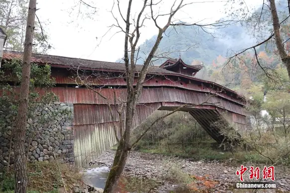 Qingyuan Covered Bridges ·
 Plan your visit
Getting there
Qingyuan County is about 125 km in a straight line from central Lishui. Search for 庆元县 in a map app to find stations and your accommodation.
Where to stay →Build your route
Start with Qingyuan Covered Bridges. The linked place guides have entrance and visit details.
Continue with Lishui →More in Lishui
Sources & geographic information
Administrative names and parent areas: Official geographic directory · Reference date 2026-09-06.
Photo: Qingyuan Covered Bridges · Source photographer · License not provided. EXIF orientation normalized; resized without changing aspect ratio; converted to WebP. No subject edits.
Map data © OpenStreetMap contributors. Pins mark approximate centres, not entrances or boundaries.