


Get to know Bijie City
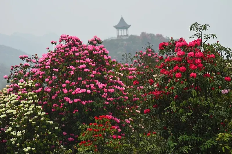
Photo adjustments
Full frame retained; proportionally resized and converted to WebP. No retouching or changes to the photographed subject. Card displays may crop the view.
- Administrative area
- Prefecture-level city · 地级市
- Part of
- Guizhou
- Chinese name
- 毕节市
- Local areas
- 8 local areas
Area & population
- Area in the source
- 26,853.00 km²
- Population · 2020 census
- 6,899,636
- Administrative seat
- Qixingguan District
Source: cited geographic source, as of the dates shown.
Setting and landscape
The land slopes from the eastern Yunnan plateau in the west down to the hills of central Guizhou in the east, at an average of 1,600 metres. The city gives its highest point as Xiao Jiucaiping (小韭菜坪) in Hezhang County (赫章县), 2,900.6 metres, and its lowest as 457 metres in the Chishui valley. The Wumeng range runs through the west and the Dalou Mountains (大娄山) through the north, and summers average 21°C, which the city calls a "natural air conditioner".
History
The Guanyindong Paleolithic site (观音洞) in Qianxi (黔西市) is paired with Zhoukoudian: "Zhoukoudian in the north, Guanyindong in the south". Before the Qin, Bijie belonged to the Yelang (夜郎) realm, and the Kele site (可乐遗址) in Hezhang is a national key cultural relic, as are the Shexiang Museum in Dafang County (大方县), honouring the early-Ming Yi heroine Shexiang (奢香) who opened nine post stations, and the Yi Datun chieftains' manor (大屯土司庄园). The Qing set up Dading prefecture, today's Dafang, in 1666. In 1935 the Central Red Army crossed the Wu River southwards in Jinsha County (金沙县), and in 1936 the Red Second and Sixth Army Groups set up the Sichuan–Yunnan–Guizhou Provincial Revolutionary Committee here. On the national intangible-heritage list are Cuotaiji (撮泰吉), a masked Yi drama whose name means "drama of becoming human" and which the list says survives only in Luoga village (裸嘎寨), Weining County, and Zhijin Miao batik (织金苗族蜡染), whose makers lay out patterns with their fingernails alone.
What to see
Zhijin Cave (织金洞), a national scenic area, is described by the city as the world's largest and most beautiful show cave. Baili Azalea (百里杜鹃), a national forest park of 125.8 square kilometres with more than 60 kinds of azalea, flowers around the Qingming festival. Caohai (草海), a national nature reserve, is a plateau freshwater lake of 27.5 square kilometres with 155 bird species. At Jiudongtian (九洞天) a 7-kilometre underground river links nine caves, and the Jiucaiping scenic area (韭菜坪) in Hezhang has stone forest and upland grassland.
Food and local products
Bijie is known as China's home of bamboo fungus (竹荪), gastrodia (天麻) and walnuts. Kele pigs (可乐猪), a native breed of Kele township in Hezhang said to resemble the pottery pigs excavated there, are made into cured pork that is simply steamed.
Getting oriented
The city government sits in Qixingguan District (七星关区). The Chengdu–Guiyang high-speed railway, opened in December 2019, stops at Bijie, Dafang and Qianxi, and Bijie Feixiong Airport (毕节飞雄机场) lies east of the city.
Highlights
- Zhijin Cave 织金洞: National scenic area that the city describes as the world's largest and most beautiful show cave.
- Baili Azalea 百里杜鹃: National forest park of 125.8 km2 with more than 60 kinds of azalea, flowering around Qingming.
- Caohai 草海: Plateau freshwater lake of 27.5 km2 and national nature reserve with 155 bird species.
- Jiudongtian 九洞天: National scenic area where a 7 km underground river links nine caves.
- Cuotaiji 撮泰吉: Masked Yi drama that the national intangible-heritage list says survives only in Luoga village, Weining County; listed in 2006.
- Kele pig cured pork 赫章可乐猪腊肉: Cured pork from the native Kele pig of Hezhang, eaten simply steamed.
Sources for this guide
毕节简介(概况) - 毕节市人民政府门户网站 · Bijie Municipal People's Government
历史沿革 - 毕节市人民政府门户网站 · Bijie Municipal People's Government
自然地理 - 毕节市人民政府门户网站 · Bijie Municipal People's Government
赫章可乐猪腊肉 - 毕节市人民政府门户网站 · Bijie Municipal People's Government
毕节市 - 维基百科,自由的百科全书 · Chinese Wikipedia · CC BY-SA 4.0
彝族撮泰吉 - 中国非物质文化遗产网·中国非物质文化遗产数字博物馆 - 中国非物质文化遗产网非遗 · China Intangible Cultural Heritage Network (Chinese National Academy of Arts)
蜡染技艺(织金苗族蜡染) - 中国非物质文化遗产网·中国非物质文化遗产数字博物馆 - 蜡染技艺(织金苗族蜡染) · China Intangible Cultural Heritage Network (Chinese National Academy of Arts)
Original English written from the listed sources and checked sentence by sentence against quoted extracts by a separate reviewer. Updated 2026-10-01.
Explore Bijie City
Core places to explore, with English and Chinese names.
Zhijin Cave 织金洞
Weining Caohai 威宁草海
Jiudongtian 九洞天
Bijie Museum 毕节市博物馆
Shexiang Museum 奢香博物馆
Baili Azalea Jinpo Scenic Area 百里杜鹃金坡景区
Baili Azalea Pudi Scenic Area 百里杜鹃普底景区
Caohai Lake Viewing Area 草海开放观景区
Zhijin Grand Canyon 织金大峡谷
Axilixi Jiucaiping Plateau 阿西里西韭菜坪
Axilixi Ertaipo Grassland 阿西里西二台坡
Lengshui River 冷水河
Baili Azalea Scenic Area 百里杜鹃
Qixingguan District 七星关区
Dafang County 大方县
Jinsha County 金沙县
Zhijin County 织金县
Nayong County 纳雍县
Weining Yi, Hui, and Miao Autonomous County 威宁彝族回族苗族自治县
Hezhang County 赫章县
Qianxi City 黔西市
Places to explore around Bijie City
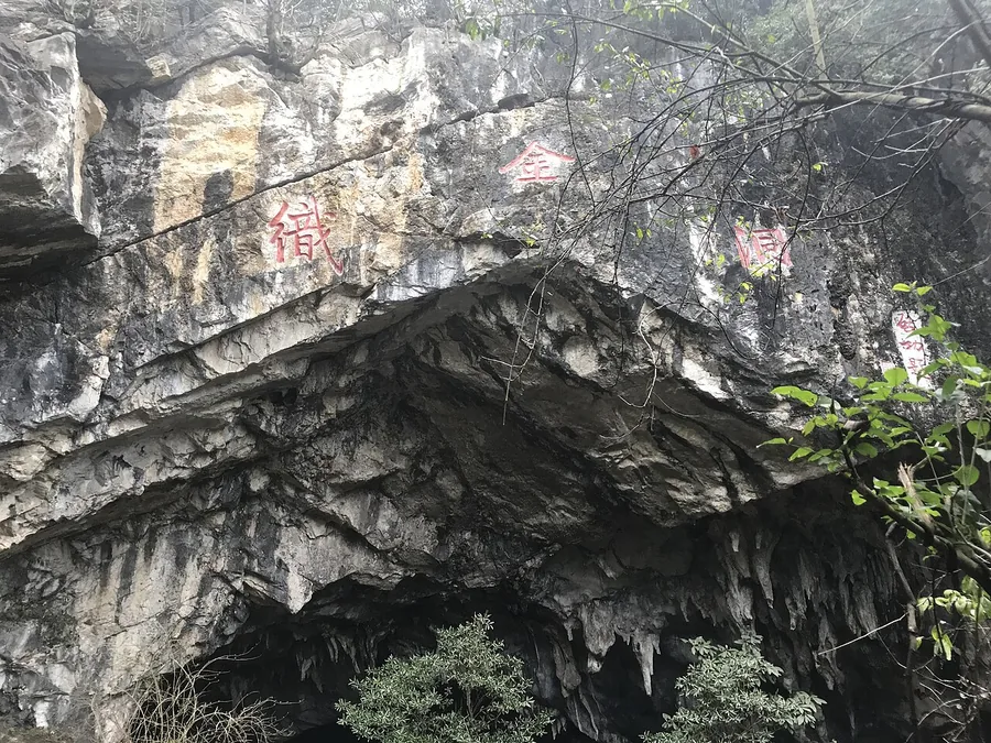 The natural rock entrance to Zhijin Cave, February 2019.
Zhijin Cave织金洞
Zhijin Cave contains large karst chambers filled with stalactites, columns and other mineral deposits. The Silver Rain Tree is its best-known individual formation, with branching, flower-like shapes that differ from the more…
Read the place guide → AI illustration · AI 示意图(仅供参考,非该地点实拍)
Weining Caohai威宁草海
Caohai is a shallow highland wetland beside Weining, with open water, reed beds and a wintering population of black-necked cranes and other waterbirds. The public landscape around the reserve provides the appropriate way to…
Read the place guide →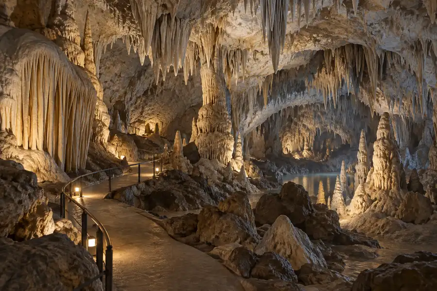 AI illustration · AI 示意图(仅供参考,非该地点实拍)
Jiudongtian九洞天
Jiudongtian is a linked cave-and-river landscape on the Liuchong River near the boundary of Dafang and Nayong. The river passes through an underground section with nine openings to the sky, giving the attraction its name. Those…
Read the place guide →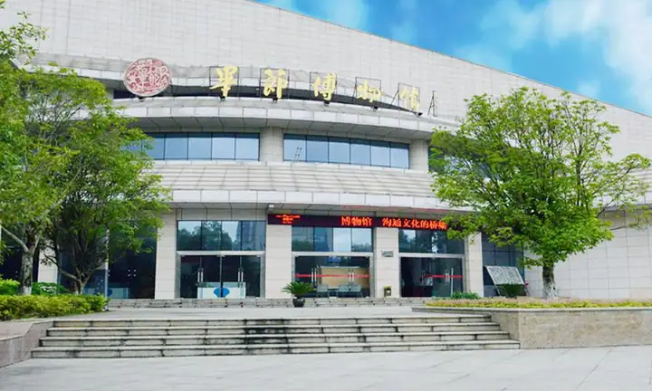 Bijie Museum · 毕节市博物馆
Bijie Museum毕节市博物馆
Bijie Museum’s main exhibition follows the Wumeng region from early human activity through later communities and modern history. Archaeological objects provide one thread; regional crafts and everyday objects provide another…
Read the place guide → Shexiang Museum · 奢香博物馆
Shexiang Museum奢香博物馆
Shexiang Museum introduces the history and culture of the Shuixi Yi communities through the figure of Shexiang and a broader collection of manuscripts and objects. The museum buildings draw on traditional Yi chieftain-estate…
Read the place guide →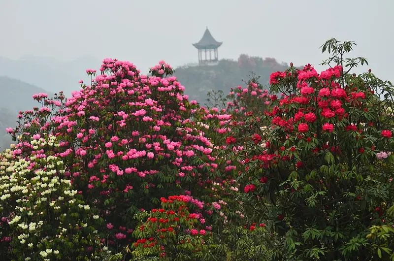 Baili Azalea Jinpo Scenic Area (百里杜鹃金坡景区), Bijie. Photograph: "Azaleas Area".
Baili Azalea Jinpo Scenic Area百里杜鹃金坡景区
Jinpo is one of Baili Dujuan’s main rhododendron-forest visitor areas. Baihuaping offers a close encounter with the flowering trees, while Suoma Flower Bridge introduces a different viewpoint over the planted and wooded…
Read the place guide →Baili Azalea Pudi Scenic Area (百里杜鹃普底景区), Bijie City. Photograph: "Azaleas Area".Baili Azalea Pudi Scenic Area百里杜鹃普底景区
Pudi is one of the principal flower-viewing areas within Baili Azalea near Bijie. Its woodland paths and higher viewpoints give a distinct route through the spring rhododendron landscape, separate from the Jinpo visitor area.
Read the place guide →AI illustration · AI 示意图(仅供参考,非该地点实拍)Caohai Lake Viewing Area草海开放观景区
Caohai is a plateau lake at the southern edge of the county town of Weining Yi, Hui and Miao Autonomous County in Bijie, western Guizhou, and is protected as a national nature reserve. The catalogue name refers to the parts of that reserve where visitors may look out over it; no source consulted uses the phrase as a designation of its own.
Read the place guide → AI illustration · AI 示意图(仅供参考,非该地点实拍)
Zhijin Grand Canyon织金大峡谷
Zhijin Grand Canyon is a karst gorge in Zhijin County, Bijie, in western Guizhou, three kilometres long and two kilometres from the Zhijin Cave scenic area. It is also known as the yixian sancao scenic area, and the Bijie municipal publicity department describes it as the surface landscape of the first world geopark in Guizhou and one of the first batch of national water conservancy scenic areas.
Read the place guide → AI illustration · AI 示意图(仅供参考,非该地点实拍)
Axilixi Jiucaiping Plateau阿西里西韭菜坪
Axilixi Jiucaiping is a high-plateau scenic area in the south-west of Hezhang County, Bijie, Guizhou, at the meeting point of Xingfa, Shuitangbao and Baiguo townships. Its subject is an upland covered in wild Chinese chives, and the Bijie municipal government also calls it the Da Jiucaiping scenic area.
Read the place guide →AI illustration · AI 示意图(仅供参考,非该地点实拍)Axilixi Ertaipo Grassland阿西里西二台坡
Ertaipo is another name for the Axilixi grassland in Hezhang County, Bijie, Guizhou, a high pasture landscape around 2,300 metres above sea level. It is also known as Yunding Caoyuan, and is one of the main scenic areas of the Guizhou Axilixi tourism region.
Read the place guide →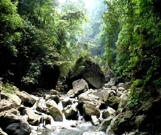 Lengshui River · 冷水河
Lengshui River冷水河
The Lengshuihe is a river and gorge in the west of Jinsha County, Bijie, Guizhou, about 30 kilometres from the county town. It gives its name both to one of the three scenic areas of the Jinsha Lengshuihe provincial forest park and to a provincial nature reserve covering the surrounding forested catchment.
Read the place guide →Blooming azaleas with a hilltop pavilion at the Hundred Miles of Azaleas scenic area, Bijie · 毕节百里杜鹃风景区,杜鹃花海与观景亭 Source-recorded photograph date: Taken on 12 April 2012.Baili Azalea Scenic Area百里杜鹃
5A scenic area in north-western Guizhou's Wumeng Mountains with a 125.8 km² wild azalea belt, Yi festivals and 19°C summers.
Read the place guide →Local life & food
Bijie City local specialties
毕节市特色美食 · 13 specialties to discover
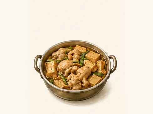 Dafang dried-tofu chicken hotpot 大方豆干鸡火锅AI dish illustration / AI 菜品示意图
The chicken provides savoury depth and the tofu a chewy contrast. Chilli heat depends on the base chosen.
Source ↗Read the dish guide → Weining cured ham 威宁火腿AI dish illustration / AI 菜品示意图
The ham has a firm texture and concentrated savouriness. Thin slices and a small quantity can season a much larger vegetable dish.
Source ↗Read the dish guide → Bijie Glutinous Rice Dumplings 毕节汤圆Reference photo of a similar dish · 同类菜品参考照片
Bijie Glutinous Rice Dumplings (毕节汤圆) are tangyuan, balls of glutinous rice dough wrapped round a sweet filling, and the Bijie (毕节) city government counts them among the city's traditional snacks.
Read the dish guide →
Photo adjustments
Full frame retained; EXIF orientation normalized, proportionally resized to at most 800 pixels and converted to WebP. No generated pixels or subject changes. Cards may crop the display.
 Zhijin Cold Buckwheat Jelly 织金荞凉粉
Zhijin Cold Buckwheat Jelly (织金荞凉粉) is a set jelly of sweet buckwheat made in Zhijin county (织金县) in Bijie (毕节), Guizhou, scraped into strands and eaten with a dip built on fermented bean curd.
Read the dish guide →Photo adjustments
EXIF orientation normalized; resized without changing aspect ratio; converted to WebP. No subject edits.
 Qianxi Yellow Rice Cake 黔西黄粑AI illustration · AI 示意图(仅供参考,非实拍)
Qianxi Yellow Rice Cake (黔西黄粑) is a golden, sticky cake of glutinous rice and soybeans made in Qianxi (黔西), Bijie (毕节), Guizhou.
Read the dish guide → Dafang Dried Tofu Hot Pot 大方豆干火锅Reference photo of a similar dish · 同类菜品参考照片
Dafang Dried Tofu Hot Pot (大方豆干火锅) is a spicy hotpot of hand-pressed squares of dried tofu from Dafang County (大方县) in Bijie (毕节), Guizhou.
Read the dish guide →
 Weining buckwheat pastries 威宁荞酥AI illustration · AI 示意图
The shell is crumbly and slightly earthy, with a deeper grain flavor than an all-wheat pastry. The filling adds sweetness and density.
Source ↗Read the dish guide →Weining Small Buckwheat Pastries 威宁小粑粑AI illustration · AI 示意图(仅供参考,非实拍)
Weining Small Buckwheat Pastries (威宁小粑粑) are the small half-moon pastries of Weining (威宁) county in Bijie (毕节), Guizhou, made with a wheat-and-buckwheat skin around a ham-and-tofu filling and cooked in a covered flat pan until the base forms a thin crust.
Read the dish guide →All dish names · 全部菜名 (13)
- Dafang dried-tofu chicken hotpot · 大方豆干鸡火锅
- Weining cured ham · 威宁火腿
- Bijie Glutinous Rice Dumplings · 毕节汤圆
- Zhijin Cold Buckwheat Jelly · 织金荞凉粉
- Qianxi Yellow Rice Cake · 黔西黄粑
- Dafang Dried Tofu Hot Pot · 大方豆干火锅
- Weining buckwheat pastries · 威宁荞酥
- Weining Small Buckwheat Pastries · 威宁小粑粑
- Hezhang Walnut Candy · 赫章核桃糖
- Nayong Torch Fish · 纳雍火把鱼
- Jinsha Mutton Rice Noodles · 金沙羊肉粉
- Zhijin Griddle Barbecue · 织金烙锅
- Bijie Stinky Tofu · 毕节臭豆腐
More dishes from across Guizhou are in the Guizhou food guide.
Counties & districts in Bijie City
8 areas belong directly to Bijie City.
8 areas
Qixingguan District 七星关区
Qixingguan District (simplified Chinese: 七星关区; traditional Chinese: 七星關區; pinyin: Qīxīngguān Qū; lit. 'pass of seven stars') is the seat of the city of Bijie, Guizhou province, China.
Explore the area →CountyDafang County 大方县
Dafang, called Dading until 1958, is a county of Guizhou province, China. It is under the administration of Bijie city.
Explore the area →CountyJinsha County 金沙县
Jinsha (simplified Chinese: 金沙县; traditional Chinese: 金沙縣; pinyin: Jīnshā Xiàn) is a county in northwestern Guizhou province, China, bordering Sichuan to the north across the Chishui River.
Explore the area →CountyZhijin County 织金县
Zhijin County is a county under the administration of the prefecture-level city of Bijie in west-central Guizhou province, China.
Explore the area →Show fewer areas
Nayong County 纳雍县
Nayong County (simplified Chinese: 纳雍县; traditional Chinese: 納雍縣; pinyin: Nàyōng Xiàn) is a county in the west of Guizhou province, China. It is under the administration of Bijie city.
Explore the area →Autonomous countyWeining Yi, Hui, and Miao Autonomous County 威宁彝族回族苗族自治县
Weining Yi, Hui and Miao Autonomous County (simplified Chinese: 威宁彝族回族苗族自治县; traditional Chinese: 威寧彝族回族苗族自治縣; pinyin: Wēiníng Yízú Huízú Miáozú Zìzhìxiàn; Nasu:, Wusa Nasu pronunciation: [ʂo˩˧ hɪ˨˩ mi˩˧]…
Explore the area →CountyHezhang County 赫章县
Hezhang is a county in the northwest of Guizhou province, China, bordering Yunnan to the north. It is under the administration of the prefecture-level city of Bijie.
Explore the area →County-level cityQianxi City 黔西市
Qianxi is a county-level city of western Guizhou province, China. It is under the administration of Bijie City. The county had a population of 970,700 in 2019.
Explore the area →No areas match this name.
Plan your visit
Getting there
Search for 毕节市 in a map app to find stations and your accommodation.
Where to stay →Build your route
Zhijin Cave and Weining Caohai are about 165 km apart in a straight line. The linked place guides have entrance and visit details.
Continue with Guizhou →More in Guizhou
Sources & geographic information
Administrative names and parent areas: Official geographic directory · Reference date 2026-09-06.
Some facts checked against 毕节市 — Wikipedia contributors, CC BY-SA 4.0.
Photo: Zhijin Cave · Esiymbro · CC BY-SA 4.0. Proportionally resized and converted to WebP without cropping, retouching or changing the photographed subject.

Photo: Bijie Museum · Source photographer · License not provided. EXIF orientation normalized; resized without changing aspect ratio; converted to WebP. No subject edits.
Photo: Shexiang Museum · Source photographer · License not provided. EXIF orientation normalized; resized without changing aspect ratio; converted to WebP. No subject edits.
Photo: Baili Azalea Jinpo Scenic Area · Fanghong · CC BY-SA 3.0. Full frame retained; EXIF orientation normalized, proportionally resized to at most 800 pixels and converted to WebP. No generated pixels or subject changes. Cards may crop the display.

Photo: Baili Azalea Pudi Scenic Area · Fanghong · CC BY-SA 3.0. Full frame retained; EXIF orientation normalized, proportionally resized to at most 800 pixels and converted to WebP. No generated pixels or subject changes. Cards may crop the display.
Photo: Lengshui River · Source photographer · License not provided. EXIF orientation normalized; resized without changing aspect ratio; converted to WebP. No subject edits.
Photo: Baili Azalea Scenic Area · Fanghong · CC BY-SA 3.0. Full frame retained; proportionally resized and converted to WebP. No retouching or changes to the photographed subject. Card displays may crop the view.

Map data © OpenStreetMap contributors. Pins mark approximate centres, not entrances or boundaries.