


Get to know Luanping County
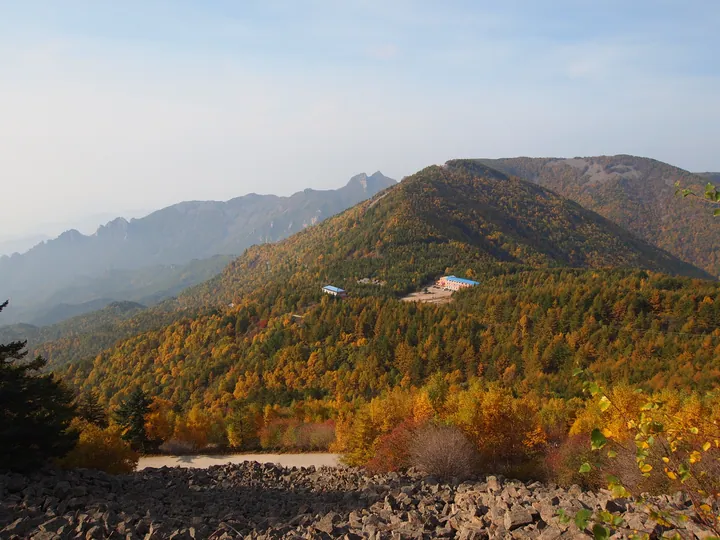
Photo adjustments
Full frame retained; proportionally resized and converted to WebP. No retouching or changes to the photographed subject. Card displays may crop the view.
- Administrative area
- County · 县
- Part of
- Chengde
- Chinese name
- 滦平县
- Local areas
- County guide
Area & population
- Area in the source
- 3,195.00 km²
- Population · 2020
- 268,647
- Administrative seat
- Luanping Town (滦平镇)
Source: cited geographic source, as of the dates shown.
Setting and landscape
The county has the mountain climate of the Yanshan (燕山) range, with four distinct seasons, long winters and short summers. Four rivers cross it: the Chao (潮河), the Luan (滦河), the Yixun (伊逊河) and the Xingzhou (兴洲河). Forest covers more than 62 percent of the land, and the state has designated the county a water-conservation zone for the capital.
History
The county government dates human settlement here to 6,800 years ago. The Shanrong (山戎) people lived in the area for more than seven centuries, from the Shang and Zhou to the Warring States period, and in the Han dynasty it held Baitan County (白檀县). Luanping itself was formally made a county in 1778, the 43rd year of the Qianlong reign.
Under the Qing, emperors travelling between Beijing and their summer retreat at Chengde had to pass through. The county counts five imperial roads, eight travelling palaces, eight temples built by imperial order and four official post stations, and records 230 journeys through the area by the Kangxi, Qianlong, Jiaqing and Xianfeng emperors.
What to see
Jinshanling Great Wall (金山岭长城) was built under the Ming general Qi Jiguang (戚继光) while he commanded the Jizhen (蓟镇) garrison between 1567 and 1586; the county government notes its dense watchtowers and good state of preservation. It is part of the Great Wall World Heritage listing, a national key protected site and a national 5A scenic area, and hosts a marathon and an apricot-blossom festival.
Baicaowa National Forest Park (白草洼国家森林公园), a 4A scenic area in the southeast of the county, covers 5,396 hectares and is described by the county as holding the largest primary-secondary white birch forest in North China. Bixia Mountain (碧霞山) scenic area lies 9 km south of the county town, and Zhuanshan Lake (转山湖) scenic area in Fuyingzi (付营子镇) rises to a main peak of 1,577 metres.
Lunhua (抡花, "swinging flowers") is on the national intangible-heritage list (2014). On the 15th day of the first lunar month, performers swing wire cylinders packed with crushed cast-iron pot fragments and birch or cypress charcoal, throwing out showers of sparks. The national list traces it to the Liang family of Dadianzi village (大店子村) in Huodoushan (火斗山), who began it in the Kangxi era as an offering to the fire god.
Getting oriented
The Beijing–Chengde (京承), Zhangjiakou–Chengde (张承) and Chengde–Chifeng (承赤) expressways cross the county, as do the Beijing–Tongliao (京通) and Tangshan–Hohhot (唐呼) railways. Tianjin is 275 km away.
Highlights
- Jinshanling Great Wall 金山岭长城: Ming wall section built under Qi Jiguang between 1567 and 1586; national 5A scenic area and part of the World Heritage listing.
- Baicaowa National Forest Park 白草洼国家森林公园: 4A forest park of 5,396 hectares with what the county calls North China's largest primary-secondary white birch forest.
- Lunhua 抡花: Lantern Festival spark display with iron and charcoal, national intangible heritage since 2014.
Sources for this guide
滦平县人民政府 滦平概况 走进滦平 · Luanping County People's Government
滦平县人民政府 滦平概况 文旅滦平 · Luanping County People's Government
元宵节(抡花) - 中国非物质文化遗产网·中国非物质文化遗产数字博物馆 · China Intangible Cultural Heritage Network (Ministry of Culture and Tourism)
Luanping County - Wikipedia · Wikipedia · CC BY-SA 4.0
Original English written from the listed sources and checked sentence by sentence against quoted extracts by a separate reviewer. Updated 2026-09-24.
Explore Luanping County
Core places to explore, with English and Chinese names.
Places to explore around Luanping County
 Jinshanling Great Wall ·
 Plan your visit
Getting there
Luanping County is about 55 km in a straight line from central Chengde. Search for 滦平县 in a map app to find stations and your accommodation.
Where to stay →Build your route
Start with Jinshanling Great Wall. The linked place guides have entrance and visit details.
Continue with Chengde →More in Chengde
Sources & geographic information
Administrative names and parent areas: Official geographic directory · Reference date 2026-09-06.
Some facts checked against Luanping County — Wikipedia contributors, CC BY-SA 4.0.
Photo: Jinshanling Great Wall · Georgio · CC BY-SA 3.0. Wikimedia thumbnail; fitted to the ranking-card frame.

Map data © OpenStreetMap contributors. Pins mark approximate centres, not entrances or boundaries.