


Get to know Longhua County
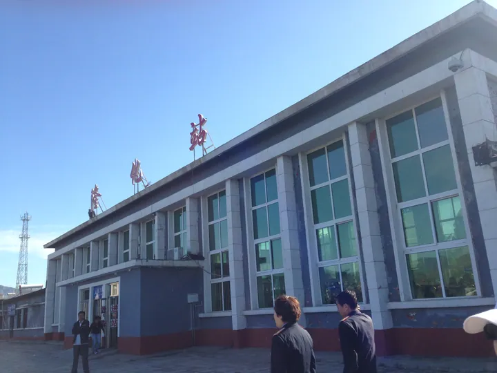
Photo adjustments
Full frame retained; proportionally resized and converted to WebP. No retouching or changes to the photographed subject. Card displays may crop the view.
- Administrative area
- County · 县
- Part of
- Chengde
- Chinese name
- 隆化县
- Local areas
- County guide
Area & population
- Area in the source
- 5,444.00 km²
- Population · 2020 census
- 347,707
Source: cited geographic source, as of the dates shown.
History
The Northern Wei set up Anzhou (安州) here, the Liao Beianzhou (北安州) and the Jin and Yuan Xingzhou (兴州). The county government records a battle between the Jin and the Khitans at Xianquan (陷泉) in 1162, and says that in 1690 the Kangxi Emperor directed the Battle of Ulan Butung (乌兰布通之战) from Longhua. The county itself dates from 1910, its name taken from a phrase meaning prosperity and enlightenment, and it lay on the route of the Qing emperors' Mulan autumn hunt (木兰秋狝); the sites of seven Qing travelling palaces survive.
Setting and landscape
The Luan, Yimatu (伊玛图河), Yixun (伊逊河) and Wulie (武烈河) rivers all belong to the Luan basin, and the county is a water source for Beijing and Tianjin. Forest covers 59.01 percent of the land and 87 percent around Qijia (七家) and Maojingba (茅荆坝) in the east. Five natural hot springs have been developed, with water up to 98 °C; the county government calls them the largest in flow and highest in temperature in North China, and the county carries the title "home of hot springs in China".
What to see
The Dong Cunrui Martyrs' Cemetery (董存瑞烈士陵园) is a 4A scenic area and one of the country's hundred classic red-tourism sites. The county has two national protected sites: the Tuchengzi city site (隆化土城子城址), with remains from the Northern Wei, Liao, Jin and Yuan periods and listed in 2013, and the imperial stele of the Mulan hunting grounds (木兰围场御制碑).
Manchu Ergui wrestling (满族二贵摔跤), on the national intangible heritage list since 2008, took shape around 1850. One performer wears a wooden frame dressed as two squat wrestlers, using arms and legs to play both and throwing them about to drums; today groups of six to eight perform it together. Provincial listings include the Longhua zhongfan banner (隆化中幡) and the bawangbian stick dance (霸王鞭).
Food and local products
Yibaijiazi bo yumian (一百家子拨御面), a noodle from the county, is on the provincial intangible heritage list, and Longhua is also named a home of beef cattle in China.
Highlights
- Dong Cunrui Martyrs' Cemetery 董存瑞烈士陵园: 4A scenic area and national classic red-tourism site.
- Tuchengzi city site 隆化土城子城址: City site of the Northern Wei to Yuan, a national key protected site since 2013.
- Manchu Ergui wrestling 满族二贵摔跤: One performer plays two wrestlers; national intangible heritage since 2008.
- Longhua hot springs 隆化温泉: Five developed natural springs with water up to 98 °C.
Sources for this guide
隆化县概况 · Longhua County People's Government
满族二贵摔跤 - 中国非物质文化遗产网·中国非物质文化遗产数字博物馆 · China Intangible Cultural Heritage Network (ihchina.cn)
隆化土城子城址 - 维基百科,自由的百科全书 · Chinese Wikipedia · CC BY-SA 4.0
Original English written from the listed sources and checked sentence by sentence against quoted extracts by a separate reviewer. Updated 2026-09-24.
Explore Longhua County
Core places to explore, with English and Chinese names.
Longhua County 隆化县
Plan your visit
Getting there
Longhua County is about 45 km in a straight line from central Chengde. Search for 隆化县 in a map app to find stations and your accommodation.
Where to stay →More in Chengde
Sources & geographic information
Administrative names and parent areas: Official geographic directory · Reference date 2026-09-06.
Some facts checked against 隆化土城子城址 — Wikipedia contributors, CC BY-SA 4.0.
Map data © OpenStreetMap contributors. Pins mark approximate centres, not entrances or boundaries.