


Get to know Chongli District
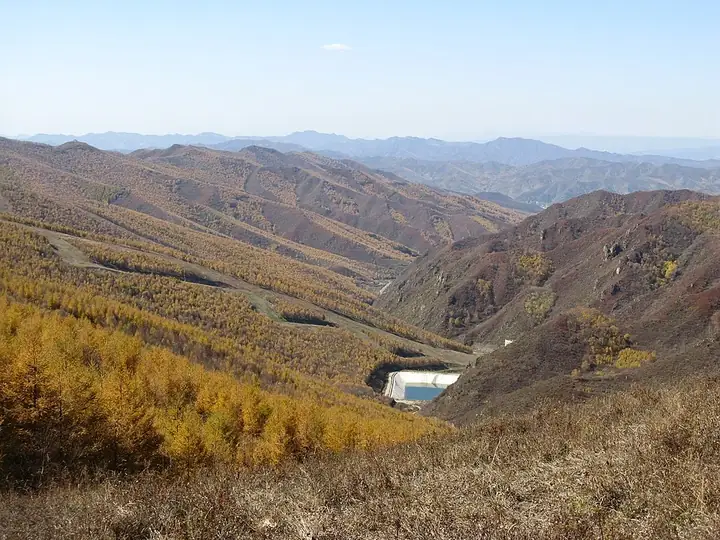
Photo adjustments
Full frame retained; resized proportionally to a maximum dimension of 960 pixels and converted to WebP quality 88. No crop, retouch, generated elements, or subject alteration. Final website rendition: full frame retained, proportionally resized to at most 720 pixels and converted to WebP. No additional retouching or subject alteration. Card displays may crop the view.
- Administrative area
- District · 市辖区
- Part of
- Zhangjiakou
- Chinese name
- 崇礼区
- Local areas
- District guide
Area & population
- Area in the source
- 2,350.00 km²
- Population · 2020
- 105,501
Source: cited geographic source, as of the dates shown.
Setting and landscape
About 80 percent of the district is mountain. The ranges belong to the meeting zone of the eastern Yin Mountains (阴山) and outliers of the Yan Mountains (燕山), mostly running northeast to southwest or east to west, with peaks usually between 1,500 and 2,000 metres. Elevation ranges from 813 to 2,174 metres. The district government sums up the terrain as endless mountains and countless gullies, and describes it as a transition between the Bashang (坝上) upland and the country below it.
Warm, moist air from the southeast is forced upward here and meets the westerlies, which the district government credits for Chongli's own microclimate. Forest covers 67 percent of the district and more than 80 percent of the core Olympic competition zone. Winter averages minus 12°C, snow falls early, and snow lies for up to 150 days.
What to see
Skiing is the main draw, and the district government notes that its mountain slopes mostly run at 5 to 35 degrees, with vertical drops of up to 800 metres. Eight ski areas have been built: Wanlong (万龙), Genting (云顶), Thaiwoo (太舞), Fulong (富龙), Yinhe (银河), Duolemeidi (多乐美地), Changchengling (长城岭) and Shixuechuan (拾雪川). Together they have 169 runs totalling about 162 kilometres. The district government calls this the largest cluster of high-end ski resorts in China, and Chongli is listed as a national-level tourism resort.
In the district seat, Xiwanzi (西湾子), stands the Xiwanzi Catholic church (西湾子天主教堂). Catholicism reached the village in 1700 and church building began in 1762. In 1841 Xiwanzi became the seat of the first bishop of the newly created Mongolia mission, and in 1865 Belgian missionaries of the Congregation of the Immaculate Heart of Mary (圣母圣心会) arrived and took over the mission. The church complex grew to more than a hundred mu, and the village became the new county seat in 1936.
History
Before the early Ming the area was grazing land of nomadic peoples. It was split from Zhangbei County (张北县) in 1934 as a separate administrative bureau, which Japanese forces turned into a county after occupying it in January 1936. Chongli County was formally restored in 1949 and joined Hebei in November 1952. It came under Zhangjiakou city in 1993 and became a district in January 2016.
Getting oriented
Chongli is 150 kilometres from Beijing in a straight line. The Chongli railway links it to Beijing, and the Beijing–Chongli Expressway (京礼高速) runs 157 kilometres.
Highlights
- Wanlong Ski Resort 万龙滑雪场: One of the eight ski areas the district government lists in Chongli.
- Genting Snow Park 云顶滑雪公园: Genting is one of the eight ski areas listed by the district government.
- Thaiwoo Ski Resort 太舞滑雪小镇: Thaiwoo (太舞) is one of the eight ski areas listed by the district government.
- Xiwanzi Catholic church 西湾子天主教堂: Church building began here in 1762; in 1841 it became the seat of the first bishop of the Mongolia mission.
Sources for this guide
张家口市崇礼区情况简介 - 张家口市崇礼区人民政府 · Chongli District People's Government, Zhangjiakou
张家口市崇礼区历史沿革 - 张家口市崇礼区人民政府 · Chongli District People's Government, Zhangjiakou
崇礼区地质地貌 - 张家口市崇礼区人民政府 · Chongli District People's Government, Zhangjiakou
西湾子天主教堂 - 维基百科,自由的百科全书 · Wikipedia (Chinese) · CC BY-SA 4.0
Original English written from the listed sources and checked sentence by sentence against quoted extracts by a separate reviewer. Updated 2026-09-25.
Explore Chongli District
Core places to explore, with English and Chinese names.
Places to explore around Chongli District
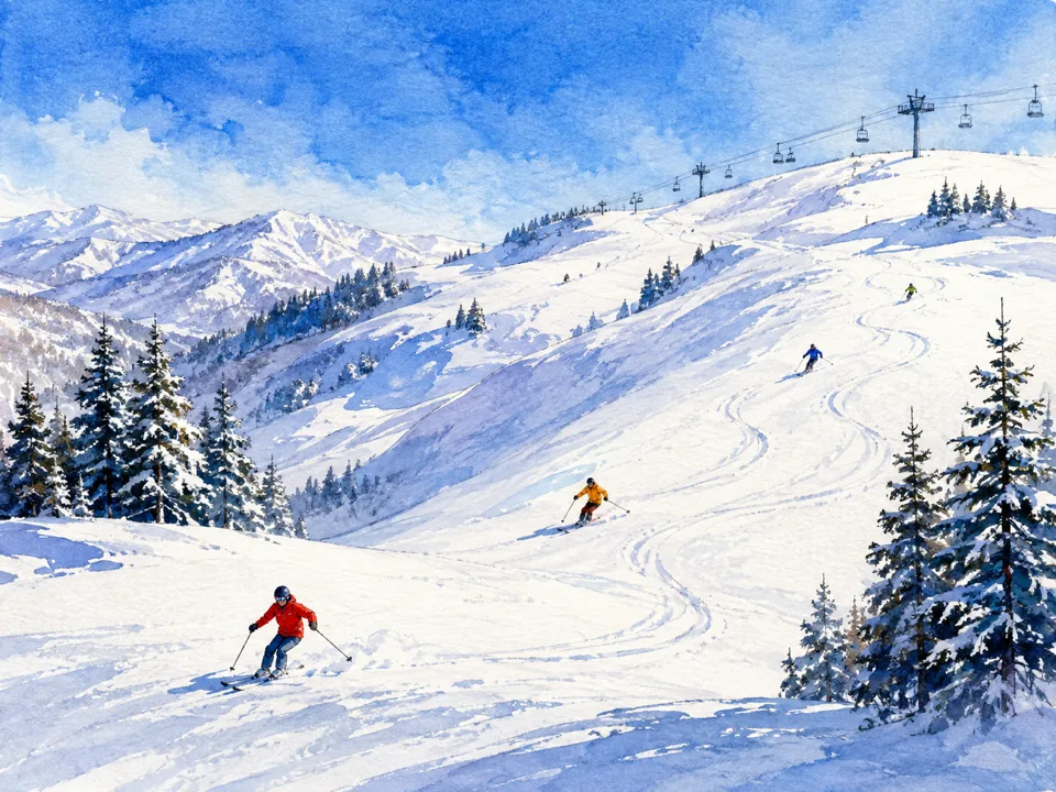 AI illustration; an interpretive view, not a photograph. AI 示意图,非景点实拍。
Wanlong Ski Resort万龙滑雪场
Wanlong occupies the Honghualiang slopes in Chongli, with mountain terrain and a network of differently graded ski runs shaping the visit. Its named trails include Wolong and Youlong as well as steeper mountain routes, but an…
Read the place guide →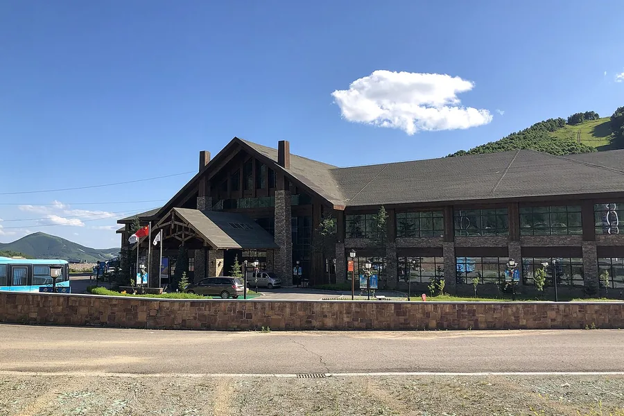 A resort base building at Genting Snow Park in Chongli during summer, before the 2022 Winter Games. Photographed on 31 July 2021.
Genting Snow Park云顶滑雪公园
Genting Snow Park is the Chongli ski resort that hosted freestyle skiing and snowboarding during the Beijing Winter Olympics. Its halfpipe and other competition terrain remain part of an active sporting landscape, with later…
Read the place guide → AI illustration · AI 示意图(仅供参考,非该地点实拍)
Thaiwoo Ski Town太舞滑雪小镇
Taiwoo Ski Town (太舞滑雪小镇) is a ski and mountain resort in Chongli, built around the valley below Yushiliang, a peak reaching 2,160 metres.
Read the place guide →Plan your visit
Getting there
Chongli District is about 40 km in a straight line from central Zhangjiakou. Search for 崇礼区 in a map app to find stations and your accommodation.
Where to stay →Build your route
Wanlong Ski Resort and Genting Snow Park are about 3 km apart in a straight line. The linked place guides have entrance and visit details.
Continue with Zhangjiakou →More in Zhangjiakou
Sources & geographic information
Administrative names and parent areas: Official geographic directory · Reference date 2026-09-06.
Some facts checked against 西湾子天主教堂 — Wikipedia contributors, CC BY-SA 4.0.
Photo: Genting Snow Park · N509FZ · CC BY-SA 4.0. Proportionally resized and converted to WebP without cropping, retouching or changing the photographed subject.
.jpg)
Map data © OpenStreetMap contributors. Pins mark approximate centres, not entrances or boundaries.