


Get to know Wanquan District
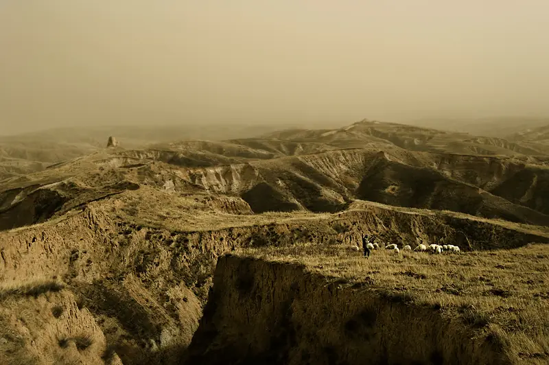
Photo adjustments
Full frame retained; EXIF orientation normalized, proportionally resized to at most 800 pixels and converted to WebP. No generated pixels or subject changes. Cards may crop the display.
- Administrative area
- District · 市辖区
- Part of
- Zhangjiakou
- Chinese name
- 万全区
- Local areas
- District guide
Area & population
- Area in the source
- 1,158.00 km²
- Population · 2020 census
- 216,795
- Administrative seat
- Kongjiazhuang Town (孔家庄镇)
Source: cited geographic source, as of the dates shown.
Setting and landscape
Along the Ming wall the district borders Shangyi (尚义) and Zhangbei (张北) counties; across the Yang River lies Huai'an County (怀安县), and to the east is Zhangjiakou's Qiaoxi District (桥西区). The ground falls from north to south: a basalt tableland and mountains of 1,200 to 1,800 metres in the north, hills in the middle and a river basin of 600 to 800 metres in the south. The East, West and South Yang rivers join inside the district to form the Yang River, and five sandy streams, among them the Ximalin River (洗马林河), run south into it. Springs are windy and dry, and winters long, cold and dry.
History
In 1393 the Ming built guard garrisons here against the remnants of the Northern Yuan. The site, with the wall at its back and the Yang River in front, was judged a "foolproof plan" (万全之策), which gave the place its name. In 1404 the Wanquan Right Guard moved to Deshengkou fort (德胜口堡), today's Wanquan town, and in 1693 the Qing turned the guard into Wanquan County. The county seat moved to Zhangjiakou in 1914, back to Wanquan town in 1939 and to Kongjiazhuang (孔家庄) in 1983; the county became a district in January 2016.
What to see
Wanquan Right Guard Fort, more than 630 years old, is described by the district as a "living fossil" of the Ming guard system. It is a national key cultural relics protection site, as are the Jade Emperor Pavilion (玉皇阁) and the town wall of Ximalin (洗马林). Hebei provincial protected sites include the Wanquan section of the Ming Great Wall, the reviewing stand of the "802" military exercise (八〇二军事演习观礼台), the Laolongwan Han tombs (老龙湾汉墓群) and the Jiuyangtun opera stage (旧羊屯戏楼).
Food and local products
Wanquan geda (万全圪渣) is a mung-bean product, pale yellow with a green tinge, known north of the Great Wall for more than 300 years. Oats (莜麦) do not grow in the old town, but the town made oat-flour noodles (莜面) its traditional fare; the district calls itself China's largest oat-processing base. Other local foods are buckwheat noodles (荞粉), fresh waxy corn, horse intestine (马板肠) and apricots from Liugou (柳沟) village, grown there for more than 400 years. Local crafts include clay figures by the family known as Wanquan Clay Figure Zhang (万全泥人张) and willow weaving in Sanlizhuang (三里庄).
Getting oriented
The district seat is 10 kilometres from Zhangjiakou's main urban area.
Highlights
- Wanquan Right Guard Fort 万全右卫城: Ming garrison town over 630 years old; national key cultural relics protection site.
- Ximalin Jade Emperor Pavilion 洗马林玉皇阁: National key cultural relics protection site, as is the Ximalin town wall.
- Wanquan geda 万全圪渣: Mung-bean product known north of the Great Wall for more than 300 years.
- Liugou apricots 柳沟杏: Grown in Liugou village for more than 400 years.
Sources for this guide
张家口市万全区区情简介 · Wanquan District People's Government, Zhangjiakou
万全区优越的地理环境 · Wanquan District People's Government, Zhangjiakou
万全区地方特产 · Wanquan District People's Government, Zhangjiakou
张家口市万全区历史发展变革 · Wanquan District People's Government, Zhangjiakou
万全特色小吃 · Wanquan District People's Government, Zhangjiakou
Original English written from the listed sources and checked sentence by sentence against quoted extracts by a separate reviewer. Updated 2026-09-24.
Explore Wanquan District
Core places to explore, with English and Chinese names.
Wanquan District 万全区
Plan your visit
Getting there
Wanquan District is about 10 km in a straight line from central Zhangjiakou. Search for 万全区 in a map app to find stations and your accommodation.
Where to stay →More in Zhangjiakou
Sources & geographic information
Administrative names and parent areas: Official geographic directory · Reference date 2026-09-06.
Map data © OpenStreetMap contributors. Pins mark approximate centres, not entrances or boundaries.