


Get to know Xuanhua District
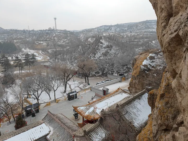
Photo adjustments
Full frame retained; proportionally resized and converted to WebP. No retouching or changes to the photographed subject. Card displays may crop the view.
- Administrative area
- District · 市辖区
- Part of
- Zhangjiakou
- Chinese name
- 宣化区
- Local areas
- District guide
History
The city goes back to the Tianbao years of the Tang (742–756), when An Lushan (安禄山) built Xiongwu fort (雄武城) here. In 1394 Zhu Hui (朱橞), Prince of Gu, enlarged it to roughly its present size. The district government calls Ming Xuanhua the first of the nine frontier towns and says it was known as the "lock and key of the capital" (京师锁钥); after the Qing set up Xuanhua Prefecture it was the first prefectural city west of Beijing. After the war against Japan it became the seat of the Chahar provincial democratic government, the first provincial-level democratic government led by the Communist Party. The former Xuanhua County was merged into the district in 2016.
What to see
Xuanhua Ancient City (宣化古城) is a national key cultural relics protection site that joins the Qingyuan Tower (清远楼), the Zhenshuo Tower (镇朔楼) and the city walls, which still run for more than 12,000 metres. The Qingyuan Tower, the bell tower, was built from 1482 to 1486: a three-eaved pavilion on an 8-metre platform with cross-shaped passages, where cart wheels have worn ruts about 20 centimetres deep into the paving. It holds a bronze bell cast in 1539, 1.7 metres across the mouth. The drum tower, Zhenshuo Tower, dates from 1440 and stands 25 metres high on the same north–south axis, facing the Gongji Tower (拱极楼) over the south gate.
In Xiabali (下八里) village lie more than ten Liao tombs, mostly of one Zhang family, listed as a national key site in 1996. Their murals show Khitan and Han customs side by side; the tomb of Zhang Shiqing (张世卿) has about 86 square metres of paintings of processions, music and banquets, and a ceiling star map that combines the Chinese 28 lunar mansions with the Babylonian zodiac.
Food and local products
Xuanhua's "cow-nipple" grapes (牛奶葡萄) have been grown for 1,800 years, trained on a funnel-shaped trellis that the district government says is found nowhere else. In 2013 China's Ministry of Agriculture and the UN Food and Agriculture Organization listed the Xuanhua Traditional Urban Vineyards as a nationally and a globally important agricultural heritage system. Xuanhua is also where hybrid millet began, sold as Zhangzagu (张杂谷).
Getting oriented
The district government puts Beijing 150 kilometres to the east, Datong 200 kilometres to the west and Zhuolu (涿鹿) 40 kilometres to the south, with Zhangjiakou airport 20 kilometres away. The Beijing–Baotou railway (Xuanhua station) and National Highways 110 and 207 pass through.
Highlights
- Qingyuan Tower 清远楼: Bell tower built 1482–1486 with cart ruts in its passages and a bronze bell cast in 1539.
- Zhenshuo Tower 镇朔楼: Drum tower from 1440, 25 metres high, part of the Xuanhua Ancient City national key site.
- Xiabali tombs 下八里墓群: Liao tombs of the Zhang family with murals and a ceiling star map; national key site since 1996.
- Xuanhua cow-nipple grapes 宣化牛奶葡萄: Grown for 1,800 years on funnel trellises; the urban vineyards are a GIAHS site.
Sources for this guide
宣化总体概况 · Xuanhua District People's Government, Zhangjiakou
宣化区 · Wikipedia (Chinese) · CC BY-SA 4.0
宣化古城 · Wikipedia (Chinese) · CC BY-SA 4.0
下八里墓群 · Wikipedia (Chinese) · CC BY-SA 4.0
Original English written from the listed sources and checked sentence by sentence against quoted extracts by a separate reviewer. Updated 2026-09-24.
Explore Xuanhua District
Core places to explore, with English and Chinese names.
Xuanhua District 宣化区
Plan your visit
Getting there
Xuanhua District is about 25 km in a straight line from central Zhangjiakou. Search for 宣化区 in a map app to find stations and your accommodation.
Where to stay →More in Zhangjiakou
Sources & geographic information
Administrative names and parent areas: Official geographic directory · Reference date 2026-09-06.
Some facts checked against 宣化区 — Wikipedia contributors, CC BY-SA 4.0.
Some facts checked against 宣化古城 — Wikipedia contributors, CC BY-SA 4.0.
Some facts checked against 下八里墓群 — Wikipedia contributors, CC BY-SA 4.0.
Map data © OpenStreetMap contributors. Pins mark approximate centres, not entrances or boundaries.