


Get to know Shuangcheng District
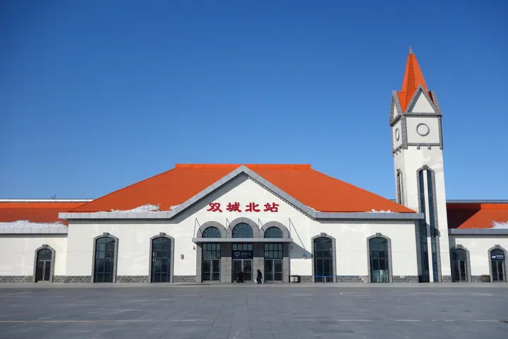
Photo adjustments
Full frame retained; proportionally resized and converted to WebP. No retouching or changes to the photographed subject. Card displays may crop the view.
- Administrative area
- District · 市辖区
- Part of
- Harbin
- Chinese name
- 双城区
- Local areas
- District guide
Area & population
- Area in the source
- 3,112.00 km²
- Population · 2019
- 766,316
Source: cited geographic source, as of the dates shown.
Setting and landscape
Shuangcheng lies about 30 kilometres south-west of Harbin and is known as the southern gate of Heilongjiang. Across the Songhua it faces Zhaoyuan (肇源) and Zhaodong (肇东); to the south and west it borders Yushu (榆树) and Fuyu (扶余) in Jilin Province. The Lalin and Songhua rivers wrap around its farmland, and it is a well-known grain-producing county.
History
One account of the name, "two walled towns", is that when the Jilin general Fujun (富俊) opened land here for farm settlement in the Qing, he named the place Shuangchengpu after two Jin-dynasty (金代) towns in the area, Dahe (达禾) and Buda (布达). A Shuangchengpu (双城堡) garrison office was set up in 1814, and the area is described as one of the homelands of the Manchu people. It became a prefecture in 1909, a county in 1913 and a county-level city in 1988; the State Council turned it into a Harbin district in May 2014.
During the civil war the front headquarters of the Northeast Democratic United Army was based here, and the overall plan for the Liaoshen Campaign was drawn up in Shuangcheng. The headquarters site is a walled courtyard compound built in 1917 as the private house of a Jilin police chief, with 35 grey-brick rooms in east and west courtyards joined by a moon gate.
What to see
Of the four gate towers added when the town wall was rebuilt in 1868, only the east gate, Chengxu Gate (承旭门), "facing the rising sun", survives. Kuixing Tower (魁星楼) dates from 1893. Shuangchengpu Railway Station (双城堡火车站), first built by the Russians in 1899 as a palace-like group with a pagoda, is described by Harbin Daily as the best-preserved Chinese Eastern Railway relic under the Harbin railway bureau. The Harbin Century Automobile History Museum (哈尔滨世纪汽车历史博物馆) completed a new hall in 2019 and holds nearly 200 cars.
Food and local products
Shuangcheng pig-slaughter feast (杀猪菜) traces back some 200 years to the settlement of bannermen from Beijing. The table carries freshly filled blood sausage, sliced pork with garlic, stewed pickled cabbage and stuffed intestines, and diners crumble charred dried chillies into the sour cabbage broth. Shuangcheng husk cherries (双城菇娘) are a national geographical-indication product, large, thin-skinned and sweet-sour. Local liquor making is traced back to the Jin dynasty.
Highlights
- Front headquarters of the Northeast Democratic United Army 东北民主联军前线指挥部旧址: 1917 courtyard compound from which commanders directed the Liaoshen and Pingjin campaigns.
- Chengxu Gate 承旭门: The only survivor of four gate towers added to the town wall in 1868.
- Kuixing Tower 魁星楼: Built in 1893.
- Shuangchengpu Railway Station 双城堡火车站: Russian-built in 1899; a palace-style Chinese Eastern Railway station.
- Shuangcheng husk cherries 双城菇娘: National geographical-indication fruit.
Sources for this guide
哈尔滨日报-早春来双城 好事准能成 · Harbin Daily
双城,一个有故事的地方 - 国际在线移动版 · China Radio International (report from Longtou News)
双城区 - 维基百科,自由的百科全书 · Wikipedia (Chinese) · CC BY-SA 4.0
Original English written from the listed sources and checked sentence by sentence against quoted extracts by a separate reviewer. Updated 2026-09-24.
Explore Shuangcheng District
Core places to explore, with English and Chinese names.
Shuangcheng District 双城区
Plan your visit
Getting there
Shuangcheng District is about 45 km in a straight line from central Harbin. Search for 双城区 in a map app to find stations and your accommodation.
Where to stay →More in Harbin
Sources & geographic information
Administrative names and parent areas: Official geographic directory · Reference date 2026-09-06.
Some facts checked against 双城区 — Wikipedia contributors, CC BY-SA 4.0.
Map data © OpenStreetMap contributors. Pins mark approximate centres, not entrances or boundaries.