


Get to know Wuchang

Photo adjustments
Full frame retained; resized proportionally to a maximum dimension of 960 pixels and converted to WebP quality 88. No crop, retouch, generated elements, or subject alteration. Final website rendition: full frame retained, proportionally resized to at most 720 pixels and converted to WebP. No additional retouching or subject alteration. Card displays may crop the view.
- Administrative area
- County-level city · 县级市
- Part of
- Harbin
- Chinese name
- 五常市
- Local areas
- County-level city guide
Area & population
- Area in the source
- 7,502.00 km²
- Population · 2018
- 897,705
Source: cited geographic source, as of the dates shown.
Setting and landscape
The Wuchang government sums up its land as six parts mountain, one part water, half a part grassland and the rest farmland, and counts it among the world's three great black-soil plains; mountains cover about 60 percent of the city. The Lalin and the Ashi River (阿什河) are the main rivers, and the city has two reservoirs, Longfengshan (龙凤山水库) and Mopanshan (磨盘山水库); Mopanshan is Harbin's main source of drinking water. The frost-free season lasts about 130 days.
History
The name refers to the five constant virtues of Confucian ethics: when the Qing opened the land to settlers in the Xianfeng reign, they formed five farming communities named after benevolence, righteousness, propriety, wisdom and trust. Earlier, in 1684, Qing troops fighting the Russians had stored grain here at the Lalin granary (拉林仓), which became the town of Lalin in 1744. A Wuchang sub-prefecture (五常厅) followed in 1881, a county in 1913, and the county-level city in 1993.
What to see
Fenghuang Mountain (凤凰山) is a national 4A scenic area, national forest park and national geopark inside the Shanhetun Forestry Bureau (山河屯林业局) lands. Its high meadows, a boulder field with dwarf pines known as the Sky Garden (空中花园), and a canyon with a chain of waterfalls are the main sights. Snow Valley (雪谷), a national 3A scenic area, lies on the western slope of the Zhangguangcai Range (张广才岭) at the foot of Datudingzi Mountain (大秃顶子山), where the Mangniu River (牤牛河), the Lalin's largest tributary, rises. The snow season lasts seven months, with snow on average more than 2 metres deep, and a hiking route leads across to China Snow Town (中国雪乡), a mountain away.
Longfengshan (龙凤山) is a lake landscape of 240 square kilometres, 45 of them water, known for red cliffs dropping straight into the lake. On the Mangniu River, the Shidaoshan (石刀山) area is called the northern "Little Three Gorges" (小三峡). Huazang Temple (华藏寺) in Lalin Town (拉林镇), founded in 1995 on 37 hectares, is described by the city as the largest monastery in north-east China.
Food and local products
Rice defines the city, which calls itself China's home of quality rice. Changan Village (长安村) in Weiguo Township (卫国乡) sits inside a 20,000-mu rice demonstration park and is a main growing area for the fragrant Daohuaxiang (稻花香) rice; visitors can walk the paddies and eat freshly cooked rice. Farm restaurants along Longfengshan's shore serve fish stewed in an iron pot.
Highlights
- Fenghuang Mountain 凤凰山: National 4A scenic area, forest park and geopark with high meadows and a waterfall canyon.
- Snow Valley 雪谷: National 3A scenic area where snow lies seven months; source of the Mangniu River.
- Longfengshan 龙凤山: Lake landscape of 240 square kilometres with red cliffs above the water.
- Huazang Temple 华藏寺: Founded in 1995 in Lalin Town on 37 hectares.
- Wuchang rice 五常大米: National geographical-indication rice; the city calls itself China's home of quality rice.
Sources for this guide
魅力五常 | 五常大米网 · Wuchang Municipal People's Government (Wuchang Rice portal)
五常市 - 维基百科,自由的百科全书 · Wikipedia (Chinese) · CC BY-SA 4.0
Original English written from the listed sources and checked sentence by sentence against quoted extracts by a separate reviewer. Updated 2026-09-24.
Explore Wuchang
Core places to explore, with English and Chinese names.
Places to explore around Wuchang
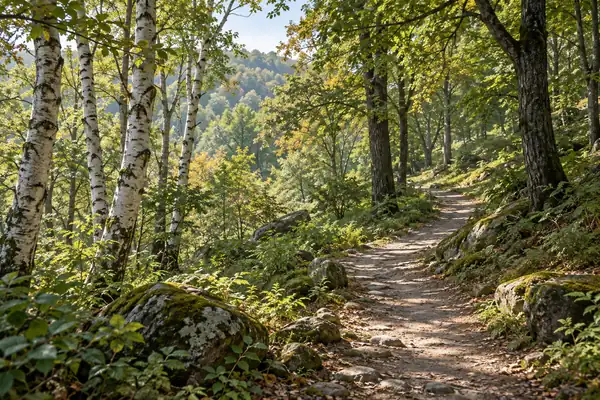 AI illustration · AI 示意图(仅供参考,非该地点实拍)
Fenghuang Mountain National Forest Park凤凰山国家森林公园
Fenghuangshan National Forest Park in Wuchang's Shanhetun forestry area combines an upland Air Garden with a wooded waterfall gorge.
Read the place guide →AI illustration · AI 示意图(仅供参考,非该地点实拍)China Snow Valley雪谷
China Snow Valley is the winter destination associated with Dongsheng Forest Farm in Wuchang, across a mountain from Xuexiang.
Read the place guide →Plan your visit
Getting there
Wuchang is about 100 km in a straight line from central Harbin. Search for 五常市 in a map app to find stations and your accommodation.
Where to stay →Build your route
Fenghuang Mountain National Forest Park and China Snow Valley are both listed here. The linked place guides have entrance and visit details.
Continue with Harbin →More in Harbin
Sources & geographic information
Administrative names and parent areas: Official geographic directory · Reference date 2026-09-06.
Some facts checked against 五常市 — Wikipedia contributors, CC BY-SA 4.0.
Map data © OpenStreetMap contributors. Pins mark approximate centres, not entrances or boundaries.