


Get to know Hulin
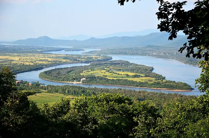
Photo adjustments
Full frame retained; resized proportionally to a maximum dimension of 960 pixels and converted to WebP quality 88. No crop, retouch, generated elements, or subject alteration. Final website rendition: full frame retained, proportionally resized to at most 720 pixels and converted to WebP. No additional retouching or subject alteration. Card displays may crop the view.
- Administrative area
- County-level city · 县级市
- Part of
- Jixi
- Chinese name
- 虎林市
- Local areas
- County-level city guide
Area & population
- Area in the source
- 9,328.71 km²
- Population · 2010
- 317,884
- Administrative seat
- Hulin Town (虎林镇)
Source: cited geographic source, as of the dates shown.
Setting and landscape
Hulin covers 9,330 square kilometres. The Ussuri and the Songacha River (松阿察河) form its eastern and southeastern border with Russia; Raohe County (饶河县) lies to the northeast, Mishan (密山市) to the west and Baoqing County (宝清县) to the northwest. Hulin's 28 rivers include the Muling (穆棱河), Qihulin (七虎林河) and Abuqin (阿布沁河).
The Zhenbaodao Wetland National Nature Reserve (珍宝岛国家级湿地自然保护区), in the east of Hulin, covers 44,500 hectares along the Ussuri. The Jixi city government describes it as the most original and typical marsh ecosystem at its latitude and records 169 bird species there.
History
Hulin's government calls the area ancient Sushen (肃慎) land and an ancestral home of the Hezhen (赫哲) people, known for birch-bark crafts and for the fish-skin clothing that earned them the name 'fish-skin tribe'. A Qing administration was set up in 1894, when the land was also opened to settlers; a second opening in 1919 brought more migrants, and the mix of Shandong and Liaoning speech produced a local dialect island. Hulin came under Jixi in August 1993 and became a city in October 1996.
From 1958 more than 40,000 demobilised soldiers came to Hulin to open up the Great Northern Wilderness (北大荒), and in 1969 over 3,000 educated youths followed.
What to see
The Hutou Scenic Area (虎头旅游景区), in Hutou town (虎头镇) facing Russia across the Ussuri, is a national 5A scenic area. The Japanese army began the Hutou Fortress in 1934, using more than 100,000 labourers over six years and digging over 70 metres deep. Its garrison held out until 26 August 1945, eleven days after Japan's surrender announcement, so the Jixi city government calls Hutou the place where the Second World War ended. The site now holds the Hutou Fortress Museum (侵华日军虎头军事要塞博物馆). The scenic area also includes the Guandi Temple (关帝庙), built in the Yongzheng reign and listed as a provincial protected site in 1987, and a copper tiger 25 metres long on the riverbank.
Zhenbao Island (珍宝岛), 0.74 square kilometres in the Ussuri, was the scene of the clashes of 2–17 March 1969; a shell-scarred 'hero tree' still grows there. The city government says Shendingfeng (神顶峰), the main peak of the Wanda Mountains, sees China's earliest summer sunrise, and describes Crescent Lake (月牙湖) as a moon-shaped lake with wild lotus.
Food and local products
The Ussuri yields chum salmon and prized northern cold-water fish grouped as 'three hua, five luo, eighteen zi' (三花五罗十八子). The Jixi city government singles out spring 'river-opening fish' (开江鱼), caught after the ice breaks, and notes cooking that keeps Hezhen seasonings such as bagao (芭蒿).
Highlights
- Hutou Fortress Museum 侵华日军虎头军事要塞博物馆: Built on the Japanese fortress whose garrison held out until 26 August 1945.
- Hutou Guandi Temple 关帝庙: Yongzheng-era temple, a provincial protected site since 1987; the only building left intact in the 1945 fighting.
- Zhenbao Island 珍宝岛: Island of 0.74 square kilometres, scene of the March 1969 clashes.
- Zhenbaodao Wetland National Nature Reserve 珍宝岛国家级湿地自然保护区: 44,500 hectares of marsh on the Ussuri with 169 bird species recorded.
- Shendingfeng 神顶峰: Main peak of the Wanda Mountains, known locally for early summer sunrises.
Sources for this guide
虎林市人民政府 (走进虎林) · Hulin City People's Government
历史概况 · Hulin City People's Government
虎林文化发展脉络 · Hulin City People's Government
虎林市旅游资源概况 · Hulin City People's Government
虎头旅游景区AAAAA · Jixi City People's Government
乌苏里江鱼 · Jixi City People's Government
Original English written from the listed sources and checked sentence by sentence against quoted extracts by a separate reviewer. Updated 2026-09-24.
Explore Hulin
Core places to explore, with English and Chinese names.
Places to explore around Hulin
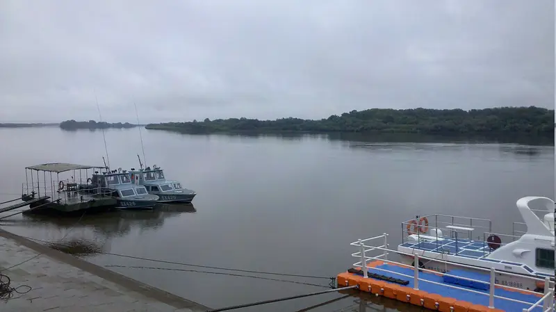 Hutou Scenic Area (虎头旅游景区), Hulin. Photograph: "乌苏里江码头一角 - panoramio".
Hutou Scenic Area虎头旅游景区
Hutou’s visitor sites in Hulin bring together the Ussuri River border landscape, a Japanese military fortification complex and a riverside temple.
Read the place guide → AI illustration · AI 示意图(仅供参考,非该地点实拍)
Zhenbao Island Wetland Birdwatching Area珍宝岛湿地开放观鸟区
The Zhenbao wetland viewing area in Hulin overlooks a protected landscape of winding channels, marsh vegetation and woodland.
Read the place guide →Plan your visit
Getting there
Hulin is about 160 km in a straight line from central Jixi. Search for 虎林市 in a map app to find stations and your accommodation.
Where to stay →Build your route
Hutou Scenic Area and Zhenbao Island Wetland Birdwatching Area are both listed here. The linked place guides have entrance and visit details.
Continue with Jixi →More in Jixi
Sources & geographic information
Administrative names and parent areas: Official geographic directory · Reference date 2026-09-06.
Photo: Hutou Scenic Area · kevin.tao · CC BY 3.0. Full frame retained; EXIF orientation normalized, proportionally resized to at most 800 pixels and converted to WebP. No generated pixels or subject changes. Cards may crop the display.

Map data © OpenStreetMap contributors. Pins mark approximate centres, not entrances or boundaries.