


Get to know Mishan
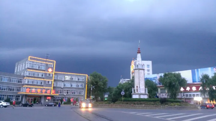
Photo adjustments
Full frame retained; proportionally resized and converted to WebP. No retouching or changes to the photographed subject. Card displays may crop the view.
- Administrative area
- County-level city · 县级市
- Part of
- Jixi
- Chinese name
- 密山市
- Local areas
- County-level city guide
Area & population
- Area in the source
- 7,722.38 km²
Source: cited geographic source, as of the dates shown.
History
The name comes from Fengmi Mountain (蜂蜜山, 'honey mountain'), a 574-metre peak south-east of the town between the Muling River (穆棱河) and Lake Khanka. The Mishan city government traces human settlement back more than 6,800 years to the Neolithic and calls the area a birthplace of the Sushen (肃慎), ancestors of the Manchu. The Qing opened the land to settlers, set up the Fengmishan land-reclamation bureau in 1899 and created Mishan Prefecture (密山府) in 1908.
Under Japanese occupation Mishan became the base of Dong'an Province (东安省) in 1939. The 359th Brigade took the town on 22 June 1946. In spring 1958 General Wang Zhen (王震) led, in the city government's figure, a hundred thousand officers and soldiers into the Great Northern Wilderness (北大荒) to reclaim land, and founded the Bayi Agricultural Reclamation University (八一农垦大学) here. Mishan became a county-level city in 1988 and has been under Jixi since 1992.
The city government also calls Mishan a cradle of New China's aviation and of the People's Liberation Army's armoured troops: the Northeast Democratic Allied Army aviation school spent three years and four months here. The Northeast tank regiment formed here produced the 'Gongchen' (功臣号, 'meritorious') tank that took part in the 1949 founding parade and is now in the Military Museum of the Chinese People's Revolution (中国军事博物馆). The home of Fu Wenchen (傅文忱), whose family was the model for Li Yuhe's family in 'The Red Lantern' (红灯记), was in Mishan.
What to see
The Dangbi Town (当壁镇) resort area lies in the south-east of the city, 36 km from central Mishan and 120 km from Jixi, with Russia across the river, Lake Khanka to the south and the Wanda Mountains (完达山) to the north. It is a national 3A scenic area at the western end of the Lake Khanka nature reserve. The Mishan government lists among its sights the Bailing River Bridge (白棱河桥), recorded by Guinness as the smallest border bridge, the cemetery of General Wang Zhen, a memorial hall to the reclamation of the Great Northern Wilderness, a deer park and a breeding base for Khanka white fish.
The Great Northern Wilderness calligraphy corridor (北大荒书法长廊) holds more than 3,000 stone carvings of works by contemporary calligraphers.
Food and local products
Lake Khanka covers 4,380 square kilometres, 1,080 of them on the Chinese side, and is known for its large white fish (大白鱼), which the Mishan government counts among China's four famous freshwater fish.
Highlights
- Lake Khanka 兴凯湖: Border lake shared with Russia; 1,080 of its 4,380 square kilometres are Chinese, and it is known for large white fish.
- Bailing River Bridge 白棱河桥: Border bridge at Dangbi, listed by Guinness as the smallest border bridge.
- Great Northern Wilderness calligraphy corridor 北大荒书法长廊: More than 3,000 stone carvings of works by contemporary calligraphers.
Sources for this guide
密山市历史文化介绍 · Mishan City People's Government
当壁镇旅游区 · Mishan City People's Government
密山市 - 维基百科,自由的百科全书 · Chinese Wikipedia · CC BY-SA 4.0
Original English written from the listed sources and checked sentence by sentence against quoted extracts by a separate reviewer. Updated 2026-09-24.
Explore Mishan
Core places to explore, with English and Chinese names.
Places to explore around Mishan
 A wave-washed sandy shoreline at Lake Khanka ·
 Plan your visit
Getting there
Mishan is about 75 km in a straight line from central Jixi. Search for 密山市 in a map app to find stations and your accommodation.
Where to stay →Build your route
Start with Lake Khanka. The linked place guides have entrance and visit details.
Continue with Jixi →More in Jixi
Sources & geographic information
Administrative names and parent areas: Official geographic directory · Reference date 2026-09-06.
Some facts checked against 密山市 — Wikipedia contributors, CC BY-SA 4.0.
Photo: Lake Khanka · Романвер · Public domain. Full frame retained; proportionally resized and converted to WebP. No retouching or changes to the photographed subject. Card displays may crop the view.

Map data © OpenStreetMap contributors. Pins mark approximate centres, not entrances or boundaries.