


Get to know Huojia County
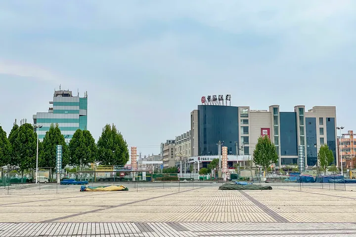
Photo adjustments
Full frame retained; proportionally resized and converted to WebP. No retouching or changes to the photographed subject. Card displays may crop the view.
- Administrative area
- County · 县
- Part of
- Xinxiang
- Chinese name
- 获嘉县
- Local areas
- County guide
Area & population
- Area in the source
- 473.00 km²
- Population · 2019
- 414,000
Source: cited geographic source, as of the dates shown.
Setting and landscape
Huojia borders Xinxiang County (新乡县) to the east, Yuanyang (原阳县) to the south and Wuzhi (武陟县) and Xiuwu (修武县) to the west; to the north the Dasha River (大沙河) separates it from Huixian (辉县市). The county government identifies the Dasha River with the Yongji Canal (永济渠), a section of the Sui-dynasty Grand Canal dug by labourers conscripted from the county. It lies 60 kilometres from Zhengzhou and 30 from Jiaozuo (焦作).
History
Local tradition, recorded by the county government, holds that before the Battle of Muye (牧野之战) King Wu of Zhou (周武王) had his troops heap up a mound north-east of the present county town and swore an oath with the allied lords on an altar there; the mound became Tongmeng Hill (同盟山, "Alliance Hill"). The name dates from the Han: Emperor Wu (汉武帝), at Xinzhong (新中乡) on a tour of the east, received the head of the rebel Nanyue minister Lü Jia (吕嘉) and founded a county there called Huojia, "capturing Jia". The county government dates the county to 112 BC.
The county also claims as natives the writer Han Yu (韩愈), said to have been born at Xuanyangyi village (宣阳驿村) in 768, and the poet Li Shangyin (李商隐), born in the county town in 812 while his father was the magistrate.
What to see
The King Wu Temple on Tongmeng Hill (同盟山武王庙), about three kilometres east of the county town, is a Henan provincial heritage site. Its surviving buildings include two gates, a worship hall, the main hall of King Wu and halls to King Wen, Taigong (太公) and the Duke of Zhou, a horse-watering pool, an old well, a Tang-dynasty pagoda tree and steles of many periods. The county has 53 protected heritage sites.
The October Fair (十月物资交流大会) began in the seventh year of the Jiajing reign of the Ming as a temple fair and is held each year from the 8th to the 18th day of the tenth lunar month.
Food and local products
Huojia helecao (获嘉饸饹条) is a noodle dish that the county government says is known nationwide, eaten hot in winter with garlic and chilli. Taishan Chinese cabbage (太山大白菜), known for its "cloudy broth" (浑汤), and Huojia black beans (获嘉黑豆), large glossy beans with green kernels, both hold national geographical-indication status. Flower growing here goes back 300 years; the county government calls Huojia Henan's largest base for cut lilies, and the State Forestry Administration and China Flower Association named it "China's hometown of flowers and trees".
Highlights
- King Wu Temple on Tongmeng Hill 同盟山武王庙: Provincial heritage site on the mound linked to King Wu's oath before the Battle of Muye.
- Huojia helecao 获嘉饸饹条: Noodle dish eaten hot in winter with garlic and chilli; the county says it is known nationwide.
- Taishan Chinese cabbage 太山大白菜: Geographical-indication cabbage known for its "cloudy broth".
- Huojia black beans 获嘉黑豆: Glossy black beans with green kernels; a geographical-indication product.
- October Fair 十月物资交流大会: Ten-day fair in the tenth lunar month, begun under the Ming Jiajing reign.
Sources for this guide
获嘉介绍_获嘉县人民政府 · Huojia County People's Government
历史沿革_获嘉县人民政府 · Huojia County People's Government
获嘉县地理环境_获嘉县人民政府 · Huojia County People's Government
Original English written from the listed sources and checked sentence by sentence against quoted extracts by a separate reviewer. Updated 2026-09-24.
Explore Huojia County
Core places to explore, with English and Chinese names.
Huojia County 获嘉县
Plan your visit
Getting there
Huojia County is about 25 km in a straight line from central Xinxiang. Search for 获嘉县 in a map app to find stations and your accommodation.
Where to stay →More in Xinxiang
Sources & geographic information
Administrative names and parent areas: Official geographic directory · Reference date 2026-09-06.
Map data © OpenStreetMap contributors. Pins mark approximate centres, not entrances or boundaries.