


Get to know Yuanyang County
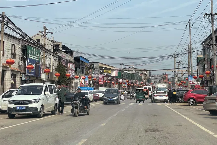
Photo adjustments
Full frame retained; proportionally resized and converted to WebP. No retouching or changes to the photographed subject. Card displays may crop the view.
- Administrative area
- County · 县
- Part of
- Xinxiang
- Chinese name
- 原阳县
- Local areas
- County guide
Area & population
- Area in the source
- 1,339.00 km²
- Population · 2019
- 650,000
Source: cited geographic source, as of the dates shown.
Setting and landscape
The ground falls gently from south-west to north-east. South of the Yellow River levee lies higher floodplain, mostly dry fields; the middle of the county is low and prone to waterlogging, and the land north of the Wenyan Canal (文岩渠) rises into low ridges. The Xinxiang city government counts seven bridges linking the county with Zhengzhou; the Beijing–Guangzhou high-speed railway and the Beijing–Hong Kong–Macau Expressway both cross the river here.
History
The area was long divided between two counties: Yangwu (阳武), first set up under the Qin, and Yuanwu (原武), founded under the Western Han on the site of today's county town. The two were briefly merged as Bolang County (博浪县) in 1936, and on 13 March 1950 the government of Pingyuan Province (平原省), itself abolished in 1952, joined them for good under the combined name Yuanyang. Bolangsha (博浪沙), where Zhang Liang (张良) tried to assassinate the First Emperor of Qin, lies within the county. The Xinxiang city government calls Yuanyang a "home of chancellors": 16 men from the area, among them Zhang Cang (张苍), Chen Ping (陈平) and Zhou Bo (周勃), reached that rank between the Qin and the Yuan. The idiom of Mao Sui volunteering himself (毛遂自荐) is also traced to Yuanyang.
What to see
Yuanyang has two national protected sites: the Linglong Pagoda (玲珑塔) and the Yuanwu Town God Temple (原武城隍庙). Both stand in the old town of Yuanwu (原武镇), which Xinxiang Daily describes as part of the Pingyuan Demonstration Zone (平原示范区). The paper calls the pagoda the landmark of the town and says the view from the top takes in the Yellow River to the south and the Taihang (太行) range to the north. Yuanwu is also known for the Yuanwu pan drum (原武盘鼓) and the Five Dragon Pool (五龙池). The Chen Ping Shrine (陈平祠), the Xiajiayuan houses (夏家院民居) and the Gudui site (谷堆遗址) are provincial protected sites.
Food and local products
Wheat and rice are the main crops. The Xinxiang city government says Yuanyang rice (原阳大米) is known across China, and more than 20 of its varieties, such as Huangjinqing (黄金晴), are well known on the market. Between 1965 and 1975 Yuanwu, whose land on the old Yellow River course was badly salinised and uneven, carried out a scheme to bring in Yellow River water and convert its fields to rice; Xinxiang Daily says this laid the foundation for Yuanyang rice and describes Dongloucun (东娄庄村) in Yuanwu as its birthplace. A Yellow River rice culture museum opened at Donghejiao (东合角村) in Yuanwu in 2020.
Highlights
- Linglong Pagoda 玲珑塔: National protected site and landmark of Yuanwu town, with views to the Yellow River and the Taihang range.
- Yuanwu Town God Temple 原武城隍庙: National protected site in the old Yuanwu town.
- Bolangsha 博浪沙: Where Zhang Liang made his attempt on the First Emperor of Qin.
- Yuanyang rice 原阳大米: Rice whose foundations Xinxiang Daily traces to a 1965-1975 Yellow River rice-conversion scheme at Yuanwu.
Sources for this guide
原阳县 - 维基百科,自由的百科全书 · Wikipedia · CC BY-SA 4.0
古镇踏歌绘新篇 ——平原示范区原武镇推动乡村振兴侧记 - 县区新闻 - 新乡网新闻中心 · Xinxiang Daily
原阳县简介_新乡市人民政府 · Xinxiang Municipal People's Government
Original English written from the listed sources and checked sentence by sentence against quoted extracts by a separate reviewer. Updated 2026-09-24.
Explore Yuanyang County
Core places to explore, with English and Chinese names.
Yuanyang County 原阳县
Plan your visit
Getting there
Yuanyang County is about 25 km in a straight line from central Xinxiang. Search for 原阳县 in a map app to find stations and your accommodation.
Where to stay →More in Xinxiang
Sources & geographic information
Administrative names and parent areas: Official geographic directory · Reference date 2026-09-06.
Some facts checked against 原阳县 — Wikipedia contributors, CC BY-SA 4.0.
Map data © OpenStreetMap contributors. Pins mark approximate centres, not entrances or boundaries.