


Get to know Xinxiang County
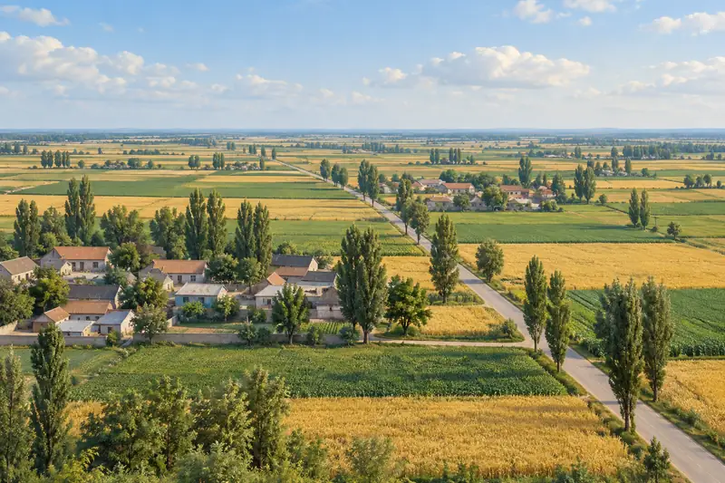
- Administrative area
- County · 县
- Part of
- Xinxiang
- Chinese name
- 新乡县
- Local areas
- County guide
Area & population
- Area in the source
- 365.00 km²
- Population · 2019
- 347,900
Source: cited geographic source, as of the dates shown.
History
The county was created in 586, under the Sui, from parts of Huojia and Ji counties, with its seat at Xinle city (新乐城). It was abolished in 1073 and restored in 1090. In May 1949 the county town was split off and enlarged to form the city of Xinxiang, and in 1953 the county government moved from Xiaoji (小冀) into the city. The county was merged into the city in 1959 and restored in 1961. In the 1950s and 1960s it became known across China for high cotton and grain yields, and Mao Zedong visited the county in 1958; the county government records his inspection of Qiliying town (七里营镇).
What to see
The Wei River (卫河) begins in the county at the Hehe sluice (合河闸) in Hehe township (合河乡). The river grew out of the Yongji Canal (永济渠) dug under the Sui in 608 and carried boats for about 1,400 years until navigation stopped in the late 1960s; under the Yuan, Ming and Qing it served as an auxiliary route of the Grand Canal for grain and building materials bound for Beijing.
The Ming-dynasty Hehe Stone Bridge (合河石桥) has stood for more than 400 years on the road to Huixian (辉县市); its plain stone railings are uncarved, but the water-spout beasts are finely cut in relief. The Hehe Taishan Temple (合河泰山庙), now inside the Hehe village primary school, keeps an opera stage rebuilt in 1903 and a Jade Emperor Hall. The Ximing Temple stele of Buddhist images (西明寺造像碑) combines high relief, flat relief and incised line carving.
At Lidazhao village (李大召村) in Dazhaoying town (大召营镇), an oval mound of about 200,000 square metres holds deposits two to three metres deep, from the Yangshao and Longshan cultures through Erlitou, Shang, Zhou and Han; Zhengzhou University excavated it four times between 2002 and 2003. It is on the Henan provincial heritage list.
Food and local products
Longquan golden pears (龙泉黄金梨) are grown in the south of the county. The fruit is nearly round, about 250 grams on average, with crisp, juicy white flesh, a very small core and a sweet taste, and ripens in the middle and late part of September.
Getting oriented
The Beijing–Guangzhou, Xinxiang–Taiyuan and Xinxiang–Heze railways meet here, and the Beijing–Zhuhai expressway and National Highway 107 cross the county.
Highlights
- Wei River at Hehe 卫河: Starting section of the Wei River, a former Sui canal navigated for about 1,400 years.
- Hehe Stone Bridge 合河石桥: Ming stone bridge over 400 years old with relief-carved water-spout beasts.
- Lidazhao site 李大召遗址: Provincially listed mound with layers from Yangshao to Han, excavated in 2002–2003.
- Longquan golden pear 龙泉黄金梨: Crisp, sweet pear from the south of the county, ripening in September.
Sources for this guide
县情简介_新乡县人民政府门户网站 · Xinxiang County People's Government
历史沿革_新乡县人民政府门户网站 · Xinxiang County People's Government
地理位置_新乡县人民政府门户网站 · Xinxiang County People's Government
新乡县国家文物保护单位简介_新乡县人民政府门户网站 · Xinxiang County People's Government
新乡县河南省文物保护单位简介_新乡县人民政府门户网站 · Xinxiang County People's Government
龙泉黄金梨_新乡县人民政府门户网站 · Xinxiang County People's Government
Original English written from the listed sources and checked sentence by sentence against quoted extracts by a separate reviewer. Updated 2026-09-24.
Explore Xinxiang County
Core places to explore, with English and Chinese names.
Xinxiang County 新乡县
Plan your visit
Getting there
Xinxiang County is about 15 km in a straight line from central Xinxiang. Search for 新乡县 in a map app to find stations and your accommodation.
Where to stay →More in Xinxiang
Sources & geographic information
Administrative names and parent areas: Official geographic directory · Reference date 2026-09-06.
Map data © OpenStreetMap contributors. Pins mark approximate centres, not entrances or boundaries.