


Get to know Furong District
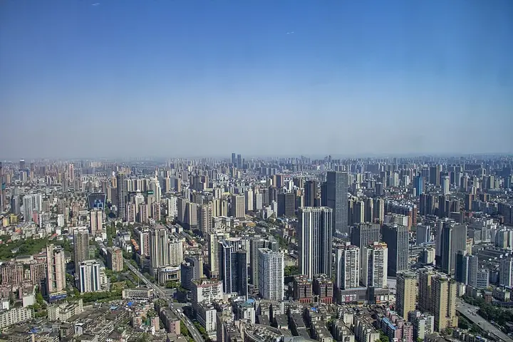
Photo adjustments
Full frame retained; proportionally resized and converted to WebP. No retouching or changes to the photographed subject. Card displays may crop the view.
- Administrative area
- District · 市辖区
- Part of
- Changsha
- Chinese name
- 芙蓉区
- Local areas
- District guide
Area & population
- Area in the source
- 42.68 km²
- Population · 2020 census
- 642,010
- Administrative seat
- Dongtundu Subdistrict
Source: cited geographic source, as of the dates shown.
Setting and landscape
The district lies on flat alluvial land laid down by the Xiang River (湘江), about 40 metres above sea level. The Liuyang River winds through it and splits it in two: west of the river is the city centre, and to the east lie Dong Lake (东湖) and the Hongqi reservoir (红旗水库). The Beijing-Guangzhou railway runs north-south through the district, with Changsha Railway Station in the middle. A 9.5-kilometre riverside park lines the Liuyang River in the east, and dragon-boat finals were held on this stretch from 2017 to 2019.
History
Dingwang Tai (定王台), the terrace built by Liu Fa (刘发), prince of Changsha in the Western Han, stood here, and many princely mansions were built in the area under the Ming and Qing. Between 1972 and 1974 the Mawangdui Han tombs yielded more than 3,000 objects and a well-preserved Western Han woman's body. In 1996 a well at Zoumalou (走马楼) on a building site produced over 100,000 bamboo and wooden slips dated to the Wu state of the Three Kingdoms.
Mao Zedong founded the weekly Xiang River Review (湘江评论) from the Xiuye School (修业学校) here. The former residence of Cheng Qian (程潜公馆), now a museum of the peaceful liberation of Hunan, was listed as a national key protected site in 2019.
What to see
Old lanes such as Duzheng Street (都正街), Baiguoyuan (白果园) and Hualongchi (化龙池) have been restored; Duzheng Street takes its name from a military office built there in the early Qing. The Mawangdui Han Culture Square has a 14-metre statue of Lady Xinzhui (辛追), the woman buried in Mawangdui Tomb No. 1. East of the Liuyang River, Longping Central Park holds the Longping Rice Museum (隆平水稻博物馆), with halls on rice history, rice science and Yuan Longping (袁隆平) and hybrid rice. The Hunan Xiang Embroidery Museum (湖南湘绣博物馆) has four themed halls and over 4,000 pieces.
A red-history walk links the former printing house of the Xiang River Review, the Shiziling (识字岭) spot where Yang Kaihui (杨开慧) was executed, and the former Eighth Route Army liaison office, set up in October 1937 by Xu Teli (徐特立) and Wang Lingbo (王凌波).
Food and local products
The district's century-old brands (老字号) include Yang Yuxing (杨裕兴), Gan Changshun (甘长顺), Jiuruzhai (九如斋), Yulou Dong (玉楼东) and Youyicun (又一村). A Hunan rice-noodle street gathers speciality rice noodles from all 14 of the province's cities and prefectures.
Highlights
- Mawangdui Han Culture Square 马王堆汉文化广场: Square with a 14-metre statue of Lady Xinzhui of Mawangdui Tomb No. 1.
- Longping Rice Museum 隆平水稻博物馆: Rice museum with halls on rice history, rice science and Yuan Longping's hybrid rice.
- Hunan Xiang Embroidery Museum 湖南湘绣博物馆: Over 4,000 pieces in four themed halls.
- Cheng Qian's former residence 程潜公馆: Museum of Hunan's peaceful liberation, a national key protected site since 2019.
- Duzheng Street 都正街: Restored old lane named after an early-Qing military office.
Sources for this guide
芙蓉区情 · Furong District People's Government
历史人文 · Furong District People's Government (Furong Yearbook Committee)
自然地理 · Furong District People's Government (Furong Yearbook Committee)
“芙蓉印记”红色游 · Furong District Culture, Tourism and Sports Bureau
Original English written from the listed sources and checked sentence by sentence against quoted extracts by a separate reviewer. Updated 2026-09-25.
Explore Furong District
Core places to explore, with English and Chinese names.
Furong District 芙蓉区
Plan your visit
Getting there
Furong District is about 10 km in a straight line from central Changsha. Search for 芙蓉区 in a map app to find stations and your accommodation.
Where to stay →More in Changsha
Sources & geographic information
Administrative names and parent areas: Official geographic directory · Reference date 2026-09-06.
Map data © OpenStreetMap contributors. Pins mark approximate centres, not entrances or boundaries.