


Get to know Wangcheng District
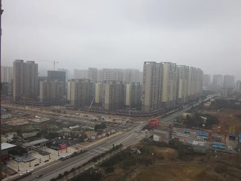
Photo adjustments
Full frame retained; EXIF orientation normalized, proportionally resized to at most 800 pixels and converted to WebP. No generated pixels or subject changes. Cards may crop the display.
- Administrative area
- District · 市辖区
- Part of
- Changsha
- Chinese name
- 望城区
- Local areas
- District guide
Area & population
- Area in the source
- 951.06 km²
- Population · 2011
- 527,600
- Administrative seat
- Gaotangling
Source: cited geographic source, as of the dates shown.
Setting and landscape
The land slopes from south to north. Red-and-yellow-soiled hills of 60 to 150 metres fill the centre, while the north-east and north-west are flat lakeside alluvial plain crossed by lakes and channels. Tuantou Lake (团头湖) is the largest lake in the district, and Heimi Peak (黑麋峰) in Qiaoyi town (桥驿镇), at 590.5 metres, is its highest point. The district government describes its stretch of the Xiang River (湘江) as the longest within Changsha's urban area, and Moon Island (月亮岛) as the city's largest river island.
History
Remains around Tuantou Lake date human activity here to three to five thousand years ago. Fengpengling No. 1 (风篷岭一号) is part of a cemetery of Han-dynasty kings of Changsha. The Tongguan kilns (铜官窑) of the Sui and Tang are known for pioneering multicoloured underglaze porcelain. On Mount Shutang (书堂山) the Xibi spring (洗笔泉) is where the calligrapher Ouyang Xun (欧阳询) and his son are said to have washed their brushes; Ming and Qing buildings include the Xizi Pagoda (惜字塔) and Wenxing Pagoda (文星塔).
What to see
Six sights hold AAAA rating: the Lei Feng Memorial (雷锋纪念馆), Heimi Peak National Forest Park (黑麋峰国家森林公园), the Qianlong Lake (千龙湖) resort, Jinggang Ancient Town (靖港古镇), the Xinhualian Tongguan Kiln Ancient Town (新华联铜官窑古镇) and the Changsha Tongguan Kiln National Archaeological Site Park (长沙铜官窑国家考古遗址公园). The Ouyang Xun Culture Park (欧阳询文化园) is one of four AAA-rated sights.
Getting oriented
Changsha County lies to the east, Kaifu (开福区) and Yuelu (岳麓区) districts to the south, and Ningxiang (宁乡) to the west. The Beijing-Guangzhou and Shimen-Changsha railways cross the district, and Changsha West Station (长沙西站) inside it is a hub for the Changsha-Zhuzhou-Xiangtan intercity line and several high-speed lines.
Highlights
- Lei Feng Memorial 雷锋纪念馆: AAAA-rated memorial in Lei Feng's home district.
- Changsha Tongguan Kiln National Archaeological Site Park 长沙铜官窑国家考古遗址公园: AAAA-rated site of the Sui and Tang kilns known for multicoloured underglaze porcelain.
- Jinggang Ancient Town 靖港古镇: One of the district's six AAAA-rated sights.
- Heimi Peak 黑麋峰: The district's highest point, 590.5 metres, now a national forest park.
- Tuantou Lake 团头湖: Largest lake in the district, with remains of human activity three to five thousand years old.
Sources for this guide
历史文化 · Wangcheng District People's Government
自然地理 · Wangcheng District People's Government
望城概况 · Wangcheng District People's Government
Original English written from the listed sources and checked sentence by sentence against quoted extracts by a separate reviewer. Updated 2026-09-25.
Explore Wangcheng District
Core places to explore, with English and Chinese names.
Wangcheng District 望城区
Plan your visit
Getting there
Wangcheng District is about 15 km in a straight line from central Changsha. Search for 望城区 in a map app to find stations and your accommodation.
Where to stay →More in Changsha
Sources & geographic information
Administrative names and parent areas: Official geographic directory · Reference date 2026-09-06.
Map data © OpenStreetMap contributors. Pins mark approximate centres, not entrances or boundaries.