


Get to know Tianxin District
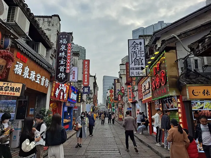
Photo adjustments
Full frame retained; proportionally resized and converted to WebP. No retouching or changes to the photographed subject. Card displays may crop the view.
- Administrative area
- District · 市辖区
- Part of
- Changsha
- Chinese name
- 天心区
- Local areas
- District guide
Area & population
- Population · 2007
- 420,000
- Administrative seat
- Qingyuan
Source: cited geographic source, as of the dates shown.
Setting and landscape
The district is long from north to south, more than 20 kilometres, and narrow from east to west, with 32 kilometres of Xiang River shore. Its northern edge is Wuyi Road (五一路), and the midline of the river's main channel forms its western boundary with Yuelu District (岳麓区). The ground rises gently in the centre and flattens towards the river in the west, with red-earth ridges. Two sandbars in the Xiang, Ezhou (鹅洲) and Xingmazhou (兴马洲), belong to the district. The Tianxin eco-city (天心生态新城) fills the south, and part of the Changsha-Zhuzhou-Xiangtan ecological green heart lies in the district.
History
Under the Qin the area belonged to Linxiang county (临湘县) in Changsha commandery, and the Han king Wu Rui (吴芮) made Linxiang the capital of his Changsha kingdom. In 1098 a separate county of Shanhua (善化县) was created with its seat at what is now Xianzheng Street (县正街). The South District was renamed Tianxin on 10 July 1996.
What to see
The former Hunan First Normal School (湖南第一师范) on Shuyuan Road (书院路) grew out of the Chengnan Academy (城南书院), founded in 1161 by the Song scholar Zhang Shi (张栻). Its buildings mix Chinese and Western styles; destroyed in the Wenxi fire (文夕大火) of 1938, they were rebuilt on the old plan in 1968, and the school became a national key protected site in 2006. Mao Zedong studied and worked here for eight years.
The Former Residence of Jia Yi (贾谊故居) at 19 Taiping Street (太平街) honours the Western Han writer who composed his lament for Qu Yuan while in Changsha; it has been a provincial protected site since 1983 and keeps an old well, the Changhuai Well (长怀井). The Baisha Well (白沙古井), also provincially protected, is a spring already known in the Ming dynasty, and people still come to draw its water. The Changsha Bamboo Slips Museum (长沙简牍博物馆) holds more than 140,000 dated slips of the Three Kingdoms state of Wu, found at Zoumalou (走马楼) in 1996, and over 20,000 early Western Han slips found in 2003.
Food and local products
Pozi Street (坡子街) has more than 1,200 years of history but was destroyed in the 1938 fire; rebuilt, it reopened on 1 October 2005 as a 640-metre street between Huangxing South Road (黄兴南路) and Xiangjiang Avenue (湘江大道). It is described as a folk food street and links the Wuyi (五一) shopping district with the Jiefang West Road (解放西路) bar street.
Highlights
- Hunan First Normal School 湖南第一师范: Successor of the 1161 Chengnan Academy; national key protected site since 2006.
- Former Residence of Jia Yi 贾谊故居: At 19 Taiping Street; provincial protected site since 1983.
- Baisha Well 白沙古井: Spring known since the Ming dynasty; provincial protected site.
- Changsha Bamboo Slips Museum 长沙简牍博物馆: More than 140,000 Wu-kingdom slips from Zoumalou and over 20,000 early Western Han slips.
- Pozi Street 坡子街: Old street rebuilt and reopened in 2005 as a 640-metre folk food street.
Sources for this guide
历史沿革 - 长沙市天心区人民政府 · Tianxin District People's Government, Changsha
自然地理 - 长沙市天心区人民政府 · Tianxin District People's Government, Changsha
长沙简牍博物馆 · Tianxin District Bureau of Culture, Tourism and Sports
白沙古井 · Tianxin District Bureau of Culture, Tourism and Sports
贾谊故居 · Tianxin District Bureau of Culture, Tourism and Sports
坡子街 · Tianxin District People's Government, Changsha
湖南第一师范 · Tianxin District Bureau of Culture, Tourism and Sports
Original English written from the listed sources and checked sentence by sentence against quoted extracts by a separate reviewer. Updated 2026-09-25.
Explore Tianxin District
Core places to explore, with English and Chinese names.
Places to explore around Tianxin District
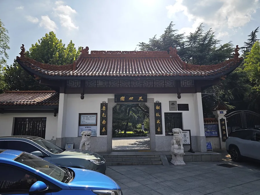 The entrance gateway to Tianxin Pavilion, Changsha; 22 August 2023.
Tianxin Pavilion天心阁
Tianxin Pavilion stands on a surviving section of Changsha’s old city defences, with a central tower and connected side pavilions overlooking the modern streets. The present pavilion was rebuilt in the 1980s after the earlier…
Read the place guide →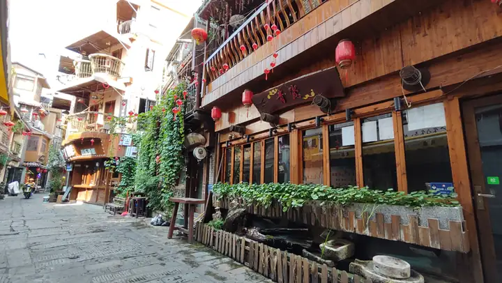 Taiping Street and Pozi Street · 太平街与坡子街
Taiping Street and Pozi Street太平街与坡子街
Taiping Street and Pozi Street (太平街与坡子街) are two adjoining old commercial streets in Tianxin District, in the centre of Changsha, Hunan. Taiping Street is a designated historic and cultural district; Pozi Street is the wider trading street that runs west from it towards the Xiang River.
Read the place guide →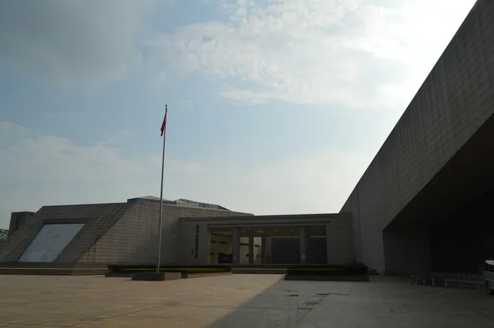 Exterior of the Hunan Museum of Geology, Tianxin District, Changsha · 长沙市天心区湖南省地质博物馆外景 Source-recorded photograph date: 2018-07-02 17:05:32.
Hunan Geological Museum湖南省地质博物馆
Geology museum in Changsha's Tianxin District, begun as a 1932 specimen room, with six halls from Earth's origins to minerals and gems.
Read the place guide →Plan your visit
Getting there
Tianxin District is about 15 km in a straight line from central Changsha. Search for 天心区 in a map app to find stations and your accommodation.
Where to stay →Build your route
Tianxin Pavilion and Taiping Street and Pozi Street are both listed here. The linked place guides have entrance and visit details.
Continue with Changsha →More in Changsha
Sources & geographic information
Administrative names and parent areas: Official geographic directory · Reference date 2026-09-06.
Photo: Tianxin Pavilion · JULIANISME · CC BY-SA 4.0. Proportionally resized and converted to WebP without cropping, retouching or changing the photographed subject.

Photo: Taiping Street and Pozi Street · Source photographer · License not provided. EXIF orientation normalized; resized without changing aspect ratio; converted to WebP. No subject edits.
Photo: Hunan Geological Museum · Huangdan2060 · CC0. Full frame retained; proportionally resized and converted to WebP. No retouching or changes to the photographed subject. Card displays may crop the view.

Map data © OpenStreetMap contributors. Pins mark approximate centres, not entrances or boundaries.