


Get to know Yuhua District
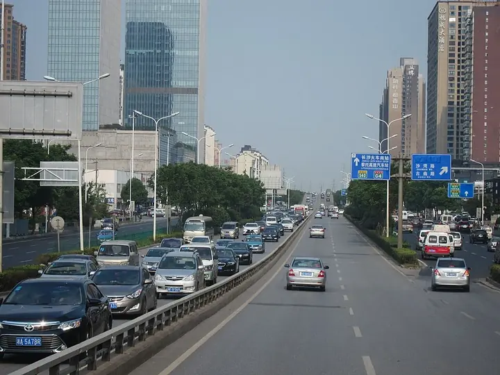
Photo adjustments
Full frame retained; proportionally resized and converted to WebP. No retouching or changes to the photographed subject. Card displays may crop the view.
- Administrative area
- District · 市辖区
- Part of
- Changsha
- Chinese name
- 雨花区
- Local areas
- District guide
Area & population
- Area in the source
- 304.90 km²
- Population · 2016
- 764,700
- Administrative seat
- Guitang
Source: cited geographic source, as of the dates shown.
Setting and landscape
The ground rises from north to south in low waves. The lowest point, at 35 metres, is by the Liuyang River; the highest is Jinkengling (金坑岭) in Tiaoma town at 274.6 metres, where the southern hills join the uplands of Zhuzhou (株洲). The Liuyang River forms much of the eastern boundary and winds 32.6 kilometres through the district before crossing into Furong District (芙蓉区) and joining the Xiang River (湘江).
The Guitang River (圭塘河) rises at the Shiyan Lake (石燕湖) reservoir in Tiaoma and runs about 28 kilometres north across the district into the Liuyang River, starting and ending inside Yuhua; the district government calls it Changsha's only urban river. The district government says two thirds of Changsha's Green Heart (长沙绿心) lies in Yuhua.
History
Yuhua was created on 19 June 1996, when Changsha abolished its suburban district and reorganised its city districts; the new district opened on 10 July that year. Tiaoma town was transferred from Changsha County in 2015. A Shang-Zhou bronze nao bell (商周青铜铙) and the epitaph of He Shaoji (何绍基) found in the district are graded national first-class relics.
What to see
Named sights include the Hunan Provincial Botanical Garden (湖南省植物园), Guihua Park (桂花公园), Qingquan Temple (清泉寺) and the Hunan provincial sports centre. The Gaoqiao (高桥) and Hongxing (红星) markets are in the district, as is the permanent hall of the China-Africa Economic and Trade Expo (中非经贸博览会).
Getting oriented
Changsha South Station (长沙南站), where the Beijing-Guangzhou and Shanghai-Kunming high-speed railways meet, is in Yuhua, as is the Changsha South bus station on Shaoshan South Road. To the east the district faces Changsha County across the Liuyang River and meets Liuyang (浏阳) at Tiaoma; it borders Zhuzhou and Xiangtan (湘潭) to the south, Tianxin District (天心区) to the west and Furong District to the north.
Highlights
- Hunan Provincial Botanical Garden 湖南省植物园: Named by the district government among its green spaces.
- Guitang River 圭塘河: About 28 km long, rising and ending within the district.
- Shiyan Lake 石燕湖: Reservoir in Tiaoma at the source of the Guitang River.
- Changsha South Station 长沙南站: Junction of the Beijing-Guangzhou and Shanghai-Kunming high-speed lines.
Sources for this guide
雨花简介 · Yuhua District People's Government
人文历史 · Yuhua District People's Government
地理环境(水文气候) · Yuhua District People's Government
地理环境(地质地貌) · Yuhua District People's Government
地理环境(区域位置) · Yuhua District People's Government
雨花区 · Chinese Wikipedia · CC BY-SA 4.0
Original English written from the listed sources and checked sentence by sentence against quoted extracts by a separate reviewer. Updated 2026-09-25.
Explore Yuhua District
Core places to explore, with English and Chinese names.
Places to explore around Yuhua District
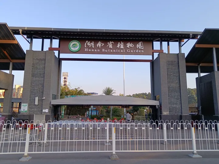 The entrance gate of Hunan Botanical Garden, Yuhua District, Changsha ·
 Plan your visit
Getting there
Yuhua District is about 15 km in a straight line from central Changsha. Search for 雨花区 in a map app to find stations and your accommodation.
Where to stay →Build your route
Start with Hunan Botanical Garden. The linked place guides have entrance and visit details.
Continue with Changsha →More in Changsha
Sources & geographic information
Administrative names and parent areas: Official geographic directory (dmfw.mca.gov.cn) · Reference date 2026-09-06.
Some facts checked against 雨花区 — Wikipedia contributors, CC BY-SA 4.0.
Photo: Hunan Botanical Garden · Huangdan2060 · CC BY 3.0. Full frame retained; proportionally resized and converted to WebP. No retouching or changes to the photographed subject. Card displays may crop the view.

Map data © OpenStreetMap contributors. Pins mark approximate centres, not entrances or boundaries.