


Get to know Yuelu District
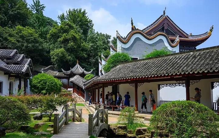
Photo adjustments
Full frame retained; proportionally resized and converted to WebP. No retouching or changes to the photographed subject. Card displays may crop the view.
- Administrative area
- District · 市辖区
- Part of
- Changsha
- Chinese name
- 岳麓区
- Local areas
- District guide
Area & population
- Population · 2020 census
- 1,526,641
- Administrative seat
- Wangyue Subdistrict
Source: cited geographic source, as of the dates shown.
History
Between the pre-Qin period and the Han dynasty a fortified town, Beijin (北津城), stood in the north of today's district, and many kings and nobles of the Han kingdom of Changsha were buried here. Lushan Temple (麓山寺) on Yuelu Mountain dates from the Jin dynasty. In the Republican era many Hunanese political figures and revolutionaries were buried on the mountain. The present district was formed in 1996 from the former West District.
What to see
The Yuelu Academy (岳麓书院) was founded in 976 by Zhu Dong (朱洞), prefect of Tanzhou (潭州), and received a name plaque from the Song emperor Zhenzong in 1015. Hunan University counts it among the four great academies of old China. In 1167 the philosophers Zhu Xi (朱熹) and Zhang Shi (张栻) held a three-day debate here, remembered as the Zhu-Zhang meeting (朱张会讲). The academy became the Hunan Higher School in 1903 and was named Hunan University in 1926; today it is the university's school of history and philosophy, and a plaque reading "seek truth from facts" (实事求是) hangs at the front of its lecture hall.
Also at the foot of the mountain is the former site of the Xinmin Study Society (新民学会旧址), founded by Mao Zedong, Cai Hesen (蔡和森) and Xiao Zisheng (萧子升). Hunan University, Central South University (中南大学) and Hunan Normal University (湖南师大) all have campuses below the mountain, and the Changsha Evening News describes the former university town growing into a science city.
Yuelu Mountain and Orange Isle, the sandbar in the Xiang, have been run as scenic areas directly under the district.
Getting oriented
The district borders Yuhu District (雨湖区) of Xiangtan (湘潭) to the south, Ningxiang (宁乡市) to the west and Wangcheng District (望城区) to the north, and faces Kaifu (开福区) and Tianxin (天心区) districts across the river. An old Changsha saying called the two banks "half countryside, half city"; the district also takes in the Meixi Lake (梅溪湖) development area and the Lugu (麓谷) science park.
Highlights
- Yuelu Academy 岳麓书院: Founded in 976; site of the 1167 Zhu-Zhang debate; now part of Hunan University.
- Lushan Temple 麓山寺: Temple on Yuelu Mountain dating from the Jin dynasty.
- Former site of the Xinmin Study Society 新民学会旧址: Where Mao Zedong, Cai Hesen and Xiao Zisheng founded the society at the foot of Yuelu Mountain.
- Orange Isle 橘子洲: Sandbar in the middle of the Xiang, part of the district.
Sources for this guide
岳麓区 - 维基百科,自由的百科全书 · Wikipedia (Chinese) · CC BY-SA 4.0
岳麓青春志丨长沙晚报封面特稿-岳麓区-长沙晚报网 · Changsha Evening News
书院简介-岳麓书院 · Yuelu Academy, Hunan University
Original English written from the listed sources and checked sentence by sentence against quoted extracts by a separate reviewer. Updated 2026-09-25.
Explore Yuelu District
Core places to explore, with English and Chinese names.
Places to explore around Yuelu District
 A stone-paved path leading across a courtyard to the open-fronted lecture hall of Yuelu Academy, its dark tiled roof and timber columns carrying name boards over the entrance; white-walled wings flank the court, with two large trees, young staked saplings and a bare sandy forecourt.
Yuelu Mountain and Yuelu Academy岳麓山与岳麓书院
Yuelu Mountain and Yuelu Academy (岳麓山与岳麓书院) occupy a wooded hill on the west bank of the Xiang River in Yuelu District, Changsha, Hunan. The academy, founded in 976 and now part of Hunan University, sits at the foot of a scenic zone that also holds a third-century Buddhist temple, a Ming Daoist hall and a group of revolutionary graves.
Read the place guide →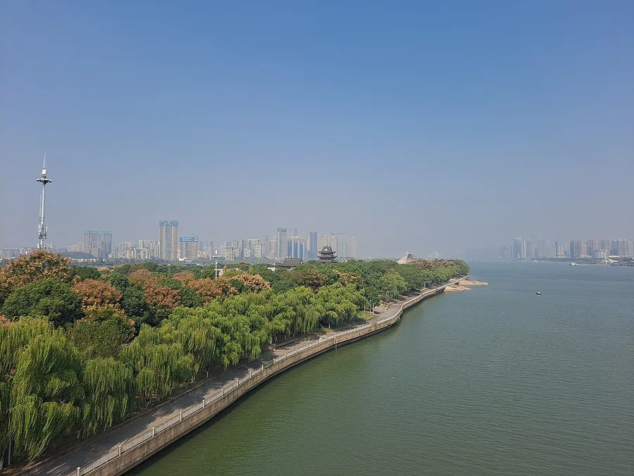 The riverbank and wooded length of Orange Isle in Changsha, November 2022.
Orange Isle橘子洲
Orange Isle is a long island within the Xiang River, offering views towards both central Changsha and Yuelu Mountain. The monumental sculpture of the young Mao Zedong near its southern end gives the riverside walk a clear…
Read the place guide →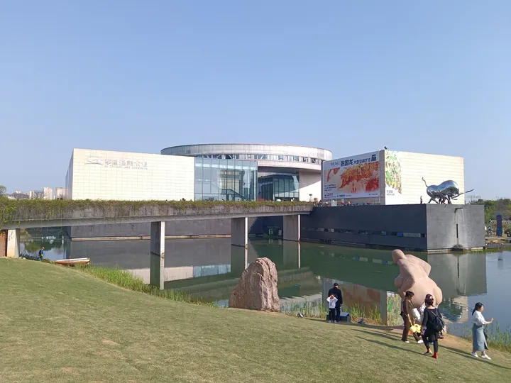 Li Zijian Art Museum on the Yanghu Wetland Park waterfront in Yuelu District, Changsha · 长沙市岳麓区洋湖湿地公园畔的李自健美术馆 Source-recorded photograph date: 2023-04-01 16:09:08.
Li Zijian Art Museum李自健美术馆
Riverside museum in Changsha built by painter Li Zijian, showing over 300 of his realist oils plus sketches by his first teacher and Hsing Yun calligraphy.
Read the place guide →Plan your visit
Getting there
Yuelu District covers the centre of Changsha. Search for 岳麓区 in a map app to find stations and your accommodation.
Where to stay →Build your route
Yuelu Mountain and Yuelu Academy and Orange Isle are both listed here. The linked place guides have entrance and visit details.
Continue with Changsha →More in Changsha
Sources & geographic information
Administrative names and parent areas: Official geographic directory · Reference date 2026-09-06.
Some facts checked against 岳麓区 — Wikipedia contributors, CC BY-SA 4.0.
Photo: Yuelu Mountain and Yuelu Academy · ScareCriterion12 · CC BY-SA 4.0. Full frame retained; proportionally resized and converted to WebP. No retouching or changes to the photographed subject. Card displays may crop the view.

Photo: Orange Isle · EditQ · CC BY-SA 4.0. Proportionally resized and converted to WebP without cropping, retouching or changing the photographed subject.

Photo: Li Zijian Art Museum · Huangdan2060 · CC BY 3.0. Full frame retained; proportionally resized and converted to WebP. No retouching or changes to the photographed subject. Card displays may crop the view.

Map data © OpenStreetMap contributors. Pins mark approximate centres, not entrances or boundaries.