


Get to know Arun Banner
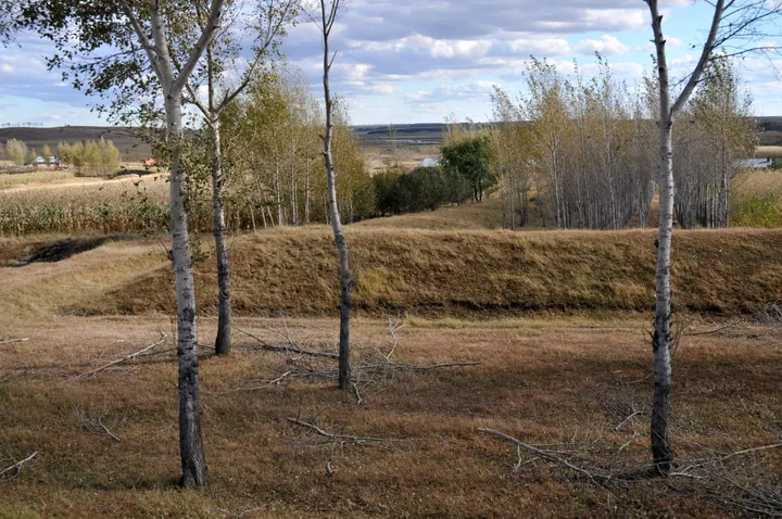
Photo adjustments
Full frame retained; proportionally resized and converted to WebP. No retouching or changes to the photographed subject. Card displays may crop the view.
- Administrative area
- Banner · 旗
- Part of
- Hulunbuir
- Chinese name
- 阿荣旗
- Local areas
- Banner guide
Area & population
- Area in the source
- 13,600.00 km²
- Population · 2020
- 257,815
- Administrative seat
- Naji Town
Source: cited geographic source, as of the dates shown.
Setting and landscape
Natural lines mark most of the boundary: the Zhagedun ridge (扎格敦山岭) in the east, the Yin River (音河) facing Zhalantun (扎兰屯) in the west, and the Bila River (毕拉河) against Oroqen Autonomous Banner (鄂伦春自治旗) in the north. In the south the border with Gannan County (甘南县) in Heilongjiang follows the Jin-dynasty border trench (金界壕). The main peak of Tuboler National Forest Park (图博勒国家森林公园) is Tuboler Peak (图博勒峰), 1,108 metres, which the banner's tourism bureau describes as the one summit in the banner that looks out over the Greater Khingan peaks; it is the remains of a Cretaceous volcano, and its name comes from a Mongolian word meaning "peace".
History
In the Yongle (永乐) reign the Ming set up the Alun Guard (阿伦卫) in the Arun River basin. Under the early Qing the land was a hunting ground of the Solon (索伦部) people. The banner itself dates from March 1933, when Manchukuo carved it out of neighbouring districts; its office moved from Honghualiangzi (红花梁子) to Najitun (那吉屯), and Naji town (那吉镇) is still the seat.
What to see
Besides Tuboler National Forest Park, the banner lists the Suoerqi National Wetland Park (索尔奇国家湿地公园) and the Wujiapo Ecological Park (五家坡生态休闲园) among its scenic spots. At Lixin village in Huoerqi (霍尔奇) the 130-mu Dujuanling (杜鹃岭) azalea area mixes wild rhododendrons with pine, birch and oak and more than ten thousand planted bushes, including white ones. Dongguang village (东光村) lies in Xinfa (新发), which the banner's tourism bureau calls Inner Mongolia's only Korean ethnic township; the village is a national key rural-tourism village with a folk museum. The banner also has the Wang Jie Memorial Hall (王杰纪念馆) and the Anti-Japanese United Army Heroes Park (抗联英雄园), a regional patriotic-education base.
Food and local products
Twenty-seven ethnic groups live here, including Mongols, Koreans, Oroqen, Evenki and Daur, and the banner's 2025 heritage list reflects that mix: roast goose making from Naji and the Delqier Evenki township (得力其尔鄂温克族乡), a fire-pot pig-slaughter dish from Fuxing (复兴) called "黑瞎子上炕" ("the black bear climbs onto the kang"), and Korean rice wine from Xinfa. Products the tourism bureau recommends taking home are roast goose, black fungus, white melon seeds and tussah silkworms (柞蚕), which carry a national agricultural geographical indication; a tussah culture centre combines a silk exhibition, hands-on activities and silk processing.
Getting oriented
National roads G111 and G301 cross the banner, and it is the end point of the Jining–Arun expressway (集阿高速).
Highlights
- Tuboler National Forest Park 图博勒国家森林公园: Tuboler Peak, 1,108 metres, is a Cretaceous volcanic remnant overlooking the Greater Khingan range.
- Dongguang Village 东光村: Korean village in Xinfa, which the banner's tourism bureau calls Inner Mongolia's only Korean ethnic township; has a folk museum.
- Dujuanling Azalea Area 杜鹃岭: 130 mu of wild and planted azaleas among pine, birch and oak at Lixin village.
- Arun tussah silkworms 阿荣旗柞蚕: Carry a national agricultural geographical indication.
- Roast goose 烤鹅: Its making was added to the banner's intangible-heritage list in 2025.
Sources for this guide
阿荣旗 - 维基百科,自由的百科全书 · Chinese Wikipedia · CC BY-SA 4.0
阿荣旗人民政府办公室关于公布阿荣旗第七批非物质文化遗产名录的通知-阿荣旗人民政府 · Arun Banner People's Government Office
魅力城市-阿荣旗人民政府 · Arun Banner People's Government
图博勒国家森林公园-阿荣旗人民政府 · Arun Banner People's Government
叮叮!请接收一份来自呼伦贝尔的“阿荣”攻略-阿荣旗人民政府 · Arun Banner Culture and Tourism Bureau, on the banner government portal
Original English written from the listed sources and checked sentence by sentence against quoted extracts by a separate reviewer. Updated 2026-09-26.
Explore Arun Banner
Core places to explore, with English and Chinese names.
Arun Banner 阿荣旗
Plan your visit
Getting there
Arun Banner is about 295 km in a straight line from central Hulunbuir. Search for 阿荣旗 in a map app to find stations and your accommodation.
Where to stay →More in Hulunbuir
Sources & geographic information
Administrative names and parent areas: Official geographic directory · Reference date 2026-09-06.
Some facts checked against 阿荣旗 — Wikipedia contributors, CC BY-SA 4.0.
Map data © OpenStreetMap contributors. Pins mark approximate centres, not entrances or boundaries.