


Get to know Morin Dawa Daur Autonomous Banner
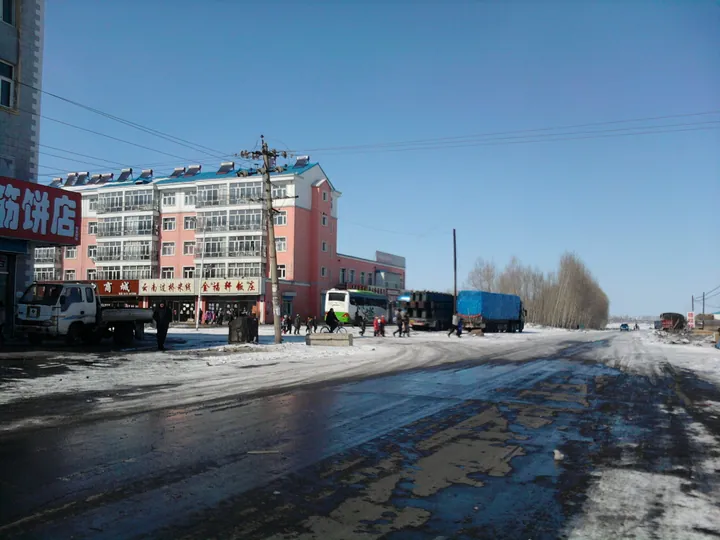
Photo adjustments
Full frame retained; proportionally resized and converted to WebP. No retouching or changes to the photographed subject. Card displays may crop the view.
- Administrative area
- Autonomous banner · 自治旗
- Part of
- Hulunbuir
- Chinese name
- 莫力达瓦达斡尔族自治旗
- Local areas
- Autonomous banner guide
Area & population
- Area in the source
- 10,400.00 km²
- Population · 2020
- 228,822
- Administrative seat
- Nirgi
Source: cited geographic source, as of the dates shown.
Setting and landscape
The banner runs about 203 kilometres north to south and 125 kilometres east to west. Across the Nen River lie Nehe (讷河) and Nenjiang (嫩江) in Heilongjiang. The name is Daur for 'horse ridge': Morin Dawa Mountain (莫力达瓦山) was steep enough that it could only be crossed on horseback. The banner government counts 56 rivers and streams. Chinese Wikipedia gives a mean temperature of 2.9°C and 403.2 mm of rain for 2025, with short warm summers and long cold winters.
The Nierji (尼尔基) water project was begun here in 2001 and started storing water and generating power in July 2006; the banner government says the full reservoir covers more than 500 square kilometres.
History
In 1689 the Qing set up the Butha (布特哈) command office to run the area; Chinese Wikipedia places it at a village now inside Nierji town, the banner seat. In 1906 Butha was split at the Nen River and this side became West Butha. Its offices moved to Nierji in 1925, the Manchukuo authorities renamed it Morin Dawa Banner in 1932, and the autonomous banner was created in 1958. It was governed from Heilongjiang between 1969 and 1979.
What to see
The banner government lists the Chinese Daur Ethnic Park (中国达斡尔民族园), the Daur Ethnic Museum (达斡尔民族博物馆), the Jin-dynasty border trenches (金界壕) and Morin Dawa Mountain. Chinese Wikipedia notes that the remains of the Jin wall are a national key cultural relic protection unit.
Daur traditional hockey (达斡尔族传统曲棍球竞技) was entered on the first national intangible-heritage list in 2006, with Morin Dawa as the nominating area. Players use sticks cut from oak with a naturally curved root; balls are of wood, rolled animal hair or, for night games, a hollow birch fungus stuffed with burning pine resin. The State Sports Commission named Morin Dawa the home of hockey in 1989.
Highlights
- Daur traditional hockey 达斡尔族传统曲棍球竞技: Listed as national intangible heritage in 2006; played with oak sticks and wooden, hair or burning fungus balls.
- Chinese Daur Ethnic Park 中国达斡尔民族园: Named by the banner government among its main visitor sights.
- Jin-dynasty border trenches 金界壕: Remains of the Jin wall, a national key cultural relic protection unit.
- Nierji Reservoir 尼尔基水库: Water project begun in 2001 and filled from 2006; more than 500 square kilometres of water when full.
Sources for this guide
莫力达瓦达斡尔族自治旗概述 · Morin Dawa Daur Autonomous Banner People's Government
人文历史 · Morin Dawa Daur Autonomous Banner People's Government
莫力达瓦达斡尔族自治旗 · Wikipedia (Chinese) · CC BY-SA 4.0
达斡尔族传统曲棍球竞技 · China Intangible Cultural Heritage Network (ihchina.cn)
Original English written from the listed sources and checked sentence by sentence against quoted extracts by a separate reviewer. Updated 2026-09-25.
Explore Morin Dawa Daur Autonomous Banner
Core places to explore, with English and Chinese names.
Morin Dawa Daur Autonomous Banner 莫力达瓦达斡尔族自治旗
Plan your visit
Getting there
Morin Dawa Daur Autonomous Banner is about 355 km in a straight line from central Hulunbuir. Search for 莫力达瓦达斡尔族自治旗 in a map app to find stations and your accommodation.
Where to stay →More in Hulunbuir
Sources & geographic information
Administrative names and parent areas: Official geographic directory · Reference date 2026-09-06.
Some facts checked against 莫力达瓦达斡尔族自治旗 — Wikipedia contributors, CC BY-SA 4.0.
Map data © OpenStreetMap contributors. Pins mark approximate centres, not entrances or boundaries.