


Get to know Dexing
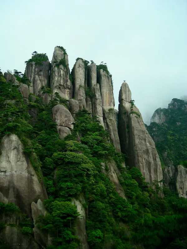
Photo adjustments
Full frame retained; EXIF orientation normalized, proportionally resized to at most 800 pixels and converted to WebP. No generated pixels or subject changes. Cards may crop the display.
- Administrative area
- County-level city · 县级市
- Part of
- Shangrao
- Chinese name
- 德兴市
- Local areas
- County-level city guide
Area & population
- Area in the source
- 2,101.00 km²
- Population · 2016
- 302,000
Source: cited geographic source, as of the dates shown.
Setting and landscape
Kaihua County (开化县) in Zhejiang lies to the east, Wuyuan (婺源) to the north, Leping (乐平) to the west, and Hengfeng (横峰) and Yiyang (弋阳) to the south. Most of the land is mountainous, with the Huaiyu Mountains (怀玉山) across the south and a small area of low hills in the west; the Le'an River (乐安江) is the main river. The city government sits in Yincheng subdistrict (银城街道). Wikipedia describes the Dexing Copper Mine (德兴铜矿) as China's largest copper mine and Asia's largest open-pit copper mine; a freight line, the Le–De railway (乐德铁路), serves it.
History
People lived here in the Neolithic. The area belonged to Jiujiang Commandery (九江郡) under the Qin and Yuzhang Commandery (豫章郡) under the Han. Dexing County was created in 938 under the Southern Tang and placed in Raozhou (饶州), to which it belonged through the Yuan, Ming and Qing. Its name comes from a phrase meaning that the treasures of the mountains and rivers flourish only through virtue. The county came under the Shangrao region in 1949 and became a county-level city in 1990.
What to see
Sanqingshan (三清山), a Taoist mountain on the south-east border with Yushan County (玉山县), was inscribed on the World Heritage List in July 2008. Damaoshan (大茅山), in the Huaiyu range where Huaqiao (花桥镇), Longtoushan (龙头山乡) and Rao'er (绕二镇) meet, rises to 1,392 metres; it became a national scenic area in October 2012. Its scenic area has three parts: the main mountain, Wufeng Cave (梧风洞) south of the summit, known for oddly shaped rocks, clear pools and streams and revolutionary sites, and Shuangxi Lake (双溪湖), a reservoir south-west of the peak. Haikou (海口镇) is described as a thousand-year-old town, with an ancient camphor tree among its sights.
Getting oriented
Dexing station, near Longtoushan, is on the Hefei–Fuzhou high-speed railway, and Dexing East station, near Xingangshan (新岗山镇), is on the Jiujiang–Quzhou railway. The Jingdezhen–Wuyuan–Changshan expressway (景婺常高速公路) also passes Xingangshan.
Highlights
- Sanqingshan 三清山: Taoist mountain on the Dexing–Yushan border, on the World Heritage List since July 2008.
- Damaoshan 大茅山: 1,392-metre peak of the Huaiyu range; national scenic area since 2012.
- Wufeng Cave 梧风洞: Part of the Damaoshan scenic area, with unusual rocks, pools, streams and revolutionary sites.
- Haikou town 海口镇: Described as a thousand-year-old town, with an old camphor tree.
Sources for this guide
德兴市 - 维基百科,自由的百科全书 · Chinese Wikipedia · CC BY-SA 4.0
大茅山 - 维基百科,自由的百科全书 · Chinese Wikipedia · CC BY-SA 4.0
Dexing, Jiangxi - Wikipedia · English Wikipedia · CC BY-SA 4.0
Original English written from the listed sources and checked sentence by sentence against quoted extracts by a separate reviewer. Updated 2026-09-25.
Explore Dexing
Core places to explore, with English and Chinese names.
Plan your visit
Getting there
Dexing is about 65 km in a straight line from central Shangrao. Search for 德兴市 in a map app to find stations and your accommodation.
Where to stay →More in Shangrao
Sources & geographic information
Administrative names and parent areas: Official geographic directory · Reference date 2026-09-06.
Some facts checked against 德兴市 — Wikipedia contributors, CC BY-SA 4.0.
Some facts checked against 大茅山 — Wikipedia contributors, CC BY-SA 4.0.
Some facts checked against Dexing, Jiangxi — Wikipedia contributors, CC BY-SA 4.0.
Map data © OpenStreetMap contributors. Pins mark approximate centres, not entrances or boundaries.