


Get to know Wannian County
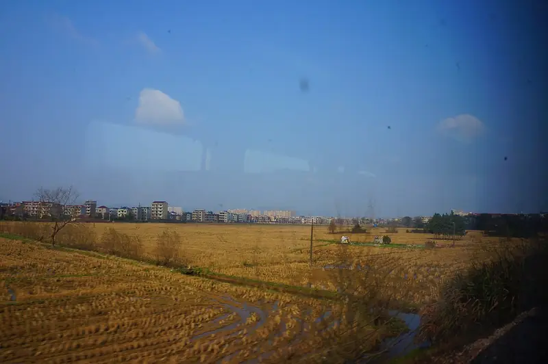
Photo adjustments
Full frame retained; EXIF orientation normalized, proportionally resized to at most 800 pixels and converted to WebP. No generated pixels or subject changes. Cards may crop the display.
- Administrative area
- County · 县
- Part of
- Shangrao
- Chinese name
- 万年县
- Local areas
- County guide
Area & population
- Area in the source
- 1,140.76 km²
- Population · 2017
- 435,700
Source: cited geographic source, as of the dates shown.
Setting and landscape
The county is mostly low ridges and hills with some lakeside plain, and the land steps down from south-east to north-west. It has long been called a "land of fish and rice" (鱼米之乡). It borders Yugan (余干) to the west and Leping (乐平) to the north. The seat is Chenying town (陈营镇). The county was created in 1512, in the Ming dynasty, from part of Yugan, and takes its name from Wannian Mountain (万年山) in the north of the county.
What to see
The two sites are in the Dayuan basin (大源盆地), about 4 km long and 1 km wide, with the limestone Da and Xiao He hills on its north side. Xianrendong is a cave at the foot of Xiaohe Hill (小荷山) facing south-east, up to 25 metres wide and 60 metres long; Diaotonghuan, about 800 metres to the south-west, is an open-ended rock shelter on a ridge. Sino-American teams led by the archaeologists MacNeish and Yan Wenming (严文明) dug here in 1993 and 1995 and found phytoliths of cultivated rice about 12,000 years old and more than 890 early pottery sherds. One restored round-bottomed jar, called "China's first pottery jar", is kept in the National Museum of China.
At the site the county has built a display area that uses changing light to show the excavation, and a "rice ancestor tribe" (稻祖部落) zone with scenes of threshing, fishing and pot-making. The site is managed together with the Shenlong Palace (神龙宫) karst caves and underground river as the Shennongyuan (神农源) scenic area, which the county describes as a national-level scenic area.
Food and local products
Rice is the county's defining crop. The "Wannian rice-farming culture system" (万年稻作文化系统) became a UN Food and Agriculture Organization pilot site for Globally Important Agricultural Heritage in 2010, and Wannian rice-farming customs entered the fourth national intangible-heritage list in 2014. Wannian tribute rice (万年贡米) has shuttle-shaped grains, needle-like awns and a jade-white colour; local legend says the Ming founder Zhu Yuanzhang (朱元璋) ordered it sent to court every year. Village households still make rice cakes at New Year.
Getting oriented
The county town is about 70 km from the rail hub of Yingtan (鹰潭), 80 km from Jingdezhen (景德镇) and 130 km from Nanchang (南昌). Wannian station is on the Anhui–Jiangxi railway (皖赣铁路), and national roads 206 and 353 and the Jingdezhen–Yingtan expressway (景鹰高速公路) cross the county.
Highlights
- Xianrendong and Diaotonghuan sites 仙人洞与吊桶环遗址: Cave and rock shelter in the Dayuan basin with cultivated-rice phytoliths about 12,000 years old and very early pottery, excavated in 1993 and 1995.
- Shenlong Palace 神龙宫: Karst caves and an underground river, part of the Shennongyuan scenic area with the cave sites.
- Wannian tribute rice 万年贡米: Shuttle-shaped, jade-white local rice; legend links it to tribute ordered by Zhu Yuanzhang.
Sources for this guide
万年县 - 维基百科,自由的百科全书 · Chinese Wikipedia · CC BY-SA 4.0
农文旅融合 万年县致力打造世界稻作文化体验地_政务动态_裴梅镇 · Wannian County People's Government
一粒种子改变世界 · Jiangxi Daily via People's Daily Online
Original English written from the listed sources and checked sentence by sentence against quoted extracts by a separate reviewer. Updated 2026-09-25.
Explore Wannian County
Core places to explore, with English and Chinese names.
Wannian County 万年县
Plan your visit
Getting there
Wannian County is about 90 km in a straight line from central Shangrao. Search for 万年县 in a map app to find stations and your accommodation.
Where to stay →More in Shangrao
Sources & geographic information
Administrative names and parent areas: Official geographic directory · Reference date 2026-09-06.
Some facts checked against 万年县 — Wikipedia contributors, CC BY-SA 4.0.
Map data © OpenStreetMap contributors. Pins mark approximate centres, not entrances or boundaries.