


Get to know Linyou County
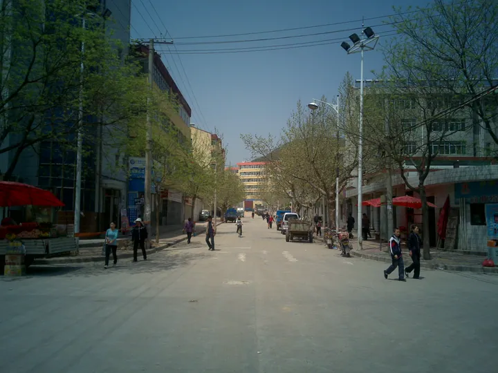
Photo adjustments
Full frame retained; proportionally resized and converted to WebP. No retouching or changes to the photographed subject. Card displays may crop the view.
- Administrative area
- County · 县
- Part of
- Baoji
- Chinese name
- 麟游县
- Local areas
- County guide
Area & population
- Area in the source
- 1,740.00 km²
- Population · 2018
- 92,100
Source: cited geographic source, as of the dates shown.
History
The county was once called Duyang (杜阳) and Purun (普润); its present name refers to a qilin (麒麟), the auspicious beast said to have roamed here. Emperor Wen of Sui ordered Renshou Palace built in 593, and it was finished in 595. He came there six times to escape the summer heat and died in its Dabao Hall (大宝殿). Emperor Taizong of Tang rebuilt it in 631 and renamed it Jiucheng Palace, and a flood destroyed it in 836.
The county government counts 21 stays by four Sui and Tang emperors, and says that Wei Zheng (魏征) presented his memorial known as the "Ten Gradual Declines" (十渐疏) here. Wei Zheng also wrote the text of the Liquan Spring stele of Jiucheng Palace (九成宫醴泉铭), written out by the calligrapher Ouyang Xun (欧阳询) and praised as the finest regular script.
What to see
The Renshou and Jiucheng Palace site (隋仁寿宫唐九成宫遗址) is a national protected site on the north bank of the Du River (杜水) in the new part of the county town. Excavations in the late 1980s and early 1990s traced the palace over about 1,010 metres from east to west.
The Cishan Temple grottoes (慈善寺石窟) lie about 5 kilometres east of the county town and were listed as a national protected site in 2001. Carving began in the Sui Renshou era, and a 28-metre cliff holds twelve caves, six niches and 47 statues. The main Buddha of the first cave on the west cliff, 5.5 metres tall, was paid for by the Sui imperial house.
Setting and local products
The county covers 1,704 square kilometres at an average altitude of 1,271 metres, with a mean annual temperature of 9.3°C. The county government lists it as a national base for black locust honey (洋槐蜜) and calls it China's home of the Boer goat (布尔羊) and of walnuts.
Highlights
- Renshou and Jiucheng Palace site 隋仁寿宫唐九成宫遗址: Sui summer palace begun in 593 and rebuilt by the Tang in 631; a national protected site.
- Cishan Temple grottoes 慈善寺石窟: Sui and Tang cave temple 5 km east of the county town, listed nationally in 2001.
- Liquan Spring stele of Jiucheng Palace 九成宫醴泉铭: Text by Wei Zheng, calligraphy by Ouyang Xun.
Sources for this guide
麟游概况 麟游县人民政府 · Linyou County People's Government
慈善寺石窟 - 维基百科 · Wikipedia (Chinese) · CC BY-SA 4.0
隋仁寿宫唐九成宫遗址 - 维基百科 · Wikipedia (Chinese) · CC BY-SA 4.0
Original English written from the listed sources and checked sentence by sentence against quoted extracts by a separate reviewer. Updated 2026-09-26.
Explore Linyou County
Core places to explore, with English and Chinese names.
Places to explore around Linyou County
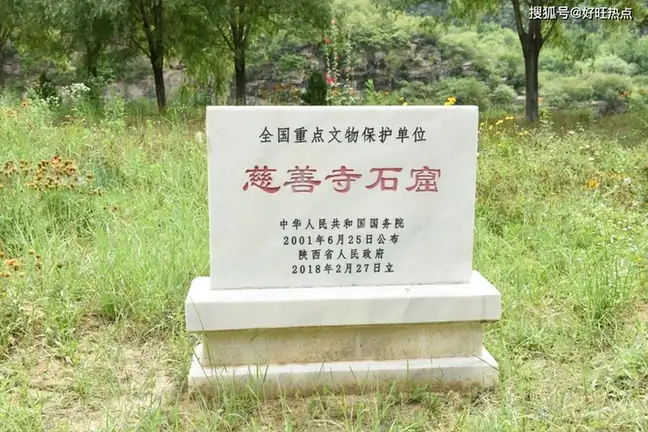 Cishan Temple Grottoes ·
 Plan your visit
Getting there
Linyou County is about 65 km in a straight line from central Baoji. Search for 麟游县 in a map app to find stations and your accommodation.
Where to stay →Build your route
Start with Cishan Temple Grottoes. The linked place guides have entrance and visit details.
Continue with Baoji →More in Baoji
Sources & geographic information
Administrative names and parent areas: Official geographic directory · Reference date 2026-09-06.
Some facts checked against 慈善寺石窟 — Wikipedia contributors, CC BY-SA 4.0.
Some facts checked against 隋仁寿宫唐九成宫遗址 — Wikipedia contributors, CC BY-SA 4.0.
Photo: Cishan Temple Grottoes · Source photographer · License not provided. EXIF orientation normalized; resized without changing aspect ratio; converted to WebP. No subject edits.
Map data © OpenStreetMap contributors. Pins mark approximate centres, not entrances or boundaries.