


Get to know Taibai County
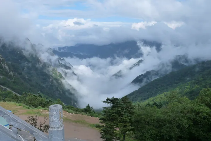
Photo adjustments
Full frame retained; proportionally resized and converted to WebP. No retouching or changes to the photographed subject. Card displays may crop the view.
- Administrative area
- County · 县
- Part of
- Baoji
- Chinese name
- 太白县
- Local areas
- County guide
Area & population
- Area in the source
- 2,780.00 km²
- Population · 2019
- 51,513
Source: cited geographic source, as of the dates shown.
What to see
The valley lies in Chaihushan Village (柴胡山村), Yingge Town (鹦鸽镇), along one of the historical routes up Mount Taibai. Named features include Guanyin Temple (观音庙), Yaowang Cave (药王洞), Yaowang Terrace (药王台) and the Shiguo Waterfall (石锅瀑布). A shaded plank walkway follows the mountain stream.
Setting and landscape
Taibai’s terrain ranges from 740 to 3,771 metres above sea level. In Yaowang Valley, autumn foliage and winter icefalls provide seasonal changes; wild kiwifruit, mountain grapes and walnuts grow among its other plants. The scenic park opened in October 2011. Local tradition associates Sun Simiao with retreat and study here, a connection retained in the names of several features.
Sources for this guide
太白县人民政府 旅游 太白概况 · Taibai County Government
太白县人民政府 旅游 药王谷风景区 · Taibai County Government
Original English written from the listed sources and checked sentence by sentence against quoted extracts by a separate reviewer. Updated 2026-09-26.
Explore Taibai County
Core places to explore, with English and Chinese names.
Taibai County 太白县
Plan your visit
Getting there
Taibai County is about 35 km in a straight line from central Baoji. Search for 太白县 in a map app to find stations and your accommodation.
Where to stay →More in Baoji
Sources & geographic information
Administrative names and parent areas: Official geographic directory · Reference date 2026-09-06.
Map data © OpenStreetMap contributors. Pins mark approximate centres, not entrances or boundaries.