


Get to know Huanglong County
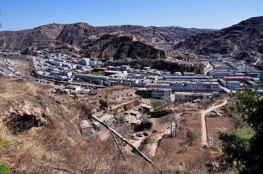
Photo adjustments
EXIF orientation normalized; resized without changing aspect ratio; converted to WebP. No subject edits.
- Administrative area
- County · 县
- Part of
- Yan'an
- Chinese name
- 黄龙县
- Local areas
- County guide
Area & population
- Area in the source
- 2,751.00 km²
- Population · 2012
- 49,500
Source: cited geographic source, as of the dates shown.
Temple and stone inscriptions
Lianyun Temple (莲云寺) preserves several halls, a gateway and old pines and cypresses. Its recorded repair steles include one from the third year of the Ming Jiajing reign (嘉靖). Nearby, a 1,900-metre cultural stone corridor uses inscriptions to present Huanglong’s geography, history and customs. The 6.2-kilometre hill path includes stone steps, timber walkways and a suspension bridge.
A view through the treetops
In Wazijie Town (瓦子街镇), the Treetop Walk camp (树顶漫步营地) occupies forest within Huanglong Mountain National Forest Park (黄龙山国家森林公园). Its steel-and-timber observation tower rises 40 metres, linked to a 1,250-metre walkway with interactive science displays and glass viewing platforms.
Sources for this guide
黄龙概况--黄龙县人民政府 · Huanglong County Government
黄龙山国家AAAA级旅游景区--黄龙县人民政府 · Huanglong County Government
树顶漫步--黄龙县人民政府 · Huanglong County Government
Original English written from the listed sources and checked sentence by sentence against quoted extracts by a separate reviewer. Updated 2026-09-26.
Explore Huanglong County
Core places to explore, with English and Chinese names.
Huanglong County 黄龙县
Plan your visit
Getting there
Huanglong County is about 120 km in a straight line from central Yan'an. Search for 黄龙县 in a map app to find stations and your accommodation.
Where to stay →More in Yan'an
Sources & geographic information
Administrative names and parent areas: Official geographic directory · Reference date 2026-09-06.
Map data © OpenStreetMap contributors. Pins mark approximate centres, not entrances or boundaries.