


Get to know Maoxian
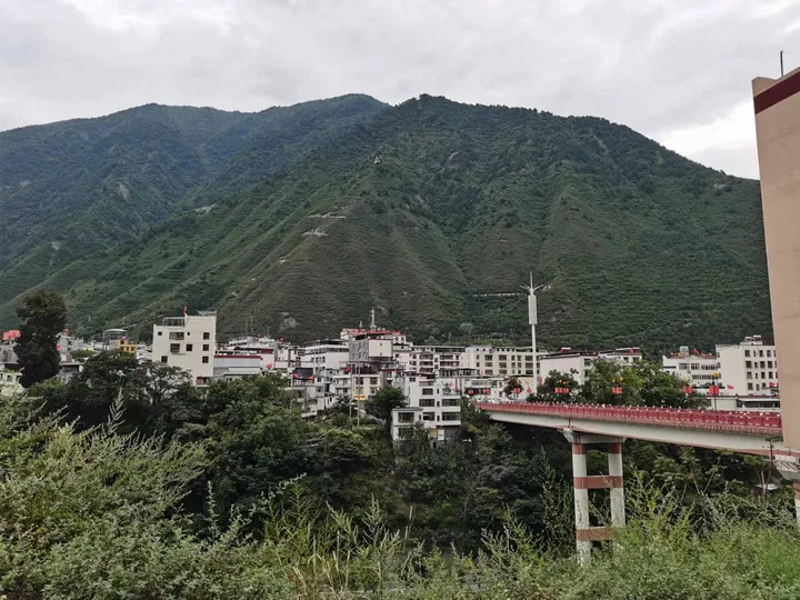
Photo adjustments
Full frame retained; proportionally resized and converted to WebP. No retouching or changes to the photographed subject. Card displays may crop the view.
- Administrative area
- County · 县
- Part of
- Ngawa Tibetan and Qiang Autonomous Prefecture
- Chinese name
- 茂县
- Local areas
- County guide
Area & population
- Area in the source
- 4,064.00 km²
- Population · 2020
- 95,361
- Administrative seat
- Fengyi
Source: cited geographic source, as of the dates shown.
Mountains and the Diexi lakes
The county’s terrain slopes down from northwest to southeast. Wannian Snow Mountain (万年雪山) rises to 5,230 metres in the west, while the lower Tumen River (土门河) valley in the east reaches only 910 metres. Diexi Haizi (叠溪海子) formed when the 1933 earthquake blocked the main channel of the Min River. The lakes lie nearly 60 kilometres upstream of the county seat.
Qiang culture and valley scenery
Chinese Ancient Qiang City (中国古羌城) anchors a county study-tour programme drawing on Qiang traditions, agriculture and food. Qiang towers and embroidery are among Maoxian’s cultural features. The county’s natural sights also include Songpinggou (松坪沟) and Mount Jiuding (九鼎山), as well as the Diexi lakes.
Sources for this guide
茂县概况_茂县人民政府 · Maoxian County Government
岷江茂县段、叠溪海子基本情况_茂县人民政府 · Maoxian County Government
“云上古羌·清凉茂县‘羌风·慧知’研学旅游产品首发仪式”在茂县中国古羌城举行_茂县人民政府 · Maoxian County Government
Original English written from the listed sources and checked sentence by sentence against quoted extracts by a separate reviewer. Updated 2026-09-26.
Explore Maoxian
Core places to explore, with English and Chinese names.
Places to explore around Maoxian
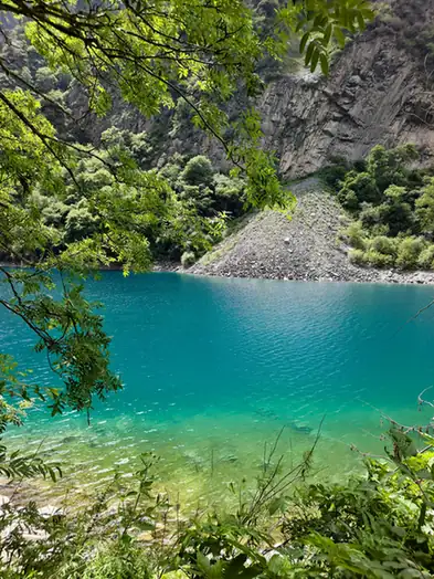 Diexi Songpinggou Valley · 叠溪松坪沟
Diexi Songpinggou Valley叠溪松坪沟
Diexi Songpinggou is a valley of barrier lakes on a Min River tributary in Diexi town, Maoxian County, Aba prefecture, Sichuan, formed when a magnitude-7.5 earthquake struck the area on 25 August 1933.
Read the place guide → The China Ancient Qiang City complex in Mao County · 茂县中国古羌城 Source-recorded photograph date: 2014-04-11 10:03:45.
China Ancient Qiang City中国古羌城
Zhongguo Gu Qiang Cheng, or China Ancient Qiang City, is a newly built Qiang-culture theme park in Pingtou village, Fengyi town, Maoxian County, Aba prefecture, Sichuan, built as a post-earthquake cultural reconstruction project rather than on a historic original site.
Read the place guide →Plan your visit
Getting there
Maoxian is about 120 km in a straight line from central Ngawa Tibetan and Qiang Autonomous Prefecture. Search for 茂县 in a map app to find stations and your accommodation.
Where to stay →Build your route
Diexi Songpinggou Valley and China Ancient Qiang City are both listed here. The linked place guides have entrance and visit details.
Continue with Ngawa Tibetan and Qiang Autonomous Prefecture →More in Ngawa Tibetan and Qiang Autonomous Prefecture
Sources & geographic information
Administrative names and parent areas: Official geographic directory · Reference date 2026-09-06.
Photo: Diexi Songpinggou Valley · Source photographer · License not provided. EXIF orientation normalized; resized without changing aspect ratio; converted to WebP. No subject edits.
Photo: China Ancient Qiang City · Popolon · CC BY-SA 4.0. Full frame retained; proportionally resized and converted to WebP. No retouching or changes to the photographed subject. Card displays may crop the view.

Map data © OpenStreetMap contributors. Pins mark approximate centres, not entrances or boundaries.