


Get to know Lixian

Photo adjustments
The exact downloaded source bytes are separately retained and hashed. Prepared JPEG is proportionally reduced to a maximum 720-pixel long edge; full frame retained, no subject alteration. Final website rendition: full frame retained, proportionally resized to at most 720 pixels and converted to WebP. No additional retouching or subject alteration. Card displays may crop the view.
- Administrative area
- County · 县
- Part of
- Ngawa Tibetan and Qiang Autonomous Prefecture
- Chinese name
- 理县
- Local areas
- County guide
Area & population
- Area in the source
- 4,318.00 km²
- Population · 2020
- 36,926
- Administrative seat
- Zhaxiling (Zagunao)
Source: cited geographic source, as of the dates shown.
Setting and landscape
The county borders Wenchuan (汶川) to the south-east, Xiaojin (小金) to the south-west, Barkam to the west, Maoxian (茂县) and Heishui (黑水) to the north and Hongyuan (红原) to the north-west. Altitudes run from 1,400 to 5,900 metres, and the county government lists snow mountains and meadows, glaciers and lakes, and virgin forest among its landscapes, with 48 rivers large and small. Giant pandas are among the eight first-class protected animal species recorded here.
History
Under the Qing the area was Lifan (理番), an independent sub-prefecture; it became Lifan County in 1914 and took the name Lixian in 1946. The county government describes it as a long-standing meeting point and trading market for the peoples of north-west Sichuan. It lists four national protected sites, among them the Putou Mountain cliff inscriptions (朴头山摩崖石刻), and eight provincial ones including the site of Weizhou city (维州城遗址). The Qiang New Year (羌年) is one of four national intangible-heritage items, and six villages, Shaji (沙吉村) among them, are on the national list of traditional villages.
What to see
The county government's own labels give the range: Miyaluo (米亚罗) as the country's largest red-leaf viewing area, Gu'ergou (古尔沟) as the "first hot spring of western Sichuan", Bipenggou (毕棚沟) as a "world of mountains and water" and the Mengtun Valley (孟屯河谷) as an "Alps of the East".
Taoping Qiang Village (桃坪羌寨) keeps stone-built houses and watchtowers in its old village, with a folk-custom hall showing Qiang wedding customs and Qiang embroidery; the new village next to it holds the shops and restaurants. The county also names the Tibetan village of Ganbao (甘堡藏寨), home of garrison soldiers, and the old town of Xuecheng (薛城古镇) among its cultural sights.
Food and local products
The county government lists Chinese cabbage, sweet cherries, "rock-sugar heart" apples and Kazi walnuts (卡子核桃) as its best-known produce. Kazi walnuts are a Chinese geographical-indication product, also known as "exposed-kernel walnuts".
Highlights
- Taoping Qiang Village 桃坪羌寨: Stone houses and watchtowers in the old village, with a hall on Qiang customs and embroidery.
- Miyaluo 米亚罗: Called the country's largest red-leaf viewing area by the county government.
- Bipenggou 毕棚沟: Valley promoted by the county as a "world of mountains and water".
- Ganbao Tibetan Village 甘堡藏寨: Tibetan village described by the county as the home of garrison soldiers.
- Kazi walnuts 卡子核桃: Geographical-indication walnut, also called the exposed-kernel walnut.
Sources for this guide
理县概况_理县人民政府 · Lixian People's Government
周末游热度攀升 桃坪羌寨文旅“热起来” 新老村寨焕发活力_理县人民政府 · Lixian People's Government
理县 - 维基百科,自由的百科全书 · Chinese Wikipedia · CC BY-SA 4.0
Original English written from the listed sources and checked sentence by sentence against quoted extracts by a separate reviewer. Updated 2026-09-25.
Explore Lixian
Core places to explore, with English and Chinese names.
Places to explore around Lixian
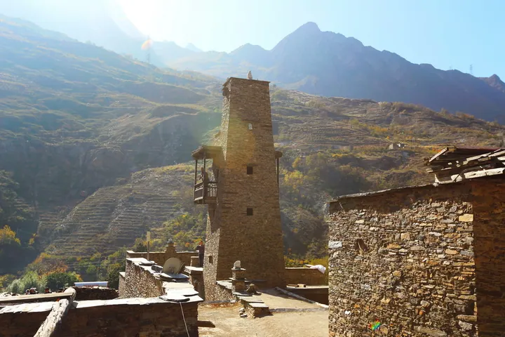 A stone watchtower and dwellings of Taoping Qiang Village, Li County, Sichuan, with the surrounding mountains behind · 四川理县桃坪羌寨石碉楼及民居,背靠群山 Source-recorded photograph date: 2015-11-14 13:56:59.
Taoping Qiang Village桃坪羌寨
Taoping’s older Qiang village is built from stone and timber, with covered passages linking houses beneath tall defensive towers. Water channels run below the buildings, making infrastructure as interesting as the skyline. A…
Read the place guide →Autumn stream and mountain scenery in Bipenggou · 毕棚沟秋林、溪流与雪山 Photograph date recorded by the source: 13 October 2013, 10:38:18.Bipenggou毕棚沟
Bipenggou is a developed mountain valley in Li County, where lakes, forest and high rocky peaks make a varied alpine excursion. Panyang Lake is a natural focus for reflections and a gentler walk, while the route toward Yanziyan…
Read the place guide →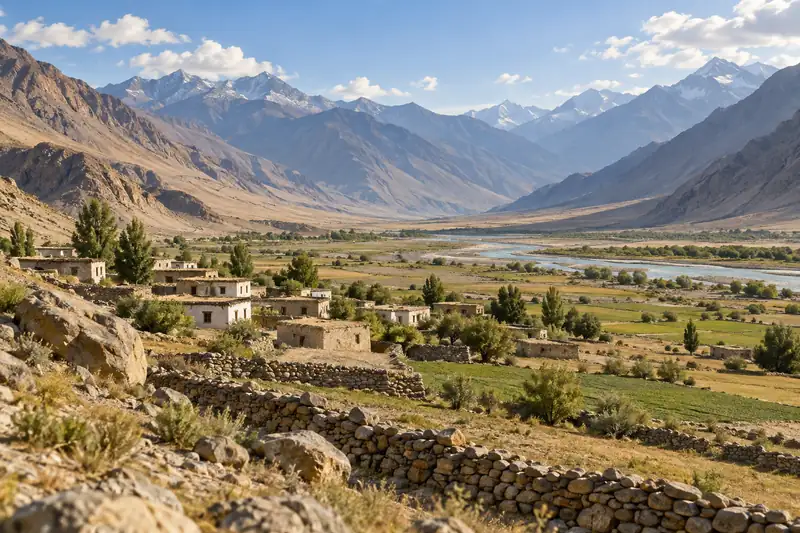 AI illustration · AI 示意图(仅供参考,非该地点实拍)
Ganbao Tibetan Village甘堡藏寨
Ganbao Zangzhai is a Jiarong Tibetan village built against a cliff at the junction of Han, Tibetan and Qiang settlement, 8 km from the county town of Lixian, Aba prefecture, Sichuan, rebuilt to the standard of a 4A-grade scenic area after the 2008 earthquake destroyed it, under a Hunan province paired-assistance programme.
Read the place guide →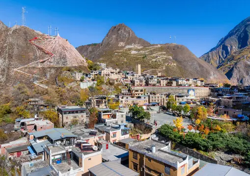 Miyaluo Autumn Foliage · 米亚罗彩林
Miyaluo Autumn Foliage米亚罗彩林
Miyaluo Autumn Foliage refers to the autumn foliage of Miyaluo town, a Jiarong Tibetan settlement 61 km northwest of the county town of Lixian, Aba prefecture, Sichuan, whose surrounding Miyaluo Provincial Nature Reserve is home to snow leopards and Sichuan snub-nosed monkeys.
Read the place guide →Plan your visit
Getting there
Lixian is about 105 km in a straight line from central Ngawa Tibetan and Qiang Autonomous Prefecture. Search for 理县 in a map app to find stations and your accommodation.
Where to stay →Build your route
Taoping Qiang Village and Bipenggou are about 50 km apart in a straight line. The linked place guides have entrance and visit details.
Continue with Ngawa Tibetan and Qiang Autonomous Prefecture →More in Ngawa Tibetan and Qiang Autonomous Prefecture
Sources & geographic information
Administrative names and parent areas: Official geographic directory · Reference date 2026-09-06.
Some facts checked against 理县 — Wikipedia contributors, CC BY-SA 4.0.
Photo: Taoping Qiang Village · Nekitarc · CC BY-SA 4.0. Full frame retained; proportionally resized and converted to WebP. No retouching or changes to the photographed subject. Card displays may crop the view.

Photo: Bipenggou · Culantor Lin · Culantor Lin — 畢棚溝_Bipenggou_Valley_1.jpg — CC BY-SA 2.0 · CC BY-SA 2.0. The exact downloaded source bytes are separately retained and hashed. Prepared JPEG is proportionally reduced to a maximum 720-pixel long edge; full frame retained, no subject alteration. Final website rendition: full frame retained, proportionally resized to at most 720 pixels and converted to WebP. No additional retouching or subject alteration. Card displays may crop the view.

Photo: Miyaluo Autumn Foliage · Source photographer · License not provided. EXIF orientation normalized; resized without changing aspect ratio; converted to WebP. No subject edits.
Map data © OpenStreetMap contributors. Pins mark approximate centres, not entrances or boundaries.