


Get to know Rangtang County
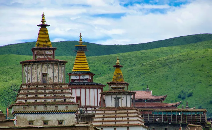
Photo adjustments
Full frame retained; proportionally resized and converted to WebP. No retouching or changes to the photographed subject. Card displays may crop the view.
- Administrative area
- County · 县
- Part of
- Ngawa Tibetan and Qiang Autonomous Prefecture
- Chinese name
- 壤塘县
- Local areas
- County guide
Area & population
- Area in the source
- 6,836.00 km²
- Population · 2020
- 44,679
- Administrative seat
- Gamda
Source: cited geographic source, as of the dates shown.
Scriptures carved in stone
Bangtuo Temple (棒托寺) stands beside the Zequ River (则曲河) in Rongmuda Township (茸木达乡). It preserves Ming- and Qing-period Buddhist scriptures carved into stone slabs. Text and Buddhist images appear on both faces of the slabs, with stupas from several historical periods surrounding the collection. Carving the scripture collection took nine years.
Tower houses and handcrafts
The Risimamba Tower House (日斯满巴碉房), in Zongke Township (宗科乡), has nine storeys and stands about 25.6 metres tall. Its architecture combines features associated with Amdo (安多), Jiarong (嘉绒) and Khampa (康巴) Tibetan houses. Rangtang also has teaching workshops devoted to thangka painting, Tibetan incense and Tibetan pottery.
Sources for this guide
壤塘概况_壤塘县人民政府 · Rangtang County Government
壤塘县自驾旅游精品线路推荐_壤塘县人民政府 · Rangtang County Government
Original English written from the listed sources and checked sentence by sentence against quoted extracts by a separate reviewer. Updated 2026-09-26.
Explore Rangtang County
Core places to explore, with English and Chinese names.
Rangtang County 壤塘县
Plan your visit
Getting there
Rangtang County is about 125 km in a straight line from central Ngawa Tibetan and Qiang Autonomous Prefecture. Search for 壤塘县 in a map app to find stations and your accommodation.
Where to stay →More in Ngawa Tibetan and Qiang Autonomous Prefecture
Sources & geographic information
Administrative names and parent areas: Official geographic directory · Reference date 2026-09-06.
Map data © OpenStreetMap contributors. Pins mark approximate centres, not entrances or boundaries.