


Get to know Batang County
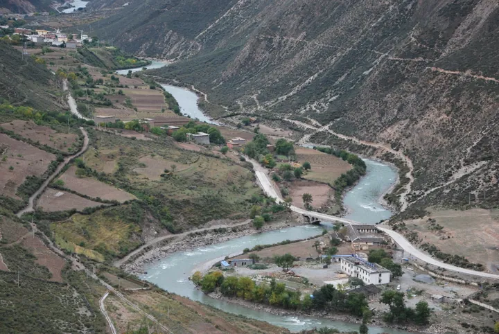
Photo adjustments
Full frame retained; proportionally resized and converted to WebP. No retouching or changes to the photographed subject. Card displays may crop the view.
- Administrative area
- County · 县
- Part of
- Garzê Tibetan Autonomous Prefecture
- Chinese name
- 巴塘县
- Local areas
- County guide
Area & population
- Area in the source
- 7,852.00 km²
- Population · 2020
- 49,967
- Administrative seat
- Qakyung (Batang)
Source: cited geographic source, as of the dates shown.
Cuopu Lake and surrounding slopes
Cuopu Lake (措普湖) sits below Zhajin Jiabo Mountain (扎金甲博山). Fir and high-mountain pine woods surround the water, with a winding lakeside path beneath the trees. To the south, below a moraine embankment, Mailongtong Meadow (麦隆通草坝) contains glacial boulders and a stream flowing from the lake. In early summer, rhododendrons and other flowers spread across Cuopu Valley’s meadows and slopes.
Xianzi music and dance
Batang xianzi (巴塘弦子) combines verse, instrumental music, singing and dancing. A Tibetan two-stringed fiddle accompanies the dancers, with its player controlling the rhythm. The performance has no fixed group size: a few people may dance together, or hundreds may join. Styles differ among villages and areas within the county.
Sources for this guide
措普沟风景名胜旅游区 - 巴塘县人民政府 · Batang County Government
巴塘文旅简介 - 巴塘县人民政府 · Batang County Government
Original English written from the listed sources and checked sentence by sentence against quoted extracts by a separate reviewer. Updated 2026-09-27.
Explore Batang County
Core places to explore, with English and Chinese names.
Places to explore around Batang County
 Cuopu Valley ·
 Plan your visit
Getting there
Batang County is about 260 km in a straight line from central Garzê Tibetan Autonomous Prefecture. Search for 巴塘县 in a map app to find stations and your accommodation.
Where to stay →Build your route
Start with Cuopu Valley. The linked place guides have entrance and visit details.
Continue with Garzê Tibetan Autonomous Prefecture →More in Garzê Tibetan Autonomous Prefecture
Sources & geographic information
Administrative names and parent areas: Official geographic directory (dmfw.mca.gov.cn) · Reference date 2026-09-06.
Photo: Cuopu Valley · Source photographer · License not provided. EXIF orientation normalized; resized without changing aspect ratio; converted to WebP. No subject edits.
Map data © OpenStreetMap contributors. Pins mark approximate centres, not entrances or boundaries.