


Get to know Luhuo County
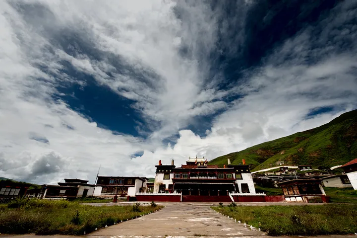
Photo adjustments
Full frame retained; proportionally resized and converted to WebP. No retouching or changes to the photographed subject. Card displays may crop the view.
- Administrative area
- County · 县
- Part of
- Garzê Tibetan Autonomous Prefecture
- Chinese name
- 炉霍县
- Local areas
- County guide
Area & population
- Area in the source
- 4,601.00 km²
- Population · 2020
- 47,185
- Administrative seat
- Xindo (Xindu)
Source: cited geographic source, as of the dates shown.
Lakes, grassland and monastery
Kasa Lake (卡萨湖), the Xialatuo Wetland (虾拉沱湿地) and Zongta Grassland (宗塔草原) are among its natural sights. Chonggu (充古) preserves a stone-coffin burial site. Shouling Monastery (寿灵寺) belongs to the Gelug school of Tibetan Buddhism and is one of the thirteen Hor monasteries (霍尔十三寺); its collections include historical cultural objects.
Butter-sculpture traditions
At Shouling Monastery, the butter-sculpture festival falls on the fifteenth day of the first Tibetan lunar month and is locally called Jiong’an Quba (炯安曲巴). Artists knead mineral pigments into pure butter to form figures. Subjects include Buddhist images, birds, animals, flowers, trees, pavilions and towers. Luhuo’s butter sculptures entered the prefecture-level intangible-cultural-heritage list in 2022.
Sources for this guide
炉霍县旅游概况 - 炉霍县人民政府 · Luhuo County Government
【实时炉霍】感受文化艺术之乡 展示非遗独特之美——酥油花 - 炉霍县人民政府 · Luhuo County Government
Original English written from the listed sources and checked sentence by sentence against quoted extracts by a separate reviewer. Updated 2026-09-27.
Explore Luhuo County
Core places to explore, with English and Chinese names.
Places to explore around Luhuo County
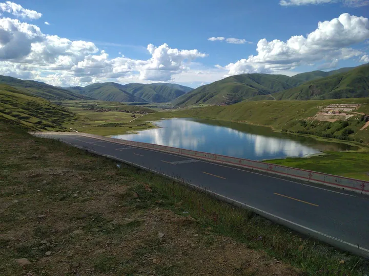 Kasa Lake beside National Highway 318, Garze Tibetan Autonomous Prefecture ·
 Plan your visit
Getting there
Luhuo County is about 195 km in a straight line from central Garzê Tibetan Autonomous Prefecture. Search for 炉霍县 in a map app to find stations and your accommodation.
Where to stay →Build your route
Start with Kasa Lake. The linked place guides have entrance and visit details.
Continue with Garzê Tibetan Autonomous Prefecture →More in Garzê Tibetan Autonomous Prefecture
Sources & geographic information
Administrative names and parent areas: Official geographic directory · Reference date 2026-09-06.
Photo: Kasa Lake · 麦丝鱿鱼 · CC BY-SA 4.0. Full frame retained; proportionally resized and converted to WebP. No retouching or changes to the photographed subject. Card displays may crop the view.

Map data © OpenStreetMap contributors. Pins mark approximate centres, not entrances or boundaries.