


Get to know Yajiang County
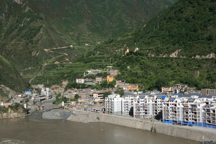
Photo adjustments
Full frame retained; proportionally resized and converted to WebP. No retouching or changes to the photographed subject. Card displays may crop the view.
- Administrative area
- County · 县
- Part of
- Garzê Tibetan Autonomous Prefecture
- Chinese name
- 雅江县
- Local areas
- County guide
Area & population
- Area in the source
- 7,558.00 km²
- Population · 2020
- 51,162
- Administrative seat
- Quka Town (Hekou)
Source: cited geographic source, as of the dates shown.
Grassland and forest
Zhusang Grassland (祝桑草原) is a highland pasture with grazing cattle and sheep and snow mountains in the distance. Forests elsewhere in Yajiang include fir, spruce, high-mountain pine and birch. Qingdagou Forest Park (庆达沟森林公园) and Pamuling (帕姆岭) are among the county's named scenic areas.
The old street and matsutake
Tizi Lane (梯子巷) is an old street in the county seat. Its redevelopment incorporates local Tibetan culture, ferry history and Long March (长征) themes. Matsutake mushrooms are another local focus: at the edible-fungus agricultural park, visitors can see mushrooms being sorted, packed and dispatched. The county's 2024 matsutake cultural season even featured matsutake pizza.
Sources for this guide
中国松茸之乡 - 雅江县人民政府 · Yajiang County Government
宜雅携手书写新时代雅江文旅融合发展新篇章 ——从“悬崖驿站”到“高原明珠”的振兴实践 · Yibin Development and Reform Commission
Original English written from the listed sources and checked sentence by sentence against quoted extracts by a separate reviewer. Updated 2026-09-26.
Explore Yajiang County
Core places to explore, with English and Chinese names.
Yajiang County 雅江县
Plan your visit
Getting there
Yajiang County is about 90 km in a straight line from central Garzê Tibetan Autonomous Prefecture. Search for 雅江县 in a map app to find stations and your accommodation.
Where to stay →More in Garzê Tibetan Autonomous Prefecture
Sources & geographic information
Administrative names and parent areas: Official geographic directory · Reference date 2026-09-06.
Map data © OpenStreetMap contributors. Pins mark approximate centres, not entrances or boundaries.